Loma Linda in San Bernardino County, California — The American West (Pacific Coastal)
Mill Creek Zanja
Photographed by Craig Baker, September 18, 2023
1. Mill Creek Zanja Marker
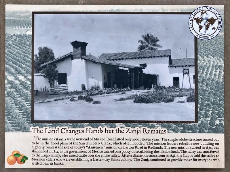
The Land Changes Hands but the Zanja Remains
The mission estancia at the west end of Mission Road lasted only about eleven years. The simple adobe structure turned out to be in the flood plain of the San Timoteo Creek, which often flooded. The mission leaders rebuilt a new building on higher ground at the site of today's "Asistencia" mission on Barton Road in Redlands. The new mission started in 1830, was abandoned in 1834, as the government of Mexico carried on a policy of secularizing the mission lands. The valley was transferred to the Lugo family, who raised cattle over the entire valley. After a disastrous snowstorm in 1848, the Lugos sold the valley to Mormon elders who were establishing a Latter-day Saints colony. The Zanja continued to provide water for everyone who settled near its banks.
photo caption: Asistencia Mission on Barton Road.
Zanja Trail in the Mission Historic District
Welcome to the City of Loma Linda! You are invited to explore the historical Mill Creek Zanja Irrigation Ditch located along this trail. The Ditch was the catalyst to developing the City. Although
this page online
Erected by City of Loma Linda.
Topics. This historical marker is listed in these topic lists: Agriculture • Religion & Religious Structures • Settlements & Settlers. A significant historical year for this entry is 1830.
Location. 34° 3.069′ N, 117° 13.729′ W. Marker is in Loma Linda, California, in San Bernardino County. It is at the intersection of Mission Road and Earp Drive, on the right when traveling west on Mission Road. Touch for map. Marker is at or near this postal address: 26367 Mission Rd, Loma Linda CA 92354, United States of America. Touch for directions.

Regionally, this marker is in Greater Los Angeles, in the Inland Empire, in the Peninsular Ranges, and specifically in the Transverse Ranges. It is also in the American Southwest. Globally, it is in North America, on the Ring of Fire, on the Pacific Rim, in the Western Hemisphere,

Photographed by Craig Baker, September 18, 2023
2. Mill Creek Zanja Marker
Other nearby markers. At least 8 other markers are within walking distance of this marker: Arrival of the Europeans (within shouting distance of this marker); The Zanja Fuels the Citrus Explosion (about 300 feet away, measured in a direct line); Zanja is Contested (about 500 feet away); History Before Europeans (about 500 feet away); Guachama Rancheria (approx. 0.6 miles away); San Bernardino Asistencia (approx. 0.7 miles away); a different marker also named San Bernardino Asistencia (approx. 0.7 miles away); El Camino Real (approx. 0.7 miles away). Touch for a list and map of all markers in Loma Linda.
Related marker. Click here for another marker that is related to this marker. - Asistencia Mission on Barton Road.
Photographed by Craig Baker, September 18, 2023
3. Mill Creek Zanja Marker

Photographed by Craig Baker, September 18, 2023
4. Citrus Trails Sign
Credits. This page was last revised on April 30, 2024. It was originally submitted on April 30, 2024, by Craig Baker of Sylmar, California. This page has been viewed 401 times since then and 35 times this year. Photos: 1, 2, 3, 4. submitted on April 30, 2024, by Craig Baker of Sylmar, California.
