Cobalt in Timiskaming District, Ontario — Central Canada (North America)
Cobalt Street & Grandview Hill
⎯⎯⎯
La rue Cobalt et la côte Grandview
| — | Heritage Silver Trail | — |

Photographed by Cosmos Mariner, June 2, 2022
1. Cobalt Street & Grandview Hill / La rue Cobalt et la côte Grandview Marker

Erected by Cobalt Historical Society.
Topics. This historical marker is listed in these topic lists: Architecture • Railroads & Streetcars • Settlements & Settlers.
Location. 47° 23.667′ N, 79° 41.216′ W. Marker is in Cobalt, Ontario, in Timiskaming District. It is at the intersection of Grandview Avenue and Cobalt Street, on the right when traveling east on Grandview Avenue. The marker is located beside the sidewalk at the southwest corner of the property at this location.
this page online

Regionally, this marker is in Northeastern Ontario and specifically in Northern Ontario. It is also in Central Canada. Globally, it is in North America, the Great North Woods, the Western Hemisphere, the Western World, and the Anglosphere. Historically, it finds itself in what was once a British colony, the Viceroyalty of New France, the Haudenosaunee (Iroquois) Confederacy, and Rupert’s Land.
Other nearby markers. At least 8 other markers are within walking distance of this marker: Cobalt Public School (within shouting distance of this marker); The Cobalt Town Hall / L'hôtel-de-ville de Cobalt (about 120 meters away, measured in a direct line); Cobalt Mining Camp (about 150 meters away); Silver Mining in Canada / Production de L'argent au Canada (about 150 meters away); Willet Green Miller (about 150 meters away); City of Cobalt Shaft / Le puits de mine de la Ville de Cobalt (about 150 meters away); Centennial Time Capsule (about 150 meters away); Cobalt Mining / L’exploitation Minière de Cobalt

Cobalt Historical Society
2. Marker detail: Houses on Cobalt Street
Related markers. Click here for a list of markers that are related to this marker. Heritage Silver Trail
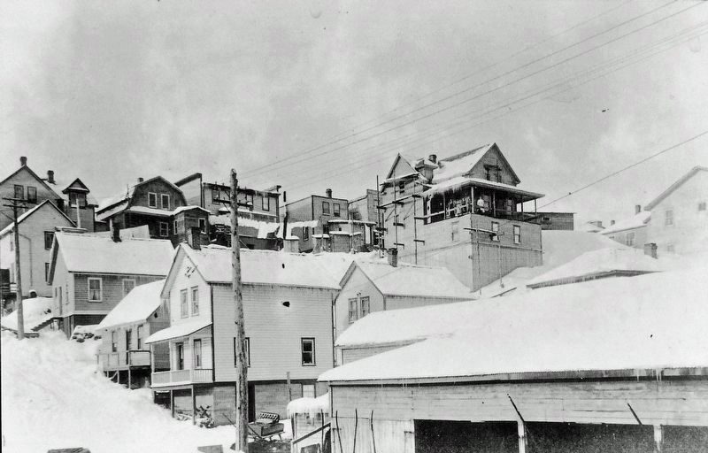
Cobalt Historical Society
3. Marker detail: Houses on Cobalt Street – Winter

Photographed by Cosmos Mariner, June 2, 2022
4. Cobalt Street & Grandview Hill / La rue Cobalt et la côte Grandview Marker
Looking north along Cobalt Street from Grandview Avenue.
Credits. This page was last revised on April 30, 2024. It was originally submitted on April 30, 2024, by Cosmos Mariner of Cape Canaveral, Florida. This page has been viewed 344 times since then and 43 times this year. Photos: 1, 2, 3, 4. submitted on April 30, 2024, by Cosmos Mariner of Cape Canaveral, Florida.
