Evesham in Worcestershire, England, United Kingdom — Northwestern Europe (the British Isles)
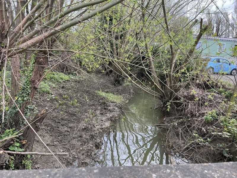
Battleton Brook

Photographed by Ray Gurganus, April 7, 2024
1. Battleton Brook Marker
Battleton Brook was known as Pedredan in Anglo Saxon times (c5th-c11th), owned by King Aetheled, and was the recorded boundary of Hampton.
When the name of this tributary became known as Battleton Brook has been lost in time -- but may have been referred to as the brook that leads to the town where the battle was. The massive Battle of Evesham (1265) would have impacted hugely on the local population and become part of the fabric of daily life for many years.
Source of Fresh Food
The brook would have been a source of fish and fresh water for human habitation even before the Bronze Age settlements that have been discovered in neighbouring Bengeworth. Later Roman activity has been unearthed throughout the Vale of Evesham, particularly on the East of the River Avon and it is thought that the great growing conditions and plentiful fish supplies made the area an important supply-source for the growing population.
Christianity blossomed in the area with the foundation of Evesham Abbey in 700 AD. The Benedictine Monks would have used the East of the Avon as orchards and for growing crops throughout the 800 years
this page online
Battleton Brook continued to be a orchard into the 1900's with apples and plums, the blossom a spectacular backdrop to the antics of the children playing and scrumping along the banks of the stream.
Wildlife
Along the 5.5 miles from the source of Battleton Brook, rising close to Aston Somerville, the brook travels north through open farmland, lined by hedges and trees that provide homes for a diverse range of wildlife. The brook then weaves its way through culverts and under bridges of the Vale Business Park and Four Pools Retail Park, emerging on a tree lined footpath to four Pools Lane.
The last mile of Battleton Brook, before it joins the River Avon, is renowned as an area of particularly interesting wildlife. From the sight and sounds of otters hunting fish, kingfishers flashing past, dancing butterflies and dragonflies to the night-time antics of foxes, hedgehogs and bats-just a few of the creatures you might spot-and who all call Battleton Brook their home.
Erected by Evesham Town Council. (Marker Number 10.)
Topics. This historical marker is listed in
Photographed by Ray Gurganus, April 7, 2024
2. Battleton Brook
Location. 52° 5.285′ N, 1° 56.744′ W. Marker is in Evesham, England, in Worcestershire. It is on Waterside, on the left when traveling west. Touch for map. Marker is at or near this postal address: 33 Waterside, Evesham, England WR11 1BU, United Kingdom. Touch for directions.

Regionally, this marker is in the Midlands. Globally, it is on the Atlantic Ocean, in the North Atlantic Region, in Europe, in Atlantic Europe, on one of the British Isles, in the Western World, and in the Anglosphere. Historically, it finds itself in what was once the Roman Empire.
Other nearby markers. At least 8 other markers are within walking distance of this marker: Evesham Abbey (approx. 0.3 kilometers away); The rise and fall of a wondrous abbey (approx. 0.3 kilometers away); a different marker also named Evesham Abbey (approx. 0.3 kilometers away); Rules and rituals, saints and sinners (approx. 0.3 kilometers away); a different marker also named Evesham Abbey (approx. 0.4 kilometers away); All Saints, Evesham (approx. 0.4 kilometers away); Site of Grand Gatehouse (approx. 0.4 kilometers away); a different marker also named Evesham Abbey (approx. 0.4 kilometers away). Touch for a list and map of all markers in Evesham.
Credits. This page was last revised on May 3, 2024. It was originally submitted on May 3, 2024, by Ray Gurganus of Washington, District of Columbia. This page has been viewed 296 times since then and 39 times this year. Photos: 1, 2. submitted on May 3, 2024, by Ray Gurganus of Washington, District of Columbia. • Andrew Ruppenstein was the editor who published this page.
