Near Washington in Hempstead County, Arkansas — The American South (West South Central)
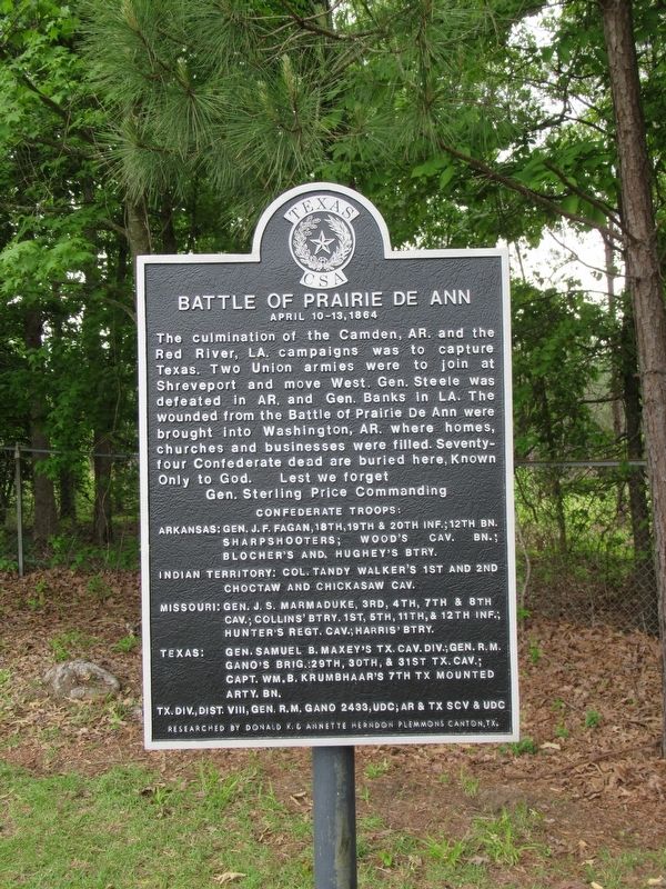
Battle of Prairie De Ann
April 10-13, 1864
Photographed by Jason Armstrong, April 22, 2023
1. Battle of Prairie De Ann Marker
Arkansas: General J.F. Fagan, 18th, 19th & 20th Infantry; 12th Battalion Sharpshooters; Wood's Cavalry Battalion; Blocher's and Hughey's Battery.
Indian Territory: Colonel Tandy Walker's 1st and 2nd Choctaw and Chickasaw Cavalry.
Missouri: General J.S. Marmaduke, 3rd, 4th, 7th, & 8th Cavalry; Collins' Battery 1st, 5th, 11th, & 12th Infantry; Hunter's Regiment Cavalry; Harris' Battery.
Texas: General Samuel B. Maxey's Texas Cavalry Division; General R.M. Gano's Brigade: 29th, 30th, & 31st Texas Cavalry; Captain WM. B. Krumbhaar's 7th Texas Mounted Artillery Battalion.
Texas Division District VIII, General R.M. Gano 2433, United Daughters Confederacy;
this page online
Researched by Donald K. & Annette Herndon Plemmons Canton, Texas.
Topics and series. This historical marker is listed in this topic list: War, US Civil. In addition, it is included in the Sons of Confederate Veterans/United Confederate Veterans, and the United Daughters of the Confederacy series lists. A significant historical date for this entry is April 10, 1864.
Location. 33° 46.617′ N, 93° 41.487′ W. Marker is near Washington, Arkansas, in Hempstead County. It can be reached from U.S. 278 one mile north of State Highway 195, on the right when traveling south. Located at the Washington Cemetery. Go through gate and head west to the back of the Cemetery. Touch for map. Marker is in this post office area: Washington AR 71862, United States of America. Touch for directions.

Regionally, this marker is in the Gulf Coastal Plain and in Caddo Territory. It is also in the American South, specifically in the Upper South, and in the Piney Woods. Globally, it is in North America, the Western Hemisphere, the Western World, and the Anglosphere. Historically, it
Photographed by Jason Armstrong, April 22, 2023
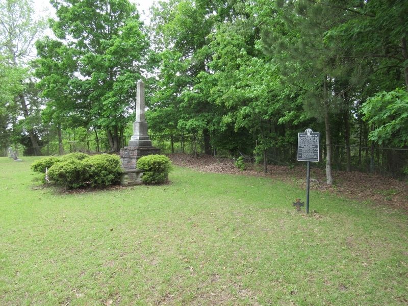
2. Battle of Prairie De Ann Marker
Other nearby markers. At least 8 other markers are within 8 miles of this marker, measured as the crow flies: Confederate Dead 1861-1865 (here, next to this marker); Hempstead County In The Civil War (about 500 feet away, measured in a direct line); The Washington Post Office (approx. 0.6 miles away); Homesite of Dr. Isaac Newton Jones and Elizabeth Littlejohn Jones (approx. 0.6 miles away); Confederate Capital (approx. 0.6 miles away); Masonic Civil War Memorial (approx. 0.6 miles away); James Black's Shop (approx. 0.7 miles away); The First Courthouse for the County of Hempstead (approx. 7.3 miles away). Touch for a list and map of all markers in Washington.
Also see . . . Skirmish at Prairie D'Ane (Encyclopedia of Arkansas).
Excerpt: The Confederates had been building earthworks for six days, and the Union troops immediately began building their own defensive positions about a mile away. Prairie D’Ane consists of about thirty square miles of open, rolling land surrounded by forests. For the next two days, the Union and Confederate armies exchanged an occasional artillery shell and engaged in limited skirmishing. Neither side wished to force a major engagement, and the bulk of the two armies received a short respite from the war. The men were able to relax and do everything from hunt rabbits to write letters home. Several small attacks were launched but did not accomplish anything; the last fighting died out about midnight on April 11. On April 11, Steele formed his army into a battle line that stretched more than two miles but did not move on the Confederates’ positions until the next day, when he found them abandoned. Price had withdrawn under cover of darkness to positions near Washington, where he prepared to defend the capital.(Submitted on May 4, 2024.)
Credits. This page was last revised on May 4, 2024. It was originally submitted on May 3, 2024, by Jason Armstrong of Talihina, Oklahoma. This page has been viewed 451 times since then and 52 times this year. Photos: 1, 2. submitted on May 3, 2024, by Jason Armstrong of Talihina, Oklahoma. • Andrew Ruppenstein was the editor who published this page.
