Central Business District in Cincinnati in Hamilton County, Ohio — The American Midwest (Great Lakes)
The Sultana
Photographed by William Fischer, Jr., October 31, 2009
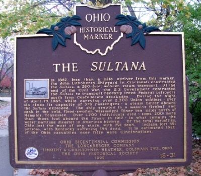
1. The Sultana Marker
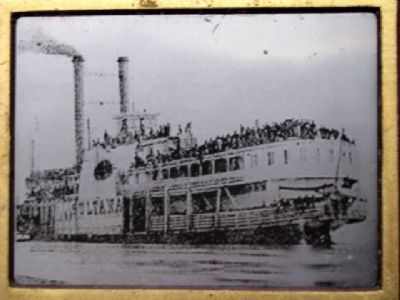
In 1862, less than a mile upriver from this marker, the John Lithoberry Shipyard in Cincinnati constructed the Sultana, a 260-foot, wooden steam transport. At the end of the Civil War, the U.S. Government contracted the Sultana to transport recently freed Federal prisoners north from Confederate stockades. During the night of April 27, 1865, while carrying over 2,300 Union soldiers - over six times its capacity of 376 passengers - a steam boiler aboard the Sultana exploded. The ship erupted in a massive fireball and sank in the cold, flood-swollen Mississippi River ten miles north of Memphis, Tennessee. Over 1,700 individuals died - some 200 more than those lost aboard the Titanic in 1912 - in what remains the worst maritime disaster in American history. Of the total casualties, Ohio lost the most of any state, with 791 dead. Indiana lost 491 persons, with Kentucky suffering 194 dead. It is estimated that, of the Ohio casualties, over fifty were Cincinnatians.
Erected 1999 by Ohio Bicentennial Commission, The Longaberger Company, Tim & Chris Heather, Colerain Twp., Ohio, and The Ohio Historical Society. (Marker Number
this page online
Topics and series. This historical marker is listed in this topic list: War, US Civil. In addition, it is included in the Ohio Historical Society / The Ohio History Connection series list. A significant historical date for this entry is April 27, 1908.
Location. 39° 6.002′ N, 84° 29.923′ W. Marker is in Cincinnati, Ohio, in Hamilton County. It is in the Central Business District. It can be reached from Purple People Bridge. Marker is along the Ohio River in Sawyer Point Park, about 90 feet southeast of the Cincinnatus statue, and about 160 feet east of the Newport Southbank pedestrian bridge (former Louisville & Nashville Railroad bridge). Touch for map. Marker is at or near this postal address: 801 East Pete Rose Way, Cincinnati OH 45202, United States of America. Touch for directions.

Regionally, this marker is in the American Midwest and in the Ohio River Valley. Globally, it is in North America, the Western Hemisphere, the Western World, and the Anglosphere. Historically, it finds itself in what was once the Haudenosaunee (Iroquois) Confederacy, the territory of the Mississippian Culture, and the Northwest Territory.
Other nearby markers. At
Photographed by William Fischer, Jr., October 31, 2009
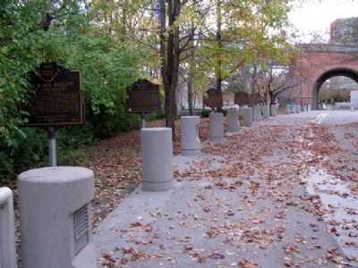
2. The Sultana Marker
Third in group of five markers.
Related markers. Click here for a list of markers that are related to this marker.
Also see . . . Remembering the Sultana Explosion. We're History website entry (Submitted on July 9, 2022, by Larry Gertner of New York, New York.)
Additional keywords. The Sultana
Photographed by William Fischer, Jr., October 31, 2009
3. Photo of the Sultana on Marker
Credits. This page was last revised on February 4, 2023. It was originally submitted on November 16, 2009, by William Fischer, Jr. of Reynoldsburg, Ohio. This page has been viewed 3,395 times since then and 120 times this year. Photos: 1, 2, 3. submitted on November 16, 2009, by William Fischer, Jr. of Reynoldsburg, Ohio.
