Marshfield in Webster County, Missouri — The American Midwest (Upper Plains)
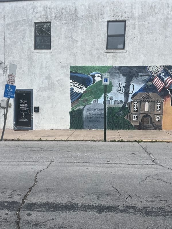
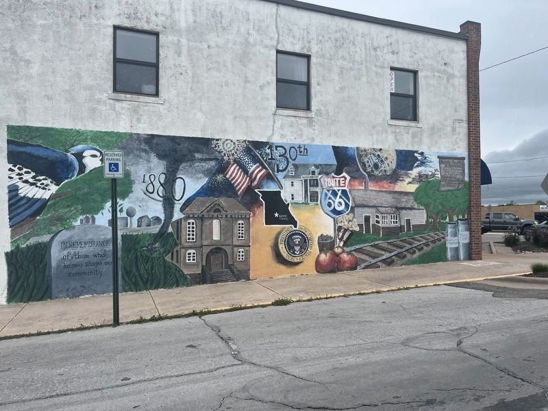
In Remembrance of Those Who Helped Shape Our Community
Photographed by Thomas Smith, May 6, 2024
1. In Remembrance of Those Who Helped Shape Our Community Mural
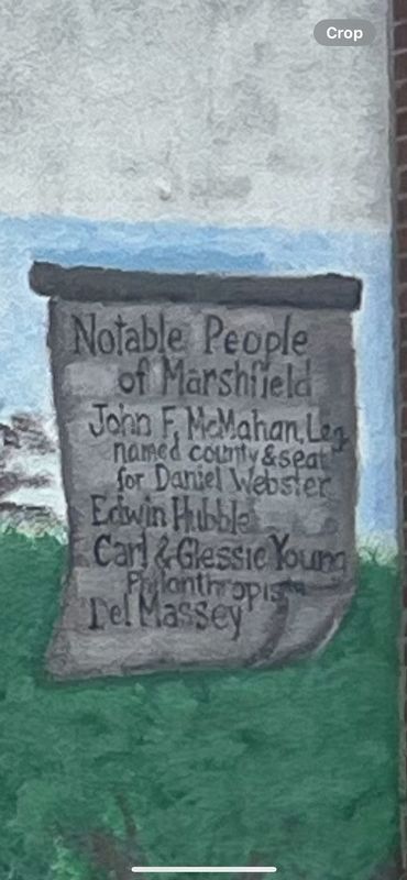
Notable People of Marshfield
John F. McMahan, Leg. named county & seat for Daniel Webster • Edwin Hubble • Carl & Glessie Young, Philanthropist • Del Massey
Topics. This historical marker is listed in these topic lists: Agriculture • Government & Politics • Political Subdivisions • Railroads & Streetcars.
Location. 37° 20.322′ N, 92° 54.457′ W. Marker is in Marshfield, Missouri, in Webster County. It is at the intersection of West Washington Street and North Clay Street, on the right when traveling west on West Washington Street. Touch for map. Marker is at or near this postal address: 203 W Washington St, Marshfield MO 65706, United States of America. Touch for directions.

Regionally, this marker is in Southwest Missouri and in Greater Springfield. It is also in the American Ozarks, in the Lewis & Clark Corridor, and in the Corn Belt. Globally, it is in North America, the Western Hemisphere, the Western World, and the Anglosphere. Historically, it finds itself in what was once the territory of the Mississippian Culture, the Louisiana Purchase,
this page online
Other nearby markers. At least 8 other markers are within walking distance of this marker: Edwin Hubble (within shouting distance of this marker); Webster County War Memorial (within shouting distance of this marker); Howitzer, Medium, Towed (within shouting distance of this marker); Marshfield Hand Dug Well (within shouting distance of this marker); Webster County (about 300 feet away, measured in a direct line); Veterans Memorial (about 400 feet away); Edwin Powell Hubble (about 400 feet away); Trail of Tears (approx. half a mile away). Touch for a list and map of all markers in Marshfield.
Photographed by Thomas Smith, May 6, 2024
2. In Remembrance of Those Who Helped Shape Our Community Mural
Photographed by Thomas Smith, May 6, 2024
3. In Remembrance of Those Who Helped Shape Our Community Mural
Credits. This page was last revised on May 11, 2024. It was originally submitted on May 6, 2024, by Thomas Smith of Waterloo, Ill. This page has been viewed 153 times since then and 28 times this year. Photos: 1, 2, 3. submitted on May 6, 2024, by Thomas Smith of Waterloo, Ill. • Devry Becker Jones was the editor who published this page.
