Pierre in Hughes County, South Dakota — The American Midwest (Upper Plains)
Exploring the Lewis & Clark Trail
May 3, 2024
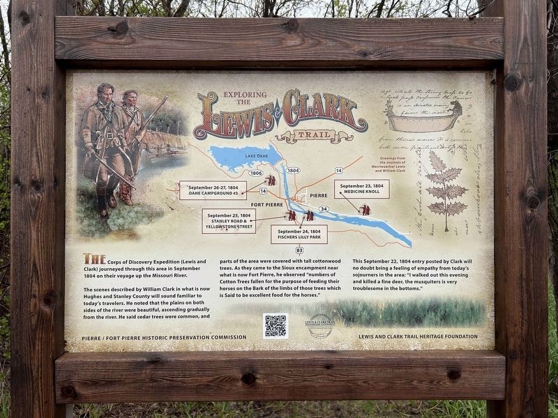
1. Exploring the Lewis & Clark Trail Marker
September 23, 1804 Medicine Knoll
September 24, 1804 Fischers Lilly Park
September 25, 1804 Stanley Road & Yellowstone Street
September 26-27, 1804 Oahe Campground #3
Drawings from the Journals of Merriweather Lewis and William Clark
The Corps of Discovery Expedition (Lewis and Clark) journeyed through this area in September 1804 on their voyage up the Missouri River.
The scenes described by William Clark in what is now Hughes and Stanley County will sound familiar to today's travelers. He noted that the plains on both sides of the river were beautiful, ascending gradually from the river. He said cedar trees were common, and parts of the area were covered with tall cottonwood trees. As they came to the Sioux encampment near what is now Fort Pierre, he observed "numbers of Cotton Trees fallen for the purpose of feeding their horses on the Bark of the limbs of those trees which is Said to be excellent food for the horses."
This September 22, 1804 entry posted by Clark will no doubt bring a feeling of empathy from today's sojourners in the area: "I walked out this evening and killed a fine deer, the musquiters
this page online
Erected by Pierre / Fort Pierre Historic Preservation Commission, Lewis & Clark Trail Stewardship Endowment, and Lewis and Clark Trail Heritage Foundation.
Topics and series. This historical marker is listed in these topic lists: Exploration • Waterways & Vessels. In addition, it is included in the Lewis & Clark Expedition series list. A significant historical date for this entry is September 22, 1804.
Location. 44° 21.344′ N, 100° 20.269′ W. Marker is in Pierre, South Dakota, in Hughes County. It is on an unnamed road 0.1 miles south of East Sully Avenue, on the left when traveling south. Located by the Lewis & Clark Trail, on the east side of the marina. Touch for map. Marker is in this post office area: Pierre SD 57501, United States of America. Touch for directions.

Regionally, this marker is in East River. It is also in the American Lewis & Clark Corridor, on the prairies, and on the Northern Plains. Globally, it is in North America, the Western Hemisphere, the Western World, and the Anglosphere. Historically, it finds itself in what was once Rupert’s Land and also the Louisiana Purchase.
May 3, 2024
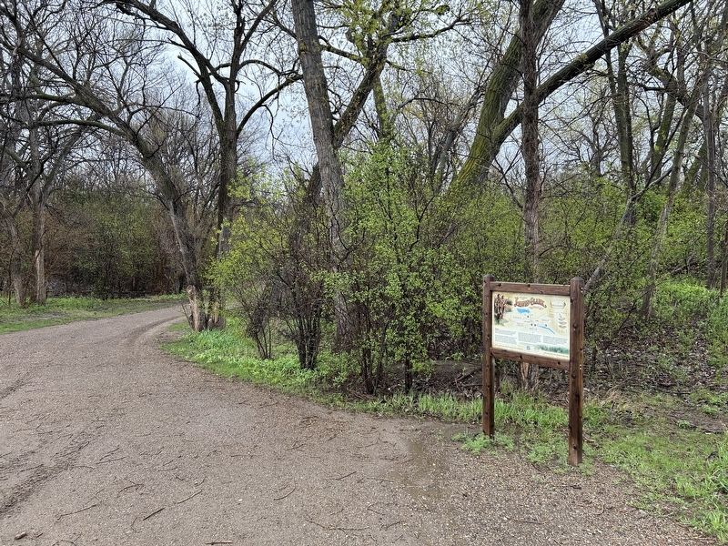
2. Exploring the Lewis & Clark Trail Marker, from the west
Other nearby markers. At least 8 other markers are within walking distance of this marker: Phil Trautner (approx. 0.3 miles away); Lewis & Clark Trail (approx. half a mile away); Coe Crawford, 6th Governor of South Dakota (approx. half a mile away); Grand Army of the Republic (approx. 0.6 miles away); Civil War Monument (approx. 0.6 miles away); a different marker also named Civil War Monument (approx. 0.6 miles away); Fighting Stallions Memorial (approx. 0.8 miles away); South Dakota World War II Veterans Memorial (approx. 0.8 miles away). Touch for a list and map of all markers in Pierre.
Also see . . . Lewis and Clark Sites | Historic Places Pierre & Fort Pierre. (Submitted on May 7, 2024.)
Credits. This page was last revised on May 8, 2024. It was originally submitted on May 7, 2024. This page has been viewed 467 times since then and 37 times this year. Photos: 1, 2. submitted on May 7, 2024.
