St. Martin in Brown County, Ohio — The American Midwest (Great Lakes)
"Cross in The Wilderness"
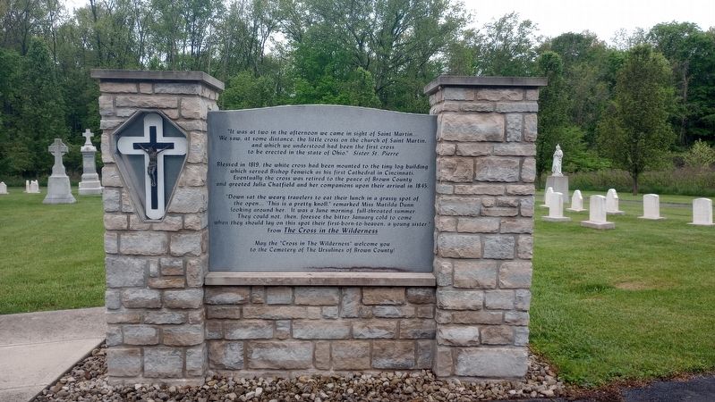
Photographed by Craig Doda, May 4, 2024
1. "Cross in The Wilderness" Marker
"It was at two in the afternoon we came in sight of Saint Martin... We saw, at some distance, the little cross on the church of Saint Martin, and which we understood had been the first cross to be erected in the state of Ohio." Sister St. Pierre
Blessed in 1819, the white cross had been mounted to the tiny log building which served Bishop Fenwick as his first Cathedral in Cincinnati. Eventually the cross was retired to the peace of Brown County and greeted Julia Chatfield and her companions upon their arrival in 1845.
"Down sat the weary travelers to eat their lunch in a grassy spot of the open… 'This is a pretty knoll.'" remarked Miss Matilda Dunn looking around her. It was a June morning, full-throated summer. They could not, then, foresee the bitter January cold to come when they should lay on this spot their first-born-to-heaven, a young sister
From The Cross in the Wilderness
May the "Cross in The Wilderness" welcome you to the Cemetery of The Ursulines of Brown County!
Topics. This historical marker is listed in these topic lists: Cemeteries & Burial Sites • Religion & Religious Structures •
this page online
Location. 39° 12.483′ N, 83° 53.266′ W. Marker is in St. Martin, Ohio, in Brown County. It can be reached from the intersection of Anderson State Road and Ohio Route 251, on the right when traveling east. The marker stands on the grounds of the Chatfield College Ursulines of Brown County in the Ursuline Cemetery. Touch for map. Marker is at or near this postal address: 20860 Route 251, Fayetteville OH 45118, United States of America. Touch for directions.

Regionally, this marker is in Greater Cincinnati and in Southern Ohio Hill Country. It is also in the American Midwest, in the Ohio River Valley, in Appalachia, and specifically in Northern Appalachia. Globally, it is in North America, the Western Hemisphere, the Western World, and the Anglosphere. Historically, it finds itself in what was once the Haudenosaunee (Iroquois) Confederacy, the territory of the Mississippian Culture, and the Northwest Territory.
Other nearby markers. At least 8 other markers are within walking distance of this marker: The Ursulines of Brown County (here, next to this marker); St. Angela Hall
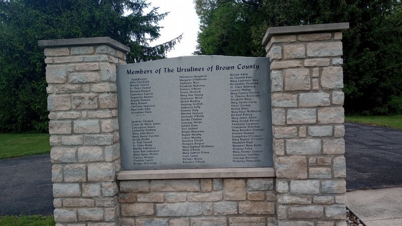
Photographed by Craig Doda, May 4, 2024
2. "Cross in The Wilderness" Marker
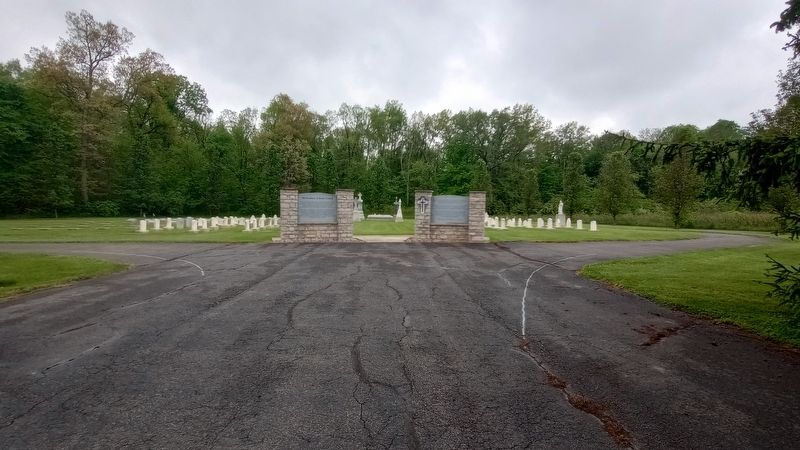
Photographed by Craig Doda, May 4, 2024
3. Ursuline Cemetery
Credits. This page was last revised on May 10, 2024. It was originally submitted on May 8, 2024, by Craig Doda of Napoleon, Ohio. This page has been viewed 206 times since then and 34 times this year. Photos: 1, 2, 3. submitted on May 8, 2024, by Craig Doda of Napoleon, Ohio. • Devry Becker Jones was the editor who published this page.
