Near Greycliff in Sweet Grass County, Montana — The American West (Mountains)
The Great Highway of the Northwest: The Yellowstone Trail

Photographed by Barry Swackhamer, August 20, 2022
1. The Great Highway of the Northwest: The Yellowstone Trail Marker
Motoring was an adventure in the second decade of the 20th century and people usually didn't travel very far from home. There were few paved roads, and most were choked with dust during the summers, knee-deep in mud in the rainy seasons, and blocked by snowdrifts in the winters. But as more people bought cars, they demanded better roads. Some banded together and formed organizations dedicated to the construction of good roads, which, they believed, increased commerce and made for prosperous communities. One way to prosperity was through tourism. Tourists stayed in local hotels or auto camps, ate at local restaurants, and spent money. For many communities, like Greycliff, a good road was just as important as the railroad.
In 1912, businessmen from South Dakota, Minnesota and Montana formed an organization dedicated to establishing a good coast-to-coast road. Called the Yellowstone Trail, a road ultimately evolved into a coast-to-coast highway connecting Plymouth Rock, Massachusetts and Seattle, Washington with a branch from Livingston south to Yellowstone National Park. The trail was an interconnected chain of county roads
this page online
The Yellowstone Trail in Montana was 800 miles long, including roads that branched off the main route to Yellowstone Park and other important tourist destinations. Initially a dirt road that was "slippery in wet weather," the Montana Highway Department began to slowly make improvements to it after World War I. By 1926, the Yellowstone Trail was officially known as US Highway 10. Montana spent more money on road improvements to the Yellowstone Trail than any other state along its route. Today, Interstates 94 and 90 parallel much of the old Yellowstone Trail.
"Will the tourist come in great numbers? Give them a road and you can not stop them."
First Year Book of the Twin Cities-Aberdeen-Yellowstone Park Trail (1914)
"Don't be afraid to tour Montana. You can

Photographed by Barry Swackhamer, August 20, 2022
2. The Yellowstone Trail Map
First Year Book of the Twin Cities-Aberdeen-Yellowstone Park Trail (1914)
"The Yellowstone Valley road is usually a splendid one, and the people of this section will be found to be the most cordial in the world. ... The tourist will find many free campgrounds, and cordial good-fellowship everywhere. The road is marked. This is the section from which the Yellowstone Trail derives its name, and in this valley are the hardy pioneers that helped give this organization its form and being."
Yellowstone Trail Route Folder (1919)
Erected by Montana Department of Transportation.
Topics. This historical marker is listed in this topic list: Roads & Vehicles.
Location. 45° 44.062′ N,
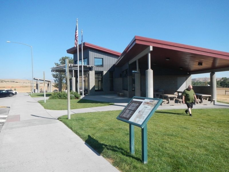
Photographed by Barry Swackhamer, August 20, 2022
3. The Great Highway of the Northwest: The Yellowstone Trail Marker

Regionally, this marker is in Yellowstone Country. It is also in the American Mountain West and in the Lewis & Clark Corridor. Globally, it is in North America, the Rocky Mountains, the Western Hemisphere, the Western World, and the Anglosphere. Historically, it finds itself in what was once Rupert’s Land and also the Louisiana Purchase.
Other nearby markers. At least 8 other markers are within 3 miles of this marker, measured as the crow flies: The Bozeman Trail (a few steps from this marker); Montana's Jurassic Park (within shouting distance of this marker); The Crazy Mountains (about 600 feet away, measured in a direct line); The Cattle Drive of 1866 (about 700 feet away); a different marker also named Montana's Jurassic Park (about 700 feet away); The Crazy Mountains (original title obscured) (about 700 feet away); Captain Wm. Clark (about 700 feet away); a different marker also named The Thomas Party (approx. 2.1 miles away). Touch for a list and map of all markers in Greycliff.
Another marker is no longer nearby. The Thomas Party (was approx. 2.1 miles away but has been replaced with another marker now near it).
Also see . . . Today's Guide to Yesterday's Auto Route West, The Yellowstone Trail -- Yellowstone Trail Assoc. Today, almost all of the route of the Yellowstone Trail is on slower, less traveled roads. Some sections of the Trail, especially in the West, have remained little changed and are a delight to visit. (Submitted on May 9, 2024, by Barry Swackhamer of Brentwood, California.)
Credits. This page was last revised on January 2, 2025. It was originally submitted on May 9, 2024, by Barry Swackhamer of Brentwood, California. This page has been viewed 318 times since then and 71 times this year. Photos: 1, 2, 3. submitted on May 9, 2024, by Barry Swackhamer of Brentwood, California.
