Durhamville in Oneida County, New York — The American Northeast (Mid-Atlantic)
The Erie Canal - The Long Level
Historic New York
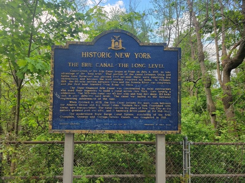
Photographed by Kevin W., May 14, 2024
1. The Erie Canal - The Long Level Marker
The State-financed Erie Canal was constructed by local contractors who used their ingenuity to build a canal across New York, then largely a wilderness. The 363-mile canal was 40 feet wide and four feet deep: 83 locks took it over different land levels. The canal was hailed as the foremost engineering achievement of the time.
When finished in 1825, the Erie Canal became the main route between the Atlantic Ocean and the Great Lakes. Western New York flourished with cheap, new transportation. The canal insured the place of New York City as the nation's greatest port and city, and it hastened development of the Mid-West.
The modernized State Barge Canal System, consisting of the Erie, Champlain, Oswego and Cayuga-Seneca
this page online
Erected 1987 by State of New York.
Topics and series. This historical marker is listed in this topic list: Waterways & Vessels. In addition, it is included in the Erie Canal series list. A significant historical date for this entry is July 4, 1817.
Location. 43° 9.319′ N, 75° 40.265′ W. Marker is in Durhamville, New York, in Oneida County. It is on New York State Route 46 0.1 miles south of Mills Road, on the left when traveling south. In the parking area just south of Mills Road. Touch for map. Marker is at or near this postal address: 6044 NY-46, Durhamville NY 13054, United States of America. Touch for directions.

Regionally, this marker is in Upstate New York and in the Mohawk Valley. It is also in the American Northeast and in the Mid-Atlantic. Globally, it is in North America, the Great North Woods, the Western Hemisphere, the Western World, and the Anglosphere. Historically, it finds itself in what was once the Haudenosaunee (Iroquois) Confederacy, New Netherland, and one of the original Thirteen Colonies.
Other nearby markers. At least 8 other markers are within 6 miles of this marker,

Photographed by Kevin W., May 14, 2024
2. The Erie Canal - The Long Level Marker
Credits. This page was last revised on May 15, 2024. It was originally submitted on May 14, 2024, by Kevin W. of Stafford, Virginia. This page has been viewed 308 times since then and 57 times this year. Photos: 1. submitted on May 14, 2024, by Kevin W. of Stafford, Virginia. 2. submitted on May 15, 2024, by Kevin W. of Stafford, Virginia.
