
Arrow Rock in Saline County, Missouri — The American Midwest (Upper Plains)
Dr. William Price House

Photographed by Jason Voigt, May 15, 2024
1. Dr. William Price House Marker
Private residence
Erected by Friends of Arrow Rock, Inc.
Topics. This historical marker is listed in these topic lists: Architecture • Science & Medicine. A significant historical year for this entry is 1812.
Location. 39° 4.161′ N, 92° 56.941′ W. Marker is in Arrow Rock, Missouri, in Saline County. It is on Main Street east of 8th Street, on the right when traveling east. Touch for map. Marker is at or near this postal address: 711
this page online

Regionally, this marker is in the Missouri River Corridor. It is also in the American Midwest, in the Lewis & Clark Corridor, in the Corn Belt, and on the Santa Fe Trail Corridor. Globally, it is in North America, the Western Hemisphere, the Western World, and the Anglosphere. Historically, it finds itself in what was once the territory of the Mississippian Culture, the Louisiana Purchase, and the Antebellum South.
Other nearby markers. At least 8 other markers are within walking distance of this marker: Santa Fe Trail (about 600 feet away, measured in a direct line); Aderton House (about 800 feet away); The Santa Fe National Historic Trail (approx. 0.2 miles away); Arrow Rock (approx. 0.2 miles away); Capt. John Burruss' Bell (approx. 0.2 miles away); Bingham Farmstead 1828 (approx. 0.2 miles away); J. Huston Tavern (approx. 0.2 miles away); The Lawless House / The Restoration of the Lawless House (approx. ¼ mile away). Touch for a list and map of all markers in Arrow Rock.
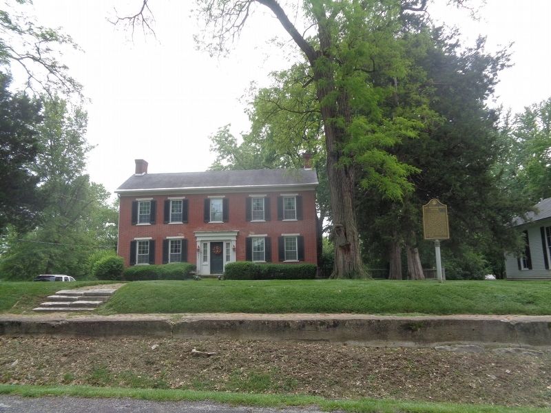
Photographed by Jason Voigt, May 15, 2024
2. Dr. William Price House Marker
Marker is in front of, as the marker says, a private residence.
Credits. This page was last revised on May 15, 2024. It was originally submitted on May 15, 2024, by Jason Voigt of Glen Carbon, Illinois. This page has been viewed 327 times since then and 27 times this year. Photos: 1, 2. submitted on May 15, 2024, by Jason Voigt of Glen Carbon, Illinois.
