
Arrow Rock in Saline County, Missouri — The American Midwest (Upper Plains)
Calaboose
1873
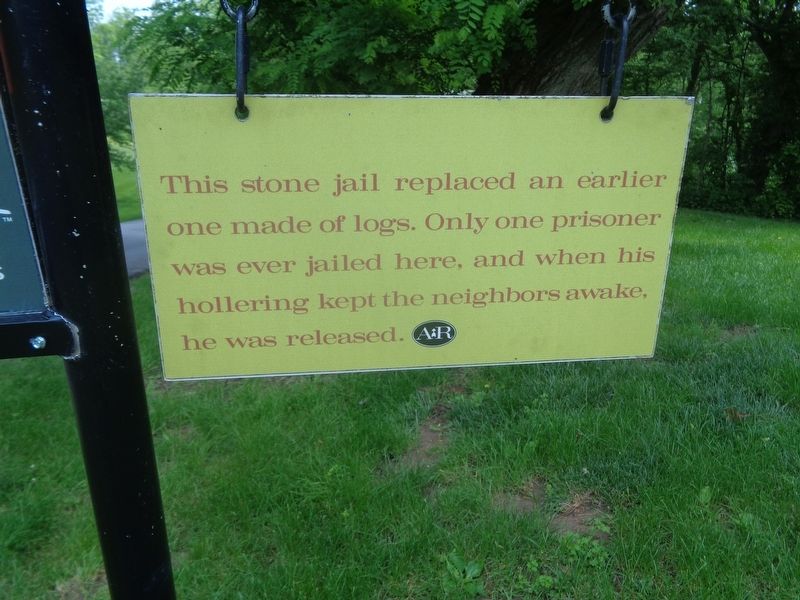
Photographed by Jason Voigt, May 15, 2024
1. Calaboose Marker
Erected by Missouri State Parks.
Topics. This historical marker is listed in this topic list: Law Enforcement.
Location. 39° 4.166′ N, 92° 56.637′ W. Marker is in Arrow Rock, Missouri, in Saline County. It is on Van Buren Street west of 1st Street, on the right when traveling east. Touch for map. Marker is at or near this postal address: 305 Main St, Arrow Rock MO 65320, United States of America. Touch for directions.

Regionally, this marker is in the Missouri River Corridor. It is also in the American Midwest, in the Lewis & Clark Corridor, in the Corn Belt, and on the Santa Fe Trail Corridor. Globally, it is in North America, the Western Hemisphere, the Western World, and the Anglosphere. Historically, it finds itself in what was once the territory of the Mississippian Culture, the Louisiana Purchase, and the Antebellum South.
Other nearby markers. At least 8 other markers are within walking
this page online

Photographed by Jason Voigt, May 15, 2024
2. Calaboose Marker
Marker is in the bottom column of the sign. These signs, which point to historical sites around Arrow Rock, are found all over. However, this is the only one that has historical text.

Photographed by Jason Voigt, May 15, 2024
3. Calaboose
Credits. This page was last revised on May 15, 2024. It was originally submitted on May 15, 2024, by Jason Voigt of Glen Carbon, Illinois. This page has been viewed 355 times since then and 57 times this year. Photos: 1, 2, 3. submitted on May 15, 2024, by Jason Voigt of Glen Carbon, Illinois.
