Strasburg in Shenandoah County, Virginia — The American South (Mid-Atlantic)
Signal Knob
Key Observation Post

Photographed by Allen C. Browne, May 13, 2024
1. Signal Knob Marker
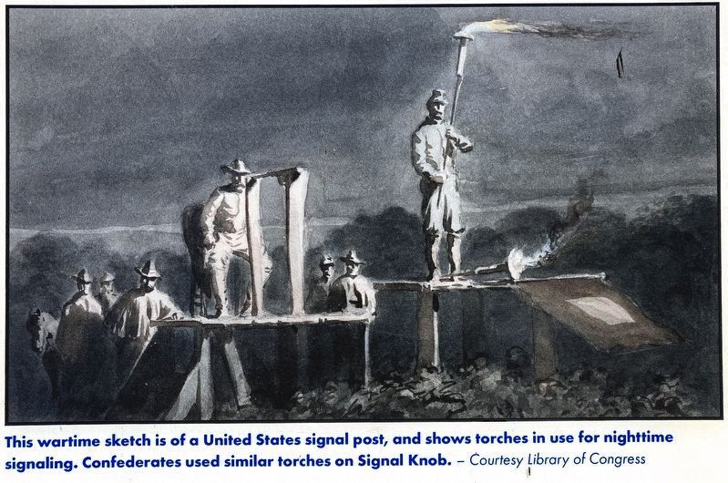
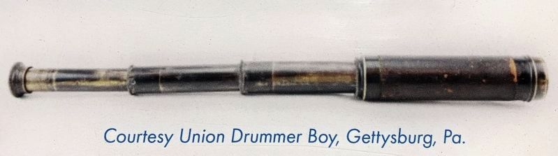
From their perch 2,110 feet above sea level, Confederate watchmen had an unparalleled view of the surrounding countryside and communicated with other signal stations at Ashby Gap (east of Winchester), Burnt Springs (south in Fort Valley), Harmony Hollow (near Front Royal), and New Market Gap. Special signal flags, lanterns, and telescopes were used to communicate from one peak to another.
Union troops attacked the signal station on August 14, 1864, in a skirmish that resulted in 10 casualties. Signal Knob was soon again a Confederate outpost, however, and it played a key role in the October 19, 1864, Battle of Cedar Creek. Peering down from Signal Knob, Confederate officers planned a devastating early morning attack, though the Union troops rallied and won the fight.
“A SPLENDID SIGHT”
On October 17, 1864, Confederate Gen. Clement A.
this page online
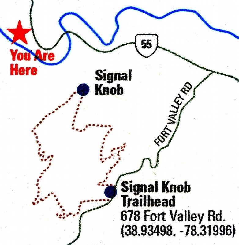
See the incredible vista! A trail that begins at 678 Fort Valley Rd. will take you to Signal Knob (see above left inset map). It's a moderate, rocky hike of 10 miles that takes about five hours round trip. Wear good hiking shoes!
Erected by Civil War Trails.
Topics. This memorial is listed in these topic lists: Communications • War, US Civil.
Location. 38° 58.409′ N, 78° 21.105′ W. Memorial is in Strasburg, Virginia, in Shenandoah County. It is on Park Road. Marker is along the banks of the North Fork of the Shenandoah River in Town Park. Touch for map. Memorial is at or near this postal address: 299 Park

Photographed by Allen C. Browne, May 13, 2024
2. Signal Knob Marker
Signal Knob is hidden by the clump of trees on the left of this photo. The distinct shape of Signal Knob cannot be seen from the Town Park, in the summer months, unless you stand in the River.

Regionally, this memorial is in the Shenandoah Valley. It is also in the American South, specifically in the Upper South, and in the Mid-Atlantic. Globally, it is in North America, the Western Hemisphere, the Western World, and the Anglosphere. Historically, it finds itself in what was once the territory of the Mississippian Culture, one of the original Thirteen Colonies, one of the Confederate States of America, and the Antebellum South.
Other nearby markers. At least 8 other markers are within one mile of this marker, measured as the crow flies: Shenandoah County / Warren County (approx. ¾ mile away); "Lest We Forget!" (approx. one mile away); The Great Train Raid (approx. one mile away); Train Heist (approx. one mile away); Historic Strasburg (approx. one mile away); The Great Train Raid of 1861 (approx. one mile away); Strasburg Stone & Earthenware Mfg. Co. (approx. one mile away); Confederate Memorial (approx. 1.1 miles away). Touch for a list and map of all markers in Strasburg.
Another marker is no longer nearby. Civil War Strasburg (was
Photographed by Allen C. Browne, May 13, 2024
3. Signal Post
This wartime sketch is of a United States signal post, and shows torches in use for nighttime signaling. Confederates used similar torches on Signal Knob. — Courtesy Library of Congress.
Close-up of image on marker.
Photographed by Allen C. Browne, May 13, 2024
4. Telescope
Photographed by CivilWarTalk
5. Gordon and Hotchkiss
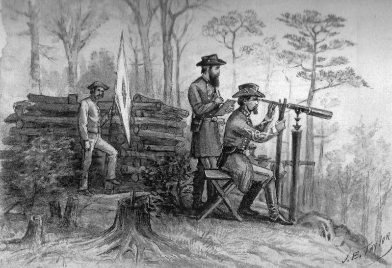
Confederate cartographer Jedediah Hotchkiss and Gen. John B. Gordon observe Federal positions from Signal Knob on October 17, 1864, before the Battle of Cedar Creek. They used a telescope similar to the one pictured on this sign. — James E. Taylor Sketchbook, Western Reserve Historical Society.
Photographed by Allen C. Browne, May 13, 2024
6. Signal Knob
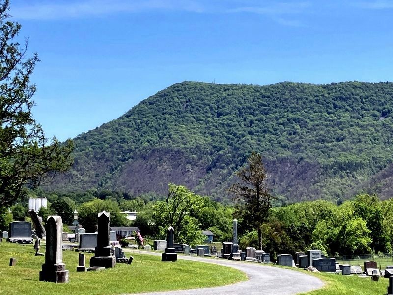
Signal Knob seen from Riverview Cemetery.
Photographed by Allen C. Browne, May 13, 2024
7. Signal Knob Trail
Credits. This page was last revised on May 16, 2024. It was originally submitted on May 16, 2024, by Allen C. Browne of Silver Spring, Maryland. This page has been viewed 334 times since then and 48 times this year. Photos: 1, 2, 3, 4, 5, 6, 7. submitted on May 16, 2024, by Allen C. Browne of Silver Spring, Maryland.
