Webster Station in Dayton in Montgomery County, Ohio — The American Midwest (Great Lakes)
The Need for Waterways
| — | Patterson Boulevard Canal Parkway | — |
Photographed by Craig Doda, May 4, 2024
1. The Need for Waterways Marker
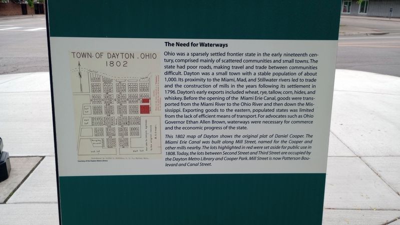
Ohio was a sparsely settled frontier state in the early nineteenth century, comprised mainly of scattered communities and small towns. The state had poor roads, making travel and trade between communities difficult. Dayton was a small town with a stable population of about 1,000. Its proximity to the Miami, Mad, and Stillwater rivers led to trade and the construction of mills in the years following its settlement in 1796. Dayton's early exports included wheat, rye, tallow, corn, hides, and whiskey. Before the opening of the Miami Erie Canal, goods were transported from the Miami River to the Ohio River and then down the Mississippi. Exporting goods to the eastern, populated states was limited from the lack of efficient means of transport. For advocates such as Ohio Governor Ethan Allen Brown, waterways were necessary for commerce and the economic progress of the state.
[Caption:]
This 1802 map of Dayton shows the original plat of Daniel Cooper. The Miami Erie Canal was built along Mill Street, named for the Cooper and other mills nearby. The lots highlighted in red were set aside for public use in 1808. Today, the lots between Second Street and Third Street are occupied by the Dayton Metro Library and Cooper Park. Mill Street is now Patterson Boulevard and Canal Street.
Erected 2017.
this page online
Topics and series. This historical marker is listed in these topic lists: Industry & Commerce • Waterways & Vessels. In addition, it is included in the The Miami & Erie Canal series list. A significant historical year for this entry is 1796.
Location. 39° 45.705′ N, 84° 11.211′ W. Marker is in Dayton, Ohio, in Montgomery County. It is in Webster Station. It is at the intersection of North Patterson Boulevard and East 2nd Street, on the right when traveling north on North Patterson Boulevard. Touch for map. Marker is at or near this postal address: 251 E 2nd St, Dayton OH 45402, United States of America. Touch for directions.

Regionally, this marker is in the Miami Valley. It is also in the American Midwest and in the Corn Belt. Globally, it is in North America, the Western Hemisphere, the Western World, and the Anglosphere. Historically, it finds itself in what was once the Haudenosaunee (Iroquois) Confederacy, the territory of the Mississippian Culture, and the Northwest Territory.
Other nearby markers. At least 8 other markers are within walking distance of this marker: Elephants in the Canal (here, next to this
Photographed by Craig Doda, May 4, 2024
2. The Need for Waterways Marker
Credits. This page was last revised on May 16, 2024. It was originally submitted on May 16, 2024, by Craig Doda of Napoleon, Ohio. This page has been viewed 128 times since then and 14 times this year. Photos: 1, 2. submitted on May 16, 2024, by Craig Doda of Napoleon, Ohio. • Devry Becker Jones was the editor who published this page.
