
Arrow Rock in Saline County, Missouri — The American Midwest (Upper Plains)
The Lewis and Clark Expedition Across Missouri

Photographed by Jason Voigt, May 14, 2024
1. The Lewis and Clark Expedition Across Missouri Marker
The day before, on June 8, the expedition had met three fur traders returning from upriver. These traders had come from the Big Sioux River, a tributary to the Missouri, some 850 miles above the mouth. It was not a shock to meet boats returning to St. Louis - this was the fifth trading party Lewis and Clark had met since leaving St. Charles. They also found a cache of canteens, axes, pumice stone and furs "hid & buried" on Island of Mills (Arrow Rock Island), where the party camped that night.
On June 9, after passing the "prarie of Arrows," the keelboat stern got stuck on one of the river's many submerged logs, "which was not
this page online
Running the Missouri River Gauntlet
The keelboat accident on June 9, just upriver from today's Arrow Rock State Historic Site, was not an isolated event. In Clark's journal, he repeatedly described the Missouri River's ferocity. Usually it was one of a triple threat of hazards threatening the keelboat and two pirogues. Until this point, logs (May 15), moving sand (May 24, June 5) and collapsing banks (June 1, June 6) had endangered the keelboat. All were made worse by the swift spring current
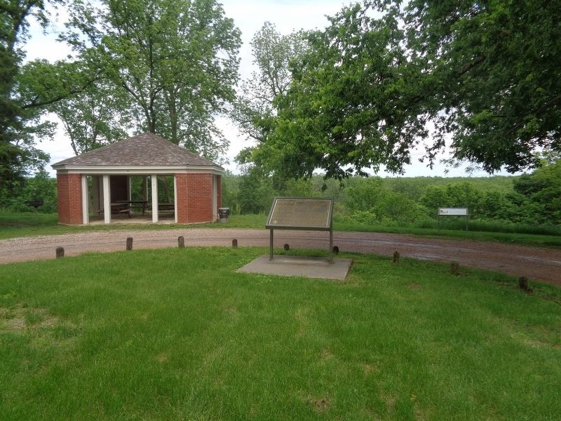
Photographed by Jason Voigt, May 14, 2024
2. The Lewis and Clark Expedition Across Missouri Marker
That May and June, many days of rain raised the Missouri River, although it was not in flood. "The Current was So Strong that we Could not Stem it" is a phrase that occurs more than once in expedition member's Missouri journal entries. The men quickly learned how to handle the ungainly 55-foot, deep-drafted keelboat in all river conditions, and rarely repeated a mistake. Two weeks earlier, at Retrograde Bend, the boat was spun around and nearly lost. On that day luck, not skill, saved the keelboat. Now, on June 9, the crew had demonstrated that they were equal to the challenges of the Missouri River. Clark's praise for the men that day indicated his belief that his highly motivated army privates were now as capable on the river as the best and most experienced French boatmen that could be hired in St. Louis.
(side quote:)
"Some of our men being prepared for all Situations leaped into the water Swam ashore with a roap, and fixed themselves in Such Situations, that the boat was off in a fiew minits, I can Say with Confidence that our party is not inferior to any that was ever on the waters of the Missoppie."
William Clark, June 9, 1804
Erected by Missouri Department of Natural Resources, Missouri Lewis and Clark Bicentennial Commission and National Park Service.
Topics and series. This historical marker is listed in these topic lists: Exploration • Waterways & Vessels. In addition, it is included in the Lewis & Clark Expedition series list. A significant historical date for this entry is June 9, 1804.
Location. 39° 4.265′ N, 92° 56.55′ W. Marker is in Arrow Rock, Missouri, in Saline County. It is on High Street east of 1st Street, on the right when traveling east. Touch for map. Marker is at or near this postal address: 14 High St, Arrow Rock MO 65320, United States of America. Touch for directions.

Regionally, this marker is in the Missouri River Corridor. It is also in the American Midwest, in the Lewis & Clark Corridor, in the Corn Belt, and on the Santa Fe Trail Corridor. Globally, it is in North America, the Western Hemisphere, the Western World, and the Anglosphere. Historically, it finds itself in what was once the territory of the Mississippian Culture, the Louisiana Purchase, and the Antebellum South.
Other nearby markers. At least 8 other markers are within walking distance of this marker: Arrow Rock and the River (a few steps from this marker); George Caleb Bingham Home (within shouting distance of this marker); Godsey's Diggings (about 300 feet away, measured in a direct line); Sappington Memorial Building (about 400 feet away); Arrow Rock River Landing: Developing a Town and a Country (about 600 feet away); Arrow Rock (about 700 feet away); Calaboose (about 700 feet away); J. Huston Tavern (approx. 0.2 miles away). Touch for a list and map of all markers in Arrow Rock.
Credits. This page was last revised on May 17, 2024. It was originally submitted on May 16, 2024, by Jason Voigt of Glen Carbon, Illinois. This page has been viewed 243 times since then and 46 times this year. Photos: 1, 2. submitted on May 16, 2024, by Jason Voigt of Glen Carbon, Illinois.
