Webster Station in Dayton in Montgomery County, Ohio — The American Midwest (Great Lakes)
The "New" Library
| — | Patterson Boulevard Canal Parkway | — |

Photographed by Craig Doda, May 4, 2024
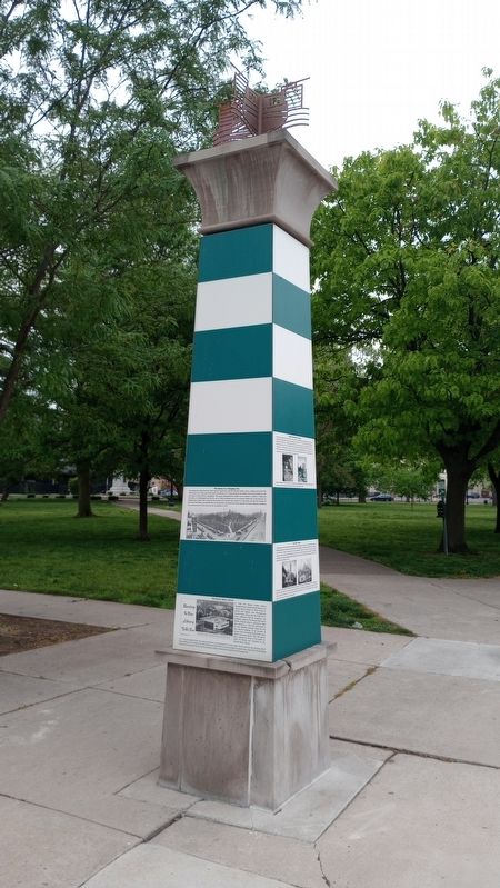
1. The "New" Library Marker
In 1888, Dayton's Free Public Library found a permanent home to house its collection in an imposing Romanesque building designed by the Dayton architectural firm of Peters and Burns. The new library building was constructed in the "Commons," renamed Cooper Park, for the early benefactor of the City of Dayton. The two story structure was built of Dayton limestone, with Marquette red sandstone trimmings lavishly used throughout. The building was set back in a newly landscaped park, its entrance facing Third Street. A Natural History Museum opened in the second floor of the library in 1893.
[Caption:]
Left image: The new Dayton Public Library quickly became part of the Cooper Park-Miami Erie Canal Basin landscape. Seen from Third Street, it was an imposing monument set within a park. Right image: Pictured from the canal, the new library provided a backdrop for street carnivals and festivities at the basin, such as the 1892 celebration of four hundred years of the discovery of America, as pictured above.
Topics and series. This historical marker is listed in these topic lists: Architecture • Education •
this page online
Location. 39° 45.701′ N, 84° 11.225′ W. Marker is in Dayton, Ohio, in Montgomery County. It is in Webster Station. It is at the intersection of North Patterson Boulevard and East 2nd Street, on the right when traveling south on North Patterson Boulevard. Touch for map. Marker is at or near this postal address: 251 E 2nd St, Dayton OH 45402, United States of America. Touch for directions.

Regionally, this marker is in Ohio’s Miami Valley. It is also in the American Midwest and in the Corn Belt. Globally, it is in North America, the Western Hemisphere, the Western World, and the Anglosphere. Historically, it finds itself in what was once the Haudenosaunee (Iroquois) Confederacy, the territory of the Mississippian Culture, and the Northwest Territory.
Other nearby markers. At least 8 other markers are within walking distance of this marker: The Library and the Flood (here, next to this marker); William McKinley Statue (here, next to this marker); Cooper Park Before the Library
Photographed by Craig Doda, May 4, 2024
2. The "New" Library Marker
Credits. This page was last revised on May 20, 2024. It was originally submitted on May 17, 2024, by Craig Doda of Napoleon, Ohio. This page has been viewed 281 times since then and 21 times this year. Photos: 1, 2. submitted on May 17, 2024, by Craig Doda of Napoleon, Ohio. • Devry Becker Jones was the editor who published this page.
