Napton in Saline County, Missouri — The American Midwest (Upper Plains)
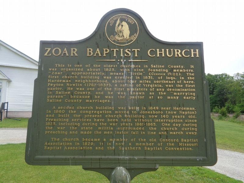
Zoar Baptist Church
Photographed by Jason Voigt, May 14, 2024
1. Zoar Baptist Church Marker
A second church building was built in 1849 near Hardeman. In 1860 the congregation moved to Jonesboro (now Napton) and built the present church building, now 140 years old. Preaching services have been held without interruption since 1825, including during the war years 1861-1865. One day during the war the state militia surrounded the church during preaching and made the men inside fall in line and march away.
The church became a member of the old Concord Baptist Association in 1829; it is now a member of the Missouri Baptist Association and the Southern Baptist Convention.
Erected by Friends
this page online
Topics. This historical marker is listed in these topic lists: Religion & Religious Structures • War, US Civil. A significant historical year for this entry is 1825.
Location. 39° 3.082′ N, 93° 4.861′ W. Marker is in Napton, Missouri, in Saline County. It can be reached from Mallard Trail east of County Route 212. Touch for map. Marker is at or near this postal address: 18330 Mallard Trail, Marshall MO 65340, United States of America. Touch for directions.

Regionally, this marker is in the Missouri River Corridor. It is also in the American Midwest, in the Lewis & Clark Corridor, in the Corn Belt, and on the Santa Fe Trail Corridor. Globally, it is in North America, the Western Hemisphere, the Western World, and the Anglosphere. Historically, it finds itself in what was once the territory of the Mississippian Culture, the Louisiana Purchase, and the Antebellum South.
Other nearby markers. At least 8 other markers are within 5 miles of this marker, measured as the crow flies: Smith Chapel Methodist Church (approx. 2.4 miles away); Santa Fe Trail (approx. 3.7 miles away); Segregation in Life and Death

Photographed by Jason Voigt, May 14, 2024
2. Zoar Baptist Church Marker
More about this marker. Marker text repeats on both sides.
Credits. This page was last revised on May 17, 2024. It was originally submitted on May 17, 2024, by Jason Voigt of Glen Carbon, Illinois. This page has been viewed 265 times since then and 46 times this year. Photos: 1, 2. submitted on May 17, 2024, by Jason Voigt of Glen Carbon, Illinois.
