
South Nashville in Davidson County, Tennessee — The American South (East South Central)
Fort Negley
Defending the Capital
| — | Hood's Campaign | — |
Photographed by Don Morfe, April 18, 2014
1. Fort Negley Marker
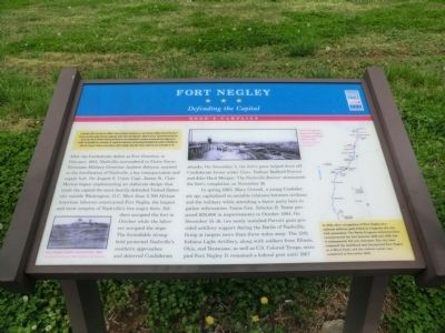
In September 1864, after Union Gen. William T. Sherman defeated Confederate Gen. John Bell Hood at Atlanta, Hood led the Army of Tennessee northwest against Sherman’s supply lines. Rather than contest Sherman’s “March to the Sea,” Hood moved north into Tennessee. Gen. John M. Schofield, detached from Sherman’s army, delayed Hood at Columbia and Spring Hill before falling back to Franklin. The bloodbath here on November 30 crippled the Confederates, but they followed Schofield to the outskirts of Nashville and Union Gen. George H. Thomas’s strong defenses. Hood’s campaign ended when Thomas crushed his army on December 15-16.
After the Confederate defeat at Fort Donelson in February 1862, Nashville surrendered to Union forces. Tennessee Military Governor Andrew Johnson insisted on the fortification of Nashville, a key transportation and supply hub. On August 6, Union Capt. James St. Clair Morton began implementing an elaborate design that made the capital the most heavily defended Unites States city outside Washington, D.C. More than 2,700 African American laborers constructed Fort Negley, the largest and most complex
this page online
In spring 1863, Mary Overall, a young Confederate spy, capitalized on amiable relations between civilians and the military while attending a dance party here to gather information. Union Gen. Zebulon B. Tower proposed $20,000 in improvements in October 1864. On December 15-16, two newly installed Parrott guns provided artillery support during the Battle of Nashville, firing at targets more than three miles away. The 12th Indiana Light Artillery, along with soldiers from Illinois, Ohio, and Tennessee, as well as U.S. Colored Troops, occupied Fort Negley. It remained a federal post until 1867.
(sidebar)
In 1928, after recognition of Fort Negley as a national military park failed in Congress, the city took possession. The Works Progress Administration reconstructed the fort between 1936 and 1938, but it subsequently fell into disrepair. The city later reopened the stabilized and interpreted Fort Negley as a Metro Park, and the visitors center was completed in December 2007.
Erected by Tennessee
Photographed by Don Morfe, April 18, 2014
2. Fort Negley Marker
Topics and series. This historical marker is listed in these topic lists: Forts and Castles • War, US Civil. In addition, it is included in the Former U.S. Presidents: #17 Andrew Johnson, and the Tennessee Civil War Trails series lists. A significant historical month for this entry is February 1862.
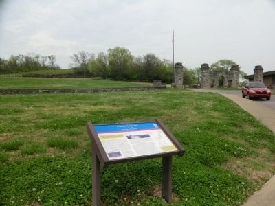
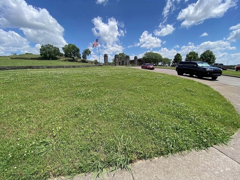
Location. Marker has been permanently removed. It was located near 36° 8.582′ N, 86° 46.559′ W. Marker was in Nashville, Tennessee, in Davidson County. It was in South Nashville. It was on Fort Negley Boulevard north of Chestnut Street, on the right when traveling north. The marker stood on the grounds of Fort Negley Park. Touch for map. Marker was in this post office area: Nashville TN 37203, United States of America.
We have been informed that this marker is no longer there and will not be replaced. This page is an archival view of what was.
Regionally, this marker was in Middle Tennessee. It was also in the American South and specifically in the Upper South. Globally, it was in North America, the Western Hemisphere, the Western World, and the Anglosphere. Historically, it found itself in what was once the territory

Photographed by Darren Jefferson Clay, May 19, 2024
3. Fort Negley Marker
Other nearby markers. At least 8 other markers are within walking distance of this location: Fort Negley Site (a few steps from this marker); a different marker also named Fort Negley (within shouting distance of this marker); a different marker also named Fort Negley (within shouting distance of this marker); War in the West (within shouting distance of this marker); The Civil War (within shouting distance of this marker); The Road to War (within shouting distance of this marker); War in the West: Battles and Campaigns (about 300 feet away, measured in a direct line); Nashville Surrendered (about 500 feet away). Touch for a list and map of all markers in Nashville.
Credits. This page was last revised on May 20, 2024. It was originally submitted on June 12, 2014, by Don Morfe of Baltimore, Maryland. This page has been viewed 953 times since then and 34 times this year. Last updated on May 19, 2024, by Darren Jefferson Clay of Duluth, Georgia. Photos: 1, 2. submitted on June 12, 2014, by Don Morfe of Baltimore, Maryland. 3. submitted on May 19, 2024, by Darren Jefferson Clay of Duluth, Georgia. • Devry Becker Jones was the editor who published this page.
