Port Bolivar in Bolivar Peninsula in Galveston County, Texas — The American South (West South Central)
Port Bolivar Cemetery
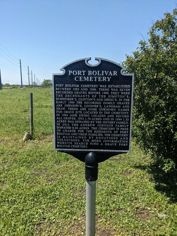
Photographed by Bruce InCharlotte, April 11, 2024
1. Port Bolivar Cemetery Marker
Topics. This historical marker is listed in this topic list: Cemeteries & Burial Sites. A significant historical year for this entry is 1885.
Location. 29° 24.914′ N, 94° 42.654′ W. Marker is in Bolivar Peninsula, Texas, in Galveston County. It is in Port Bolivar. It is on State Road 87 west of Magnolia Lane, on the left when traveling east. Touch for map. Marker is at or near this postal address: 3925
this page online

Regionally, this marker is in the Houston Metropolitan Area. It is also in the American South and on the Gulf Coast. Globally, it is in North America, a Gulf of Mexico state, the Western Hemisphere, the Western World, and the Anglosphere. Historically, it finds itself in what was once New Spain, the Republic of Texas, and one of the Confederate States of America.
Other nearby markers. At least 8 other markers are within 7 miles of this marker, measured as the crow flies: Port Bolivar (a few steps from this marker); Crenshaw Family Cemetery (approx. 1½ miles away); Bolivar Point (approx. 4.3 miles away); Jane Herbert Wilkinson Long (approx. 4.3 miles away); Fort Travis (approx. 4.4 miles away); Fort San Jacinto (approx. 6.1 miles away); SS Selma (approx. 6.8 miles away); Galveston: Gateway to Texas (approx. 6.8 miles away).
Another marker is no longer nearby. Point Bolivar (was approx. 4.6 miles away but has been confirmed missing).
Credits. This page was last revised on May 20, 2024. It was originally submitted on May 20, 2024, by Bruce InCharlotte of Charlotte, North Carolina. This page has been viewed 297 times since then and 48 times this year. Photo 1. submitted on May 20, 2024, by Bruce InCharlotte of Charlotte, North Carolina. • James Hulse was the editor who published this page.
Editor’s want-list for this marker. A wide view photo of the marker and the surrounding area together in context. • Can you help?
