Katonah in Westchester County, New York — The American Northeast (Mid-Atlantic)
The Organization of the Farm
John Jay Homestead
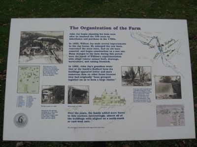
John Jay began planning his farm soon after he amassed the 750 acres by inheritance and purchase in the 1780s.
In 1832, William Jay made several improvements to the Jay farm. He enlarged the cow barn, renovated the main barn, had an old barn removed, and began construction on a new one. Many changes to the farm during this period were the result of William’s experimentation with silage (winter animal feed), drainage, horticulture, and raising livestock.
In 1862, John Jay’s grandson wrote that at the family’s Bedford farm the buildings appeared better and more numerous than on other farms because they had originally “been grouped together – so as to form a large cluster.”
Over the years, the family added more barns to this nucleus. Interestingly, almost all of the buildings were aligned on a north-south or east-west axis.
Erected by Friends of the Jay Homestead. (Marker Number 6.)
Topics. This historical marker is listed in these topic lists: Agriculture • Notable Places. A significant historical year for this entry is 1832.
Location. Marker has been reported missing. It was located near 41° 15.102′ N, 73° 39.521′ W. Marker was in Katonah, New York, in Westchester County. Marker could be reached from Jay Street (New York State Route 22) 0.1 miles south of Beaver Dam Road, on the left when traveling south. Located on the grounds of the John Jay Homestead. Touch for map. Marker was at or near this postal address: 400 Route 22, Katonah NY 10536, United States of America. Touch for directions.
Other nearby markers. At least 8 other markers are within walking distance of this location. The Farm Manager’s Cottage (within shouting distance of this marker); The Stable Courtyard (within shouting distance of this marker); The Barn Complex (within shouting distance of this marker); The Brick Lot (within shouting distance of this marker); Intergenerate Chicken Co-op (within shouting distance of this marker); Bedford House (within shouting distance of this marker); The Schoolhouse and Homestead Lawn (about 300 feet away, measured in a direct line); The John Jay Potting Sheds (about 300 feet away). Touch for a list and map of all markers in Katonah.
Photographed By Michael Herrick, November 10, 2009
3. Sawmill and Gristmill
[ detail from the marker ]
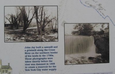
John Jay built a sawmill and gristmill along the Cross River on the northern border of his lands in the 1790s. These photographs were taken shortly before the river was dammed in 1908 to create a reservoir for the New York City water supply.
John Jay built a sawmill and gristmill along the Cross River on the northern border of his lands in the 1790s. These photographs were taken shortly before the river was dammed in 1908 to create a reservoir for the New York City water supply.
Credits. This page was last revised on August 4, 2023. It was originally submitted on November 21, 2009, by Michael Herrick of Southbury, Connecticut. This page has been viewed 732 times since then and 33 times this year. Photos: 1, 2, 3, 4, 5. submitted on November 21, 2009, by Michael Herrick of Southbury, Connecticut. • Syd Whittle was the editor who published this page.
