Near Kenton in Cimarron County, Oklahoma — The American South (West South Central)
Rocks Reveal Jurassic Life
Photographed by Jason Armstrong, May 6, 2023
1. Rocks Reveal Jurassic Life Marker
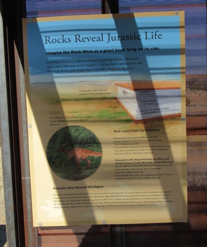
Imagine the Black Mesa as a giant book lying on its side.
Each layer of rock is a different chapter in geologic history. The basalt cap on top is the most recent chapter - it's less than 5 million years old. As you go down, each deeper layer is an older chapter in the story.
Layer by layer, the rocks tell stories of earlier periods in time.
150 million years ago, this area was a tropical swamp, inhabited by dinosaurs like this Allosaurus.
Rock Layers from Top to Bottom
* Raton Basalt (Less than 5 million years old} * Sands and gravels of the Pliocene Ogallala group (2 to 5 million years old} * Cross-bedded sandstone of the Cretaceous Dakota Group, Gray shale and sandstone of the Cretaceous Purgatoire Formation (92 to 106 million years old)
Exposed on the slopes between the Mesa and North Carizzo Creek (the trail crosses this area): * Jurassic Morrison Formation (134 to 150 million years old) * Marl and shale of the Jurassic Exeter Sandstone (152 to 57 million years old) * Red and buff shale, marl, and conglomerate of the Triassic Dockum Group (215 to 231 million years old)
Dinosaurs Once Roamed this Region
this page online
One layer in the book, the Morrison Formation, revealed an amazing story of ancient dinosaur life, including Apatosaurus, Stegosaurus, and the fearsome meat-eater Allosaurus. Approximately 6,000 dinosaur bones were excavated from the 134 to 150 million year-old Jurassic rocks during projects led by one of Oklahoma's most illustrious vertebrate paleontologists, Dr. John Stovall. From 1930 until his death in 1953, Dr. Stovall devoted much of his career to the geology and paleontology of the Cimarron Valley. He was a professor of geology and director of the University of Oklahoma's museum.
Erected by Oklahoma Tourism and Recreation Department.
Topics. This historical marker is listed in these topic lists: Animals • Anthropology & Archaeology • Paleontology.
Location. 36° 56.874′ N, 102° 59.384′ W. Marker is near Kenton, Oklahoma, in Cimarron County. It can be reached from Black Mesa Road 5 miles Oklahoma Highway 325, on the left when traveling north. The directions noted here are to the Trailhead parking area. From there it is 3 miles west on the Black Mesa Trail to
Photographed by Jason Armstrong, May 6, 2023
2. Rocks Reveal Jurassic Life Marker
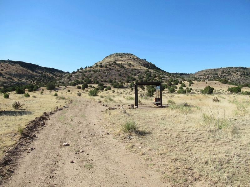
The marker is at the 3 mile rest area on the Black Mesa Trail.

Regionally, this marker is in the Oklahoma Panhandle. It is also in the American South, specifically on the prairies, on the Southern Plains, on the High Plains, and on the Santa Fe Trail Corridor. Globally, it is in North America, the Western Hemisphere, the Western World, and the Anglosphere. Historically, it finds itself in what was once New Spain, the Comanchería, the territory of the Mississippian Culture, the Dust Bowl, the Louisiana Purchase, the Republic of Texas, and Cimmaron Territory.
Other nearby markers. At least 6 other markers are within 16 miles of this marker, measured as the crow flies: Highest Point in Oklahoma (approx. 1.2 miles away); Cimarron County (approx. 1½ miles away); Black Mesa Nature Preserve (approx. 1.6 miles away); The Santa Fe Trail (approx. 15.1 miles away); a different marker also named Santa Fe Trail (approx. 15.1 miles away); Fort Nichols (approx. 15.1 miles away).
Credits. This page was last revised on May 29, 2024. It was originally submitted on May 22, 2024, by Jason Armstrong of Talihina, Oklahoma. This page has been viewed 205 times since then and 26 times this year. Photos: 1, 2. submitted on May 22, 2024, by Jason Armstrong of Talihina, Oklahoma. • J. Makali Bruton was the editor who published this page.
