Marker Logo HMdb.org THE HISTORICAL
MARKER DATABASE
“Bite-Size Bits of Local, National, and Global History”
Near Union Point in Greene County, Georgia — The American South (South Atlantic)
 

Bethesda Baptist Church


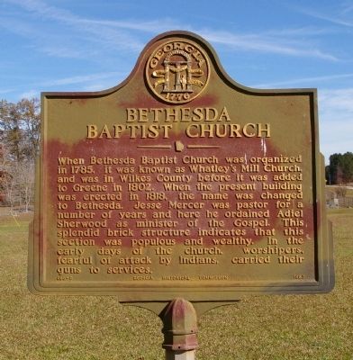
Bethesda Baptist Church Marker image. Click for full size.
Photographed By David Seibert, November 14, 2009
1. Bethesda Baptist Church Marker
Inscription. When Bethesda Baptist Church was organized in 1785, it was known as Whatley’s Mill Church, and was in Wilkes County before it was added to Greene in 1802. When the present building was erected in 1818, the name was changed to Bethesda. Jesse Mercer was pastor for a number of years and here he ordained Adiel Sherwood as minister of the Gospel. This splendid brick structure indicates that this section was populous and wealthy. In the early days of the church, worshipers, fearful of attack by Indians, carried their guns to services.
 
Erected 1957 by Georgia Historical Commission. (Marker Number 066-9.)
 
Topics and series. This historical marker is listed in these topic lists: Churches & ReligionNative Americans. In addition, it is included in the Georgia Historical Society series list. A significant historical year for this entry is 1785.
 
Location. 33° 39.048′ N, 83° 0.624′ W. Marker is near Union Point, Georgia, in Greene County. Marker is at the intersection of Bethesda Church Road and Mercer Durham Road, on the left when traveling north on Bethesda Church Road. Touch for map. Marker is in this post office area: Union Point GA 30669, United States of America. Touch for directions.
 
Other nearby markers. At least 8 other markers are within 7 miles of this marker, measured as the crow flies. Great Buffalo Lick (approx. 4 miles away); The Two Committees
Paid Advertisement
Click on the ad for more information.
Please report objectionable advertising to the Editor.
Click or scan to see
this page online
(approx. 4½ miles away); First Regimental Reunion of Confederate Veterans (approx. 4½ miles away); Confederate Wayside Home 1862-64 (approx. 4½ miles away); Site of Wayside Home (approx. 4.6 miles away); Confederate Gun Shop (approx. 5.3 miles away); Liberty-Salem-Woodstock-Philomath (approx. 5.4 miles away); Bethany Presbyterian Church (approx. 6½ miles away). Touch for a list and map of all markers in Union Point.
 
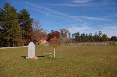
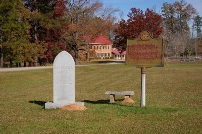
Bethesda Baptist Church Marker image. Click for full size.
Photographed By David Seibert, November 14, 2009
2. Bethesda Baptist Church Marker
Bethesda Baptist Church Marker, Church, and Old Cemetery image. Click for full size.
Photographed By David Seibert, November 14, 2009
3. Bethesda Baptist Church Marker, Church, and Old Cemetery
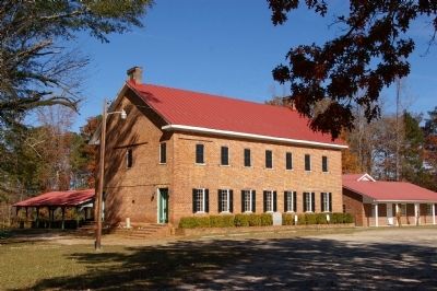
Bethesda Baptist Church, c. 1818 image. Click for full size.
Photographed By David Seibert, November 14, 2009
4. Bethesda Baptist Church, c. 1818
 
 
Credits. This page was last revised on January 30, 2020. It was originally submitted on November 21, 2009, by David Seibert of Sandy Springs, Georgia. This page has been viewed 1,334 times since then and 46 times this year. Photos:   1, 2, 3, 4. submitted on November 21, 2009, by David Seibert of Sandy Springs, Georgia. • Craig Swain was the editor who published this page.
Share this page.  
Share on Tumblr
m=24724

CeraNet Cloud Computing sponsors the Historical Marker Database.
This website earns income from purchases you make after using our links to Amazon.com. We appreciate your support.
Paid Advertisement
Apr. 20, 2024