Boonville in Cooper County, Missouri — The American Midwest (Upper Plains)
Boonville to Pilot Grove
Points of Interest
Photographed by Jason Voigt, May 14, 2024
1. Boonville to Pilot Grove Marker
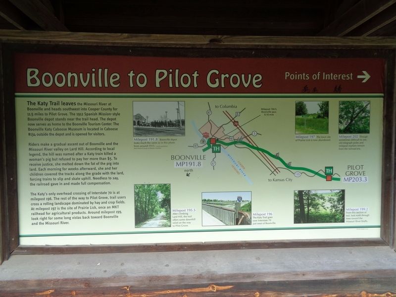
Riders make a gradual ascent out of Boonville and the Missouri River valley on Lard Hill. According to local legend, the hill was named after a Katy train killed a woman's pig but refused to pay her more than $5. To receive justice, she melted down the fat of the pig into lard. Each morning for weeks afterward, she and her children covered the tracks along the grade with the lard, forcing trains to slip and skate uphill. Needless to say, the railroad gave in and made full compensation.
The Katy's only overhead crossing of Interstate 70 is at milepost 196. The rest of the way to Pilot Grove, trail users cross a rolling landscape dominated by hay and crop fields. At milepost 197 is the site of Prairie Lick, once an MKT railhead for agricultural products.
this page online
(photo captions:)
Milepost 191.8 - Boonville depot looks much the same as in this photo from around 1915.
Milepost 195.5 - After climbing Lard Hill, the trail offers some downhill relief on the way to Pilot Grove.
Milepost 196 - The Katy Trail goes over Interstate 70 just west of Boonville.
Milepost 197 - The town site of Prairie Lick is now abandoned.
Milepost 199.2 - From this section of trail, look north through trees toward the Missouri River bluffs.
Milepost 202 - Though sometimes difficult to see, old telegraph poles and milepost markers remain from the railroad era.
Erected by Missouri State Parks.
Topics and series. This historical marker is listed in these topic lists: Animals • Railroads & Streetcars • Roads & Vehicles. In addition, it is included in the Katy Trail State Park series list. A significant historical year for this entry is 1912.
Location. 38° 58.422′ N, 92° 44.944′ W. Marker is in Boonville, Missouri, in Cooper County. It can be reached from the intersection of West Spring Street
Photographed by Jason Voigt, May 14, 2024
2. Boonville to Pilot Grove Marker
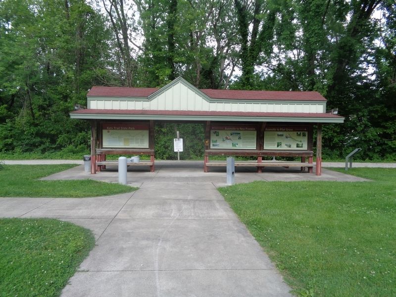
Marker is the far right column, at the Katy Trail Boonville Trailhead.

Regionally, this marker is in the Missouri River Corridor. It is also in the American Midwest, in the Lewis & Clark Corridor, in the Corn Belt, and on the Santa Fe Trail Corridor. Globally, it is in North America, the Western Hemisphere, the Western World, and the Anglosphere. Historically, it finds itself in what was once the territory of the Mississippian Culture, the Louisiana Purchase, and the Antebellum South.
Other nearby markers. At least 8 other markers are within walking distance of this marker: From Boone's Lick to Boonslick (here, next to this marker); 25th Anniversary (here, next to this marker); Boonville to New Franklin (a few steps from this marker); History of Boonville (a few steps from this marker); Boonville Depot (about 500 feet away, measured in a direct line); The End of the Line (about 500 feet away); "Caboose #134" (about 600 feet away); Kemper Military School & College 1844-2002 (approx. ¼ mile away). Touch for a list and map of all markers in Boonville.
Also see . . . Katy Trail State Park (Missouri State Parks). (Submitted on May 26, 2024, by Jason Voigt of Glen Carbon, Illinois.)
Credits. This page was last revised on May 26, 2024. It was originally submitted on May 26, 2024, by Jason Voigt of Glen Carbon, Illinois. This page has been viewed 422 times since then and 48 times this year. Photos: 1, 2. submitted on May 26, 2024, by Jason Voigt of Glen Carbon, Illinois.
