Beverly in Randolph County, West Virginia — The American South (Appalachia)
Presbyterian Church
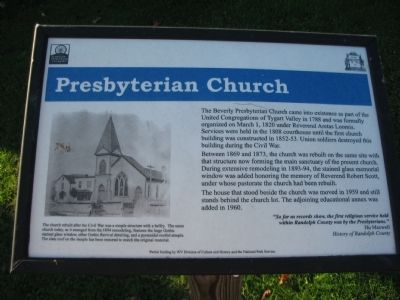
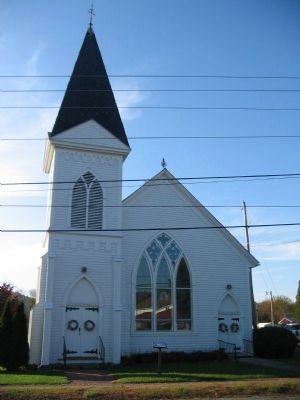
Between 1869 and 1873, the church was rebuilt on the same site with that structure now forming the main sanctuary of the present church. During extensive remodeling in 1893-94, the stained glass memorial window was added honoring the memory of Reverend Robert Scott, under whose pastorate the church had been rebuilt.
The house that stood beside the church was moved in 1959 and still stands behind the church lot. The adjoining educational annex was added in 1960.
"So far as records show, the first religious service held within Randolph County was by the Presbyterians."
Hu Maxwell
History or Randolph County
The church rebuilt after the Civil War was a simple structure with a belfry. The same church today, as it emerged from the 1894 remodeling, features the large Gothic stained glass window, other Gothic Revival detailing, and a pyramidal-roof steeple. The slate roof on the steeple has been restored to match the original material.
Erected by Staunton Parkersburg Turnpike and Historic Beverly, W.Va.
Topics. This historical marker is listed in these topic lists: Churches & Religion • War, US Civil. A significant historical month for this entry is March 1840.
Location. 38° 50.582′ N, 79° 52.441′ W. Marker is in Beverly, West Virginia, in Randolph County. Marker is at the intersection of Main Street (U.S. 219) and Collett Street, on the right when traveling south on Main Street. Located at stop eight of the tour of Historic Beverly. Touch for map. Marker is in this post office area: Beverly WV 26253, United States of America. Touch for directions.
Other nearby markers. At least 8 other markers are within walking distance of this marker. Gum Hart / Collett House (within shouting distance of this marker); Beverly Methodist Church (within shouting distance of this marker); Peter Buckey House (about 300 feet away, measured in a direct line); Public Education in Beverly, VA-WV Beginning 1858 (about 400 feet away); Laura Jackson Arnold (about 400 feet away); Jonathan Arnold House (about 500 feet away); Crozet~Chenoweth / Rich Mountain Battlefield (about 500 feet away); Beverly Covered Bridge (about 600 feet away). Touch for a list and map of all markers in Beverly.
Also see . . . Beverly Presbyterian Church. Page from the Historic Beverly web site. (Submitted on November 22, 2009, by Craig Swain of Leesburg, Virginia.)
Credits. This page was last revised on June 16, 2016. It was originally submitted on November 22, 2009, by Craig Swain of Leesburg, Virginia. This page has been viewed 879 times since then and 18 times this year. Photos: 1, 2. submitted on November 22, 2009, by Craig Swain of Leesburg, Virginia.

