Charlevoix in Charlevoix County, Michigan — The American Midwest (Great Lakes)
The Lower Channel
⎯⎯⎯
Bridges, Boats, and the Weathervane Inn

Photographed by J. J. Prats, September 24, 2023
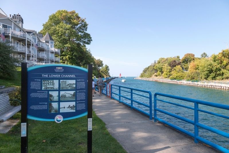
1. The Lower Channel side of marker
Click on image to examine photos.
Hotel Alhambra, ca. 1935 The Lewis Grand Opera House was constructed on this site, abutting the channel, in 1883. Served the community as a theater and meeting place until the building was converted into the red brick Hotel Alhambra in the early 1920s. This operated into the World War II years, after which the early empty structure was torn down in 1947 for the installation of today’s Memorial Bridge.
Channel South Revetment, ca. 1905 The first channel revemtents were made of wood, at first just double pilings connected by boards. These gradually grew more substantial as the channel was widened, as seen here. All the wood revetments needed constant repair or replacement due to curremts. waves, ice, and rot. A particularly hand winter could almost destroy them. All the early revetments had narrow, unprotected walkways along the channel edge.
Cement Revetments, 1960s To alleviate the perpetual replacement needs, much heavier concrete revetments were installed in the late 1930s. But within twenty years these began to crack and tilt precariously in places, some segments angling inward so steeply it was impossible to walk atop them. These rapidly
this page online
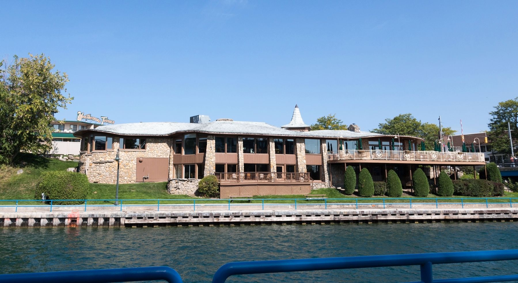
Argo Milling Company, ca. 1953 Across the channel from the opera house stood the Rifenburg Milling Company grist mill, built in 1885. It was later named the Charlevoix Roller Mills, finally the Argo Milling Company. After ten years of negotiations, builder in stone Earl A. Young bought them in 1953, and tore it down to rerplace it with his mastepiece, the Weathervane Inn, opened in July 1954.
Fountain City House Hotel, 1880s Just beyond the grist mill stood the Fountain City House, the first hotel north of Traverse City. Begun in 1867, it was named after a passenger boat that brought in many of in first clients. Within less than ten years the Fountain City House grew into the largest hotel in northern lower Michigan and was in business almost nine decades. Earl A. Young bought the property to build the Weathervane Terrace hotel from 1961 to 1964.
Ruined North Revetment. 1906 The Federal government maintained the entire channel, but for some unknown reason at the end of the 19th century allowed the entire north revetment to disintegrate almost to nothing until

Photographed by J. J. Prats, September 24, 2023
2. Bridges, Boats, and the Weathervane Inn side of marker
Fourth Channel Bridge, 1901 In 1897, it was reported that more marine tonnage was entering Charlevoix than any other port on the east side of Lake Michigan. The large vessels of the time needed access to Round Lake and Lake Charlevoix, thus necessitating construction of a widened channel and a longer span. As a result, in 1901, the year the project was completed, the bridge tender swung open the new bridge a recond-breaking 91 times on one summer Sunday alone.
Sixth Channel Bridge, April, 1949 The current Memorial Bridge opened in late June of 1949, widening the draw to the extent that the largest lake freighters could now each the far ends of Lake Charlevoix. Shown is the final balance testing of the “leaves.” In the distance appears the temporary bridge, in place between 1947 and 1949. This is one of the most photographed bridges in Michigan.
Weathervane Threatened, June, 1971 In November of 1970, very high water combined with three days of high winds reaching to hurricane
Photographed by J. J. Prats, September 24, 2023
3. The Lower Channel / Bridges, Boats, and the Weathervane Inn Marker
“City of Grand Rapids,” 1880s Small passenger steamers, such as the City of Grand Rapids, were the lifelines for travelers to and from all the ports between the Straits of Mackinac and Chicago. They could stretch their seasons longer than the larger passenger liners did, plus the liners did not serve many of the smaller ports. At far left appears the Fountain City House hotel, today the site of the Weathervane Terrace Hotel.
First “Emerald Isle,” late 1950s. Irregular ferry transportation between Charlevoix and Beaver Island was in place by 1894. When the permanent Federal mail route was obtained here in 1896, regular scheduled service began. The officially named Beaver Island Boat Company was established in 1954. Seen here is the company’s first Emerald Isle, in service from 1955 to 1962.
“South American,” late 1950s. Tje

Photographed by J. J. Prats, September 24, 2023
4. The Lower Channel / Bridges, Boats, and the Weathervane Inn Marker
Erected by Charlevoix Historical Society. (Marker Number 5.)
Topics. This historical marker is listed in these topic lists: Bridges & Viaducts • Waterways & Vessels. A significant historical month for this entry is April 1949.
Location. 45° 19.16′ N, 85° 15.555′ W. Marker is in Charlevoix, Michigan, in Charlevoix County. It can be reached from the intersection of Bridge Street and Park Avenue, on the left when traveling north. It is on the south walking path of the Round lake channel, across from the Weathervane Restaurant. Touch for map. Marker is at or near this postal address: 101 Park Ave, Charlevoix MI 49720, United States of America. Touch for directions.

Regionally, this marker is in Northern Michigan Lower Peninsula, in the Grand Traverse Bay Region, and in one of the Lake Michigan Shore counties. It is also in the American
Photographed by J. J. Prats, September 24, 2023
5. The former Weathervane Inn
Other nearby markers. At least 8 other markers are within walking distance of this marker: History of Indigenous People in the Region / History of Indigenous People in the Area (within shouting distance of this marker); The Last Swing Bridge (about 300 feet away, measured in a direct line); Robert Bridge Memorial Park (about 300 feet away); The Lower Channel Bridges (about 300 feet away); 103 Main Street (now Park Avenue) (about 400 feet away); Fishing and Lumbering - Round Lake, North Shore / Bridge Park and Bridge Street (about 400 feet away); Pierre Francois-Xavier de Charlevoix (about 600 feet away); The First Congregational Church (about 700 feet away). Touch for a list and map of all markers in Charlevoix.
Credits. This page was last revised on September 22, 2024. It was originally submitted on May 27, 2024, by J. J. Prats of Powell, Ohio. This page has been viewed 365 times since then and 20 times this year. Photos: 1, 2, 3, 4, 5. submitted on May 27, 2024, by J. J. Prats of Powell, Ohio.
