
Sunset Heights in El Paso in El Paso County, Texas — The American South (West South Central)
El Paso del Rio del Norte
Photographed by Richard Denney, December 25, 2007
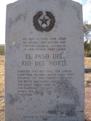
1. El Paso del Rio del Norte Marker
Through this old pass, the lowest snow-free feasible route from the Atlantic to the Pacific through the Rocky Mountains, extend today the great trunk lines of telegraph and railroad. The city of El Paso marks the place and perpetuates the name.
Erected 1936 by State of Texas. (Marker Number 1427.)
Topics and series. This historical marker is listed in these topic lists: Hispanic Americans • Settlements & Settlers. In addition, it is included in the Texas 1936 Centennial Markers and Monuments series list. A significant historical month for this entry is May 1992.
Location. 31° 45.73′ N, 106° 30.556′ W. Marker is in El Paso, Texas, in El Paso County. It is in Sunset Heights. It can be reached from West Paisano Drive, on the right when traveling south. Near Old Fort Bliss, the marker is near the parking lot of the La Hacienda Restaurant. Touch for map. Marker is at or near this postal address: 1704 W Paisano Dr, El Paso TX 79922, United States of America. Touch for directions.

Regionally,
this page online
Other nearby markers. At least 8 other markers are within walking distance of this marker: Major Simeon Hart (here, next to this marker); Capt. James W. Magoffin (here, next to this marker); The Camino Real (here, next to this marker); Fort Bliss Officers' Quarters (about 700 feet away, measured in a direct line); Sunset Heights (approx. half a mile away); The University of Texas at El Paso (approx. 0.7 miles away); Wallace Apartments (approx. 0.7 miles away); Old Main (approx. 0.7 miles away). Touch for a list and map of all markers in El Paso.
Photographed by Richard Denney, December 25, 2007
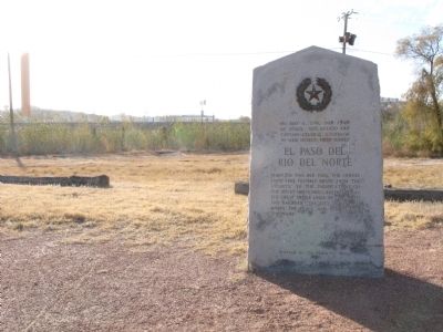
2. View looking west into Mexico from the marker
Credits. This page was last revised on June 25, 2024. It was originally submitted on November 22, 2009, by Richard Denney of Austin, Texas. This page has been viewed 3,475 times since then and 159 times this year. Photos: 1, 2. submitted on November 22, 2009, by Richard Denney of Austin, Texas. • Kevin W. was the editor who published this page.
