Near New Franklin in Howard County, Missouri — The American Midwest (Upper Plains)
Visit the Trail - West
Santa Fe National Historic Trail

Photographed by Jason Voigt, May 15, 2024
1. Visit the Trail - West Marker
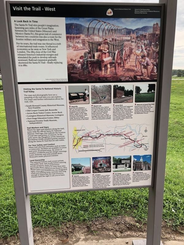
A Look Back in Time
The Santa Fe Trail stirs people's imagination. Spanning 900 miles of the Great Plains between the United States (Missouri) and Mexico (Santa Fe), this great trail of commerce between two countries was also a route for the frontier military and emigration to the West.
For 60 years, the trail was one thread in a web of international trade routes. It influenced economies as far away as New York and London. The 1865 close of the Civil War released America's industrial energies and stimulated the push to develop railroads westward. Railroad expansion gradually shortened the Santa Fe Trail - finally replacing it in 1880.
(list of Santa Fe towns and sites:)
1) Boonville
Boonville was platted in 1817 on the south bank of the Missouri River. Boonville residents such as James L. Collins, captain of the 1828 Santa Fe Trail caravan, were involved in the Santa Fe trade. Numerous 19th century structures survive in the town.
2) Boone's Lick
Daniel Boone's sons, Nathan and Daniel Morgan Boone, set up a salt manufacturing works in 1805 at this salty spring. William Becknell, "Father of the Santa Fe
this page online
3) Arrow Rock
The Arrow Rock bluff appeared on maps beginning in 1732. The Osage Trace, which became the Santa Fe Trail, crossed the Missouri River here. Arrow Rock was a landmark for explorers, traders, and travelers. The town is a national historic landmark and includes a state historic site and visitor center.
4) Weinrich & Grand Pass Ruts
Impressive eroded ruts are clearly visible where the trail crossed Indian Spring and Harvey Spring, and in the cemetery at Grand Pass behind the Methodist Church.
5) Waverly
Founded as Middleton, this was one of the earliest towns along the Osage Trace that became the Road to Santa Fe. A DAR marker stands in front of the 1818 Col. John Thomas log house that is being restored as a visitor center.
6) Lexington
Here caravans were outfitted in the 1820s and 1830s. This town was the headquarters of the Aull Brothers and Russell, Majors & Waddell who were major outfitters. A driving tour brochure is available from the tourism office and from the historical museum, which
Photographed by Duane and Tracy Marsteller, July 1, 2024
2. Visit the Trail - West Marker
7) Fort Osage
Fort Osage, founded in 1808 under the direction of William Clark, primarily served the fur trade with the Osage and other tribes. After Congress abolished this Indian trade in 1822, the fort waned. The fort was a staging area for George Sibley's 1825-27 Santa Fe Trail survey.
8) Independence
From 1828 until the mid-1840s Independence was the principle point for the Santa Fe traders and emigrants heading west. Many Santa Fe, Oregon and California trail-related sites remain.
Erected by Missouri Department of Natural Resources, National Park Service & Santa Fe Trail Association.
Topics and series. This historical marker is listed in these topic lists: Railroads & Streetcars • Roads & Vehicles. In addition, it is included in the Santa Fe Trail series list. A significant historical year for this entry is 1865.
Location. 38° 59.234′ N, 92° 45.318′ W. Marker is near New Franklin, Missouri, in Howard County. It is on Missouri Route 87 west of U.S. 40, on the right when traveling north. Marker is at a roadside pullout (with other markers) which also connects to the Katy Trail. Touch for map.
Photographed by Jason Voigt, May 15, 2024
3. Visit the Trail - West Marker
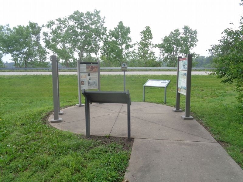
Marker is on the far left

Regionally, this marker is in Little Dixie and in the Missouri River Corridor. It is also in the American Midwest, in the Lewis & Clark Corridor, in the Corn Belt, and on the Santa Fe Trail Corridor. Globally, it is in North America, the Western Hemisphere, the Western World, and the Anglosphere. Historically, it finds itself in what was once the territory of the Mississippian Culture, the Louisiana Purchase, and the Antebellum South.
Other nearby markers. At least 8 other markers are within walking distance of this marker: Franklin (here, next to this marker); Visit the Trail (here, next to this marker); The Boone's Lick Road (here, next to this marker); The Lewis and Clark Expedition Across Missouri (here, next to this marker); The Missouri Intelligencer and Boon's Lick Advertiser (within shouting distance of this marker); Lewis & Clark Corps of Discovery (about 300 feet away, measured in a direct line); Santa Fe Trail (about 300 feet away); Boonville / Franklin (about 300 feet away). Touch for a list and map of all markers in New Franklin.
Credits. This page was last revised on July 27, 2024. It was originally submitted on May 29, 2024, by Jason Voigt of Glen Carbon, Illinois. This page has been viewed 266 times since then and 38 times this year. Photos: 1. submitted on May 29, 2024, by Jason Voigt of Glen Carbon, Illinois. 2. submitted on July 26, 2024, by Duane and Tracy Marsteller of Murfreesboro, Tennessee. 3. submitted on May 29, 2024, by Jason Voigt of Glen Carbon, Illinois.
