Wells in York County, Maine — The American Northeast (New England)
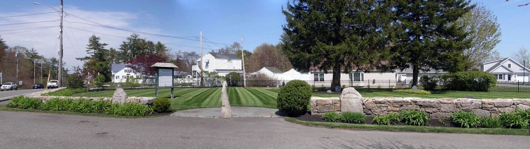
Webhannet Burial Grounds
Buffum Hill Cemetery
| — | 739 Post Road - Wells, Maine | — |
Photographed by Larry Gertner, May 14, 2024
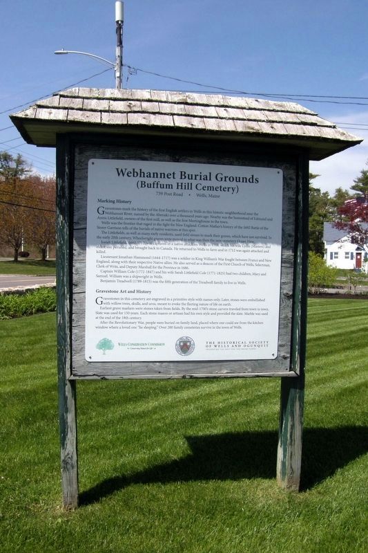
1. Webhannet Burial Grounds Marker
Marking History
Gravestones mark the history of the first English settlers in Wells in this historic neighborhood near the Webhannet River, named by the Abenaki over a thousand years ago. Nearby was the homestead of Edmond and Annis Littlefield, owners of the first mill, as well as the first Meetinghouse in the town.
Wells was the frontier that raged in the fight for New England. Cotton Mather’s history of the 1692 Battle of the Storer Garrison tells of burials of native warriors at this spot.
The Littlefields, as well as many early residents, used field stones to mark their graves, which have not survived. In the early 20th century, Wheelwright graves were moved to what was then the new cemetery Ocean View.
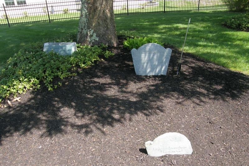
Josiah Littlefield, 1644-1712, was captured in a native attack on Wells in 1708, which his wife Lydia (Masters) and eldest son perished, and brought back to Canada. He returned to Wells to farm and in 1712 was again attacked and killed.
Lieutenant Johnathan Hammond (1644-1717) was a soldier in King William’s War fought between France and New England, along with their respective Native allies. He also served as a deacon of the First Church of Wells, Selectman, Clerk of Writs, and Deputy Marshall for the province in 1686.
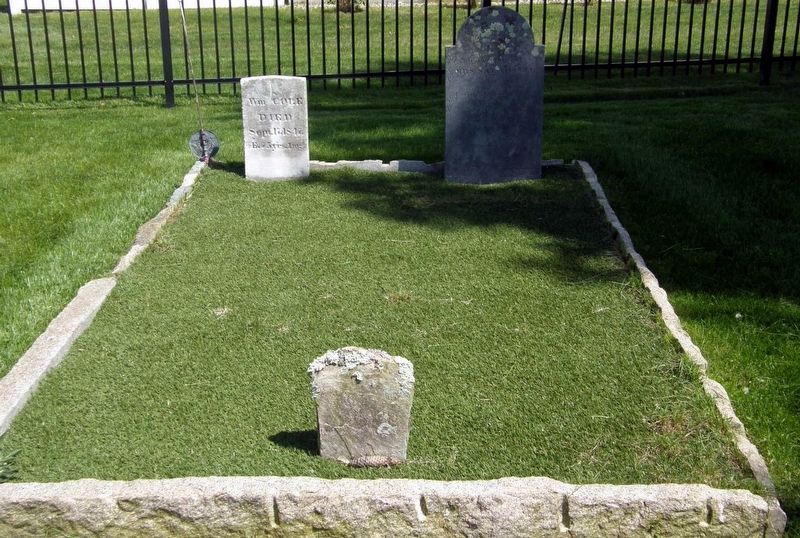
Captain Willian Cole (1772-1847) and his wife Sarah Littlefield Cole (1771-1825) had two children, Mary and Samuel. William was a shipwright in Wells.
Benjamin Tredwell (1780-1815) was the fifth generation of the Treadwell family to live in Wells.
Gravestone Art and History
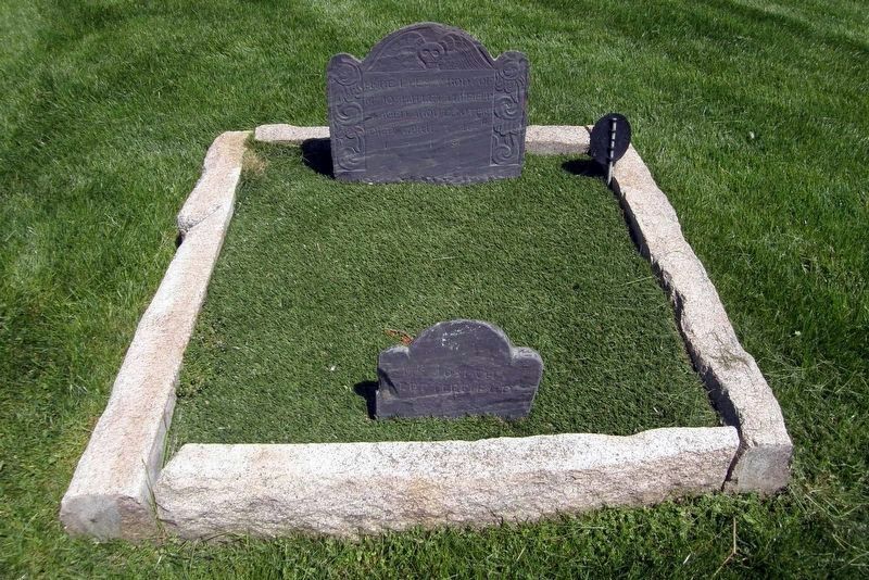
Gravestones in this cemetery are engraved in a primitive style with names only. Later, stones were embellished with willow trees, skulls, and urns, meant to evoke the fleeting nature of life on earth.
Earliest grave markers were stones taken from fields. By the mid-1700’s stone carvers traveled
this page online
After the Revolutionary War, people were buried on family land, placed where one could see from the kitchen window where a loved one “lie sleeping”. Over 200 family cemeteries survive in the town of Wells.
Erected by Wells Conservation Commission; The Historical Society of Wells and Ogunquit.
Topics. This historical marker is listed in this topic list: Cemeteries & Burial Sites. A significant historical year for this entry is 1692.
Location. 43° 17.735′ N, 70° 35.277′ W. Marker is in Wells, Maine, in York County. It is at the intersection of Post Road (U.S. 1) and Starfish Road, on the right when traveling north on Post Road. Touch for map. Marker is at or near this postal address: 739 Post Rd, Wells ME 04090, United States of America. Touch for directions.

Regionally, this marker is on Southern Maine Coast. It is also in the American Northeast, in New England, and on the Eastern Seaboard. Globally, it is in the North Atlantic Region, North America, the Western
Photographed by Larry Gertner, May 14, 2024
2. Webhannet Burial Grounds
Other nearby markers. At least 8 other markers are within 4 miles of this marker, measured as the crow flies: Civil War Soldiers Monument (approx. 1.7 miles away); World War Memorial (approx. 1.7 miles away); World War II, Korea, and Vietnam Era Veterans Memorial (approx. 1.7 miles away); David von Schlegell (approx. 3.3 miles away); Farmhouse (approx. 3.4 miles away); Water Tower (approx. 3½ miles away); Ice House (approx. 3½ miles away); Cow Barn (approx. 3½ miles away). Touch for a list and map of all markers in Wells.
Also see . . . A History of Locating of Cemeteries in Wells, Maine. Town of Wells website entry (Submitted on May 29, 2024, by Larry Gertner of New York, New York.)
Photographed by Larry Gertner, May 14, 2024
3. William and Sarah Cole
Stone and slate

Photographed by Larry Gertner, May 14, 2024
4. Benjamin Tredwell
Willow tree motif
Photographed by Larry Gertner, May 14, 2024
5. The Littlefields
Skull motif
Photographed by Larry Gertner, May 14, 2024
6. The Hammonds
Skull motif
Photographed by Larry Gertner, May 14, 2024
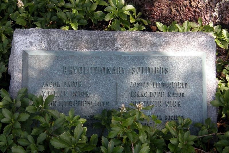
7. Revolutionary War Soldiers plaque
Credits. This page was last revised on June 12, 2024. It was originally submitted on May 29, 2024, by Larry Gertner of New York, New York. This page has been viewed 542 times since then and 72 times this year. Photos: 1, 2, 3, 4, 5, 6, 7. submitted on May 29, 2024, by Larry Gertner of New York, New York.
