Near Tensaw in Baldwin County, Alabama — The American South (East South Central)
Mims Plantation
| — | Fort Mims Historical and Archaeological Site | — |
Photographed by Mark Hilton, May 28, 2024
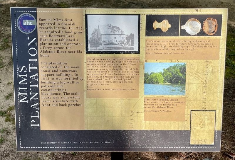
1. Mims Plantation Marker
Samuel Mims first appeared in Spanish records in 1786. In 1797, he acquired a land grant near Boatyard Lake. Here he established a plantation and operated a ferry across the Alabama River near his home.
The plantation consisted of the main house and numerous support buildings. In 1813, it was fortified by building a log wall or palisade and constructing a blockhouse. The main house was a one-story frame structure with front and back porches.
Captions:
Middle:
The Mims house may have looked something like this Creole cottage, a type of vernacular architecture indigenous to the Gulf Coast of the United States. The style was a dominant house type along the central Gulf Coast from about 1790 to 1840 in the former settlements of French Louisiana in Alabama, Louisiana, and Mississippi. The style may have evolved from French and Spanish colonial house-forms, although the true origins are unclear.
Source: Eugene Wilson, A Guide To Rural Houses of Alabama
Right top:
Artifacts recovered on this site during archaeological investigation. Left: brass furniture hardware, probably a drawer pull. Right: tin drinking cups. The shiny tin cup is a reproduction of the original on the right.
Source: Alabama Historical Commission
Right bottom:
Mims Ferry Landing. Samuel Mims operated a ferry to transport travelers on the federal road across the Alabama River.
Source: Gregory A. Waselkov
Erected 2022
this page online
Topics. This historical marker is listed in these topic lists: Forts and Castles • Waterways & Vessels. A significant historical year for this entry is 1786.
Location. 31° 10.822′ N, 87° 50.268′ W. Marker is near Tensaw, Alabama, in Baldwin County. It can be reached from Fort Mims Road 0.4 miles Boatyard Road, on the right when traveling west. Located within the Fort Mims site. Touch for map. Marker is at or near this postal address: 1813 Fort Mims Rd, Stockton AL 36579, United States of America. Touch for directions.

Regionally, this marker is on the Gulf Coast and in the Mobile Bay area. It is also in the American South, specifically in the Deep South, and on the Gulf Coast. Globally, it is in North America, a Gulf of Mexico state, the Western Hemisphere, the Western World, and the Anglosphere. Historically, it finds itself in what was once New Spain, the Viceroyalty of New France, the territory of the Mississippian Culture, one of the Confederate States of America, and the Antebellum South.
Other nearby markers. At least 8 other markers are within walking distance of this

Photographed by Mark Hilton, May 28, 2024
2. Mims Plantation Marker

Photographed by Mark Hilton, July 25, 2015
3. Fort Mims Site sign.
Credits. This page was last revised on June 4, 2024. It was originally submitted on May 29, 2024, by Mark Hilton of Montgomery, Alabama. This page has been viewed 1,469 times since then and 182 times this year. Photos: 1, 2, 3. submitted on May 29, 2024, by Mark Hilton of Montgomery, Alabama.
