Near Tensaw in Baldwin County, Alabama — The American South (East South Central)
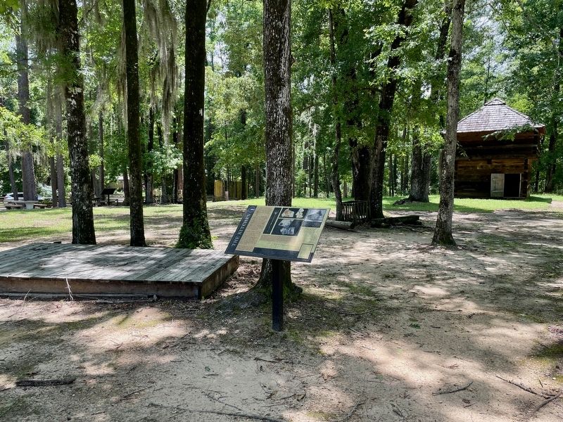
The Kitchen
| — | Fort Mims Historical and Archaeological Site | — |

Photographed by Mark Hilton, May 28, 2024
1. The Kitchen Marker
The Mims homestead was made up of a main house and several small buildings. The kitchen and smokehouse stood near here.
These were important buildings, necessary for. the preservation and preparation of food. The smokehouse served dual purposes to smoke and store the meat. The kitchen and smokehouse may have been combined into one building on the Mims homestead.
Around 3:00pm, the Red Stick Creek warriors set fire to either the smokehouse or the blacksmith shop, both located on the south side of the fort. The fire quickly spread to other buildings and the fort's walls.
The fire burned so hot that it melted cast iron cooking pots and glass.
Captions:
Middle:
Artifacts recovered on this site during archaeological investigations. Left: fragment of a small table fork. Top: tea cup fragments decorated with multicolored, hand painted design often called "majolica"., Bottom: fragments of a dish decorated in a cobalt willow pattern, a decoration that mimicked popular designs on more expensive Chinese porcelain.
Source: Alabama Historical Commission
Right:
Representative illustration of a smokehouse, Henry Whitehead Place, Townsend, Tennessee.
Source: Library of Congress
Erected 2022
this page online
Topics. This historical marker is listed in these topic lists: Forts and Castles • Wars, US Indian.
Location. 31° 10.82′ N, 87° 50.278′ W. Marker is near Tensaw, Alabama, in Baldwin County. It can be reached from Fort Mims Road 0.4 miles Boatyard Road, on the right when traveling west. Located with the Fort Mims site. Touch for map. Marker is at or near this postal address: 1813 Fort Mims Rd, Stockton AL 36579, United States of America. Touch for directions.

Regionally, this marker is on the Gulf Coast and in the Mobile Bay area. It is also in the American South, specifically in the Deep South, and on the Gulf Coast. Globally, it is in North America, a Gulf of Mexico state, the Western Hemisphere, the Western World, and the Anglosphere. Historically, it finds itself in what was once New Spain, the Viceroyalty of New France, the territory of the Mississippian Culture, one of the Confederate States of America, and the Antebellum South.
Other nearby markers. At least 8 other markers are within walking distance of this marker:
Photographed by Mark Hilton, May 28, 2024
2. The Kitchen Marker and footprint of kitchen building.

Photographed by Mark Hilton, July 25, 2015
3. Fort Mims Site sign.
Credits. This page was last revised on June 4, 2024. It was originally submitted on May 29, 2024, by Mark Hilton of Montgomery, Alabama. This page has been viewed 311 times since then and 32 times this year. Photos: 1, 2, 3. submitted on May 29, 2024, by Mark Hilton of Montgomery, Alabama.
