Near Tensaw in Baldwin County, Alabama — The American South (East South Central)
The Battle of Fort Mims
| — | Fort Mims Historical and Archaeological Site | — |

Photographed by Mark Hilton, May 28, 2024
1. The Battle of Fort Mims Marker
As the occupants of Fort Mims took their mid-day meal on August 30, 1813, a force of around 700 Redstick Creek warriors charged toward the fort's open east gate (1). Major Daniel Beasley, commander of the Mississippi Territorial Volunteers garrison, fell near the gate along with most of his men (2). Survivors of the initial onslaught took refuge inside the main compound, where hundreds of civilians and the local militia came under fire from Redstick warriors shooting through gunports in the south wall (3). Redsticks and Americans fought for control of the block- house (4), which was unoccupied when the attack occurred.
After several hours of fighting, the battle stalemated. When the Redstick Creeks renewed their attack, they shot fire arrows into the kitchen and other buildings (5) near the south wall, setting the entire fort ablaze. Defenders held out in the Mims family home (6) until overcome by smoke and flames. The north wall had been stoutly defended throughout the battle by local Tensaw militia (7) led by Captain Dixon Bailey, a Creek métis like many of his men. By early evening, with nearly
this page online
This map of the Fort Mims battlefield, drawn by a member of an American reconnaissance party, probably on September 8, 1813, was found many years later among the papers of Gen. Ferdinand Claiborne, commander of the Mississippi Territorial Volunteers. [Map courtesy of the Alabama Department of Archives and History]
Lieutenant Spruce McKay Osborne, chief surgeon with the Mississippi Territorial Volunteers, died in the loom house (near 7) toward the end of the battle. [Only known image of a battle participant, image courtesy of the Alabama Department of Archives and History]
Archaeology at Fort Mims has uncovered many fascinating artifacts. A broad axe (a), found in one of the fort's wells, still carries the owner's initials, ZM, pecked into the poll. Zachariah McGirth walked out of the fort minutes before the Redstick Creek attack and hid in a nearby cane thicket during the battle.
The wooden pulley (b) was preserved underwater at the bottom

Photographed by Mark Hilton, May 28, 2024
2. The Battle of Fort Mims Marker (left of stone memorials).
Erected 2013 by the Alabama Historical Commission.
Topics. This historical marker is listed in these topic lists: Forts and Castles • Wars, US Indian. A significant historical date for this entry is August 30, 1813.
Location. 31° 10.814′ N, 87° 50.266′ W. Marker is near Tensaw, Alabama, in Baldwin County. It can be reached from Fort Mims Road 0.4 miles Boatyard Road, on the right when traveling west. Located within the Fort Sims Site. Touch for map. Marker is at or near this postal address: 1813 Fort Mims Rd, Stockton AL 36579, United States of America. Touch for directions.

Regionally, this marker is on the Gulf Coast and in the Mobile Bay area. It is also in
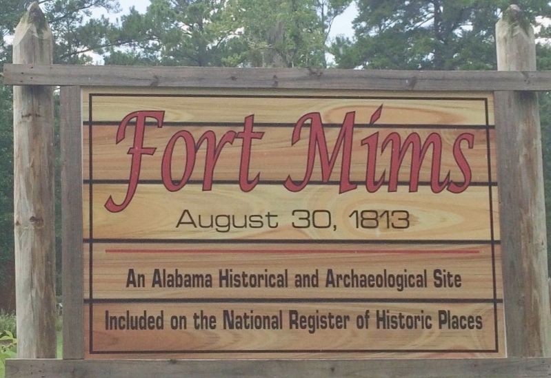
Photographed by Mark Hilton, July 25, 2015
3. Fort Mims Site sign.
Other nearby markers. At least 8 other markers are within walking distance of this marker: Fort Mims Massacre (a few steps from this marker); Mims Plantation (a few steps from this marker); War in the Tensaw, 1813 (a few steps from this marker); The Kitchen (a few steps from this marker); Wells (a few steps from this marker); The South Wall (within shouting distance of this marker); The Blockhouse (within shouting distance of this marker); Main Compound (within shouting distance of this marker). Touch for a list and map of all markers in Tensaw.
Also see . . . Fort Mims Battle and Massacre - The Encyclopedia of Alabama. (Submitted on May 29, 2024, by Mark Hilton of Montgomery, Alabama.)
Credits. This page was last revised on June 4, 2024. It was originally submitted on May 29, 2024, by Mark Hilton of Montgomery, Alabama. This page has been viewed 566 times since then and 65 times this year. Photos: 1, 2, 3. submitted on May 29, 2024, by Mark Hilton of Montgomery, Alabama.
