Peterborough in Peterborough County, Ontario — Central Canada (North America)
The Peterborough Lift Lock
⎯⎯⎯
L'ascenseur a bateaux de Peterborough

Photographed by Cosmos Mariner, May 31, 2024
1. The Peterborough Lift Lock / L'ascenseur a bateaux de Peterborough Marker

this page online
Erected 1985 by Historic Sites and Monuments Board of Canada / Commission des lieux et monuments historiques du Canada.
Topics and series. This historical marker is listed in these topic lists: Architecture • Waterways & Vessels. In addition, it is included in the Canada, Historic Sites and Monuments Board series list. A significant historical year for this entry is 1904.
Location. 44° 18.428′ N, 78° 18.08′ W. Marker is in Peterborough, Ontario, in Peterborough County. It can be reached from Hunter Street East 0.1 kilometers west of Ashburnham Drive, on the left when traveling south. The marker is located near the northeast corner of the Trent-Severn Waterway, Peterborough Lift Lock Visitor Centre, overlooking the canal and the southwest corner of the lift lock. Touch for map. Marker
Photographed by Cosmos Mariner, May 31, 2024
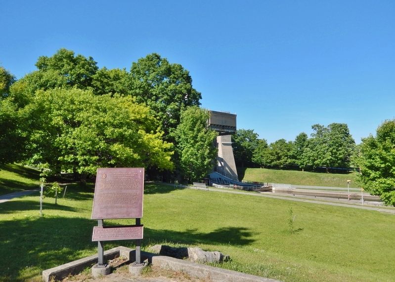
2. The Peterborough Lift Lock / L'ascenseur a bateaux de Peterborough Marker
Looking northeast; the southwest corner of the lift lock is in the background.

Regionally, this marker is in the Kawarthas Northumberland Area and in Eastern Ontario. It is also in Central Canada. Globally, it is in North America, the Western Hemisphere, the Western World, and the Anglosphere. Historically, it finds itself in what was once a British colony, the Viceroyalty of New France, the Haudenosaunee (Iroquois) Confederacy, and Rupert’s Land.
Other nearby markers. At least 8 other markers are within walking distance of this marker: D-Day/Jour J (within shouting distance of this marker); Women and the Second World War / Les femmes et la Seconde Guerre mondiale (within shouting distance of this marker); Red River Resistance / La résistance de la Rivière-Rouge (within shouting distance of this marker); Richard Birdsall Rogers (about 90 meters away, measured in a direct line); Trent-Severn Waterway National Historic Site (about 90 meters away); Tollington Bridge (approx. 1.2 kilometers away); The Robinson Settlement (approx. 1.4 kilometers away); The Peterborough Club (approx.
Photographed by Cosmos Mariner, May 31, 2024
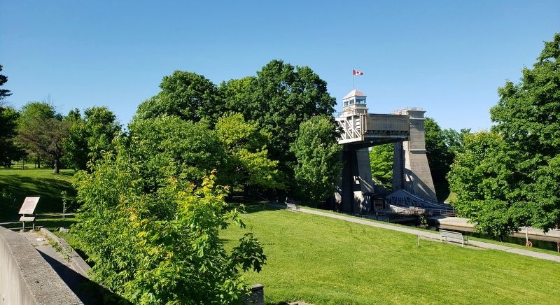
3. The Peterborough Lift Lock & Canal
(as seen from the Visitor Centre)
(as seen from the Visitor Centre)
Looking northeast from the Peterborough Lift Lock Visitor Centre; the marker is visible on the left; the southwest corner of the lift lock is in the right background.
Regarding The Peterborough Lift Lock / L'ascenseur a bateaux de Peterborough. Listed on the Canadian Register of Historic Places, 02/27/2009.
Related markers. Click here for a list of markers that are related to this marker. Peterborough Lift Lock National Historic Site
Also see . . .
1. Peterborough Lift Lock (Wikipedia). Excerpt:
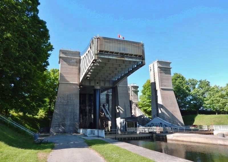
The Peterborough Lift Lock is located on the Trent Canal and is Lock 21 on the Trent-Severn Waterway. For many years, the lock's dual lifts were the highest hydraulic boat lifts in the world, raising boats 65 ft. This was a considerable accomplishment in the first years of the 20th century, when conventional locks usually only had a 7 ft rise. In the 1980s, a visitor centre was built beside the lock. It offers interactive simulations of going over the lift lock in a boat, and historical exhibits detailing the construction of the lift lock. The Peterborough Lift Lock was designated a National Historic Site in 1979 and was named an Historic Mechanical Engineering Landmark by the American Society of Mechanical(Submitted on June 1, 2024, by Cosmos Mariner of Cape Canaveral, Florida.)Engineers in 1987.Photographed by Cosmos Mariner, May 31, 20244. The Peterborough Lift Lock & CanalLooking north from the south (low) side. The west chamber is seen here in its highest position. The giant steel hydraulic supporting ram is visible underneath the chamber.
The final project included many engineering firsts. It was the first lock to be built out of concrete, and at the time was the largest structure ever built in the world with unreinforced concrete. Construction was by Corry and Laverdure of Peterborough, which excavated the site and built the concrete towers and lock, and Dominion Bridge Company of Montreal, which completed the metal work including rams, presses and large caissons, and was finished in 1904. The lift lock officially opened to the public to a crowd of thousands on 9 July 1904, and remains in full use today.
2. Peterborough Lift Lock National Historic Site of Canada. Excerpt:
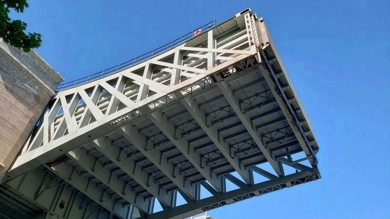
The key elements that contribute to the heritage character of this site include: its ongoing function as a lift lock integral to the Trent-Severn Waterway; the structure itself, namely the concrete and steel construction, the towers, caisson pits and breastworks, the two chambers, and the mechanical works both visible and below ground which enable the lock to function; the immediate upper and lower(Submitted on June 1, 2024, by Cosmos Mariner of Cape Canaveral, Florida.)canal cuts and the embankments; the architectural detailing, including the pilasters, string courses and cornices on the towers, breastworks and lockmaster’s cabin.Photographed by Cosmos Mariner, May 31, 20245. Peterborough Lift Lock: underside of the west chamberLooking up from the south side of the lock, the west chamber is seen in its highest position – level with the canal on the north side of the lock.
3. Peterborough Lift Lock (Canada Register of Historic Places). Excerpt:
The lock operates on a balance system, whereby water is let into the upper chamber, a connecting valve is opened and the heavier chamber automatically descends, forcing up the lower chamber to start a new cycle. The lift lock continues to function as part of the Trent–Severn Waterway National Historic Site of Canada under the management of Parks Canada.(Submitted on June 1, 2024, by Cosmos Mariner of Cape Canaveral, Florida.)
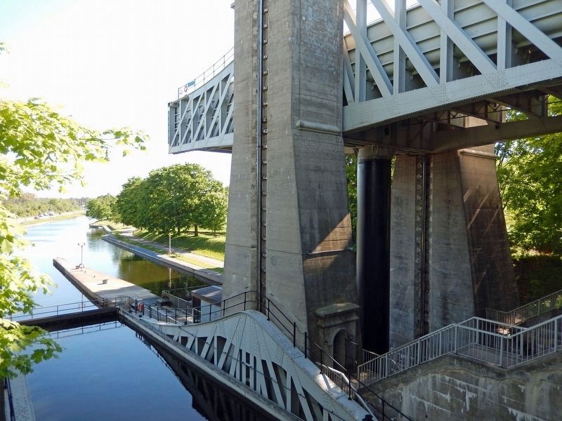
Photographed by Cosmos Mariner, May 31, 2024
6. Peterborough Lift Lock: east and west chambers
Looking south from inside the lock structure. The east chamber (in lowest position) is poised to receive watercraft from the south (low) side of the lock. The west chamber (in highest position) is poised to receive watercraft from the north (high) side of the lock. The lock manages a 65-foot elevation change between its south and north sides.
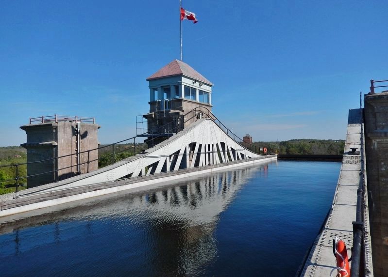
Photographed by Cosmos Mariner, May 31, 2024
7. Peterborough Lift Lock: west chamber
Looking south across the west chamber (in highest position).
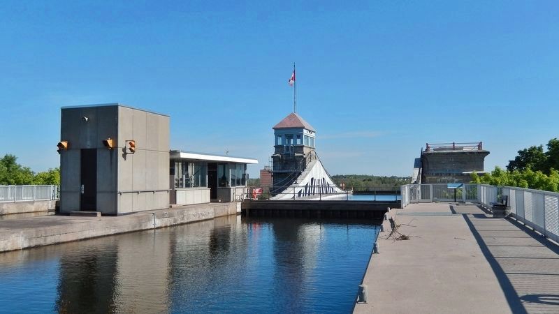
Photographed by Cosmos Mariner, May 31, 2024
8. The Peterborough Lift Lock & Canal
Looking south from the north (high) side. The west chamber is seen here in its highest position.

Photographed by Cosmos Mariner, May 31, 2024
9. The Peterborough Lift Lock Structure (west elevation)
Looking east; Hunter Street East passes through the one-lane tunnel at the base of the lock structure. The Peterborough Lift Lock Visitor Centre is located to the right of the sign.
Credits. This page was last revised on November 17, 2024. It was originally submitted on June 1, 2024, by Cosmos Mariner of Cape Canaveral, Florida. This page has been viewed 457 times since then and 73 times this year. Photos: 1, 2, 3, 4, 5, 6, 7, 8, 9. submitted on June 1, 2024, by Cosmos Mariner of Cape Canaveral, Florida.
