Morro Bay in San Luis Obispo County, California — The American West (Pacific Coastal)
Morro Rock
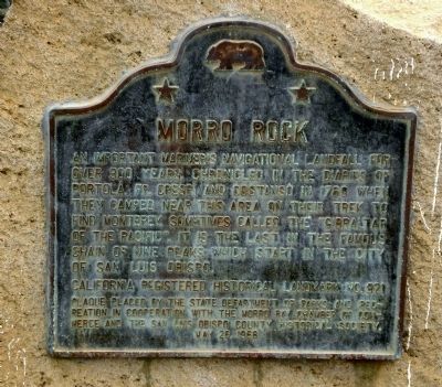
Photographed by Andrew Ruppenstein, September 5, 2008
1. Morro Rock Marker
California Registered Historical Landmark No. 821
Plaque placed by the State Department of Parks and Recreation in cooperation with the Morro Bay Chamber of Commerce and the San Luis Obispo County Historical Society.
Erected 1968 by California State Department of Parks and Recreation. (Marker Number 821.)
Topics and series. This historical marker is listed in these topic lists: Exploration • Landmarks • Natural Features. In addition, it is included in the California Historical Landmarks, and the Portolá Expedition series lists. A significant historical date for this entry is May 25, 1792.
Location. 35° 22.232′ N, 120° 51.899′ W. Marker is in Morro Bay, California, in San Luis Obispo County. It is on Coleman Drive 0.3 miles west of Embarcadero, on the right when traveling west.
this page online

Regionally, this marker is on the Central Coast and specifically on the Coast Ranges. It is also on the American Pacific Coast. Globally, it is in North America, on the Ring of Fire, on the Pacific Rim, in the Western Hemisphere, in the Western World, and in the Anglosphere. Historically, it finds itself in what was once New Spain and also Mexico’s Alta California.
Other nearby markers. At least 8 other markers are within walking distance of this marker: Endearing & Endangered (within shouting distance of this marker); The First Landing of Filipinos in the Continental United States (approx. ¼ mile away); a different marker also named Morro Rock (approx. ¼ mile away); Gifts From The Sea (approx. 0.3 miles away); Landing of the First Filipinos - October 18, 1587 (approx. 0.3 miles away); USCG in Morro Bay (approx. 0.4 miles away); Commercial Deepwater Groundfish Fishery (approx. 0.6 miles away); The Abalone of Morro Bay (approx. 0.7 miles away). Touch for a list and map of all markers in Morro Bay.
More about this marker.
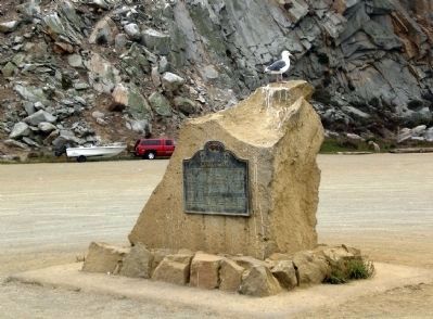
Photographed by Andrew Ruppenstein, September 5, 2008
2. Morro Rock Marker and Monument (with Morro Rock in the background)
Regarding Morro Rock.
• In 1542, Juan Rodriguez Cabrillo, the Portugese explorer, sighted and named Morro Rock.
• In 1769, Gaspar de Portola, Father Juan Crespi, and some sixty other men and one hundred mules marched north on an overland expedition from San Diego, to find Monterey Bay, camping at one point near Morro Rock.
• The Rock was quarried periodically from 1889 to 1963. In 1966 the State of California obtained title to it, and in 1968 was declared a state landmark, and Morro Rock is now a nature preserve.
Also see . . . Morro Rock. Morro Rock was an island up to the 1930s. This site provides discussion and numerous historical photographs of how the area surrounding Morro Rock has changed over time. (Submitted on November 25, 2009.)
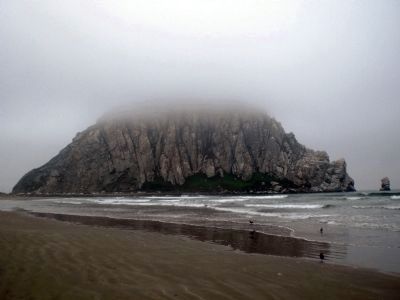
Photographed by Andrew Ruppenstein, September 5, 2008
3. Morro Rock (View from the North)
Morro Rock is estimated to be about 23 million years old, and is the plug remnant of an extinct volcano. Its roughly 580 foot tall peak was obscured by marine coastal fog on what was otherwise a warm and sunny day not very far from where this photo was taken.
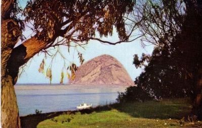
Distributed by Bob Ball, Visalia, California, Color by Mike Roberts, Berkeley, Calif.
4. Morro Rock - Morro Bay, Calif.
Description on Postcard:
Discovered by Cabrillo in 1542, this sheer piece of granite rises 576 feet to guard the broad white beaches and sheltered waters of picturesque Morro Bay.
Discovered by Cabrillo in 1542, this sheer piece of granite rises 576 feet to guard the broad white beaches and sheltered waters of picturesque Morro Bay.
Credits. This page was last revised on September 10, 2020. It was originally submitted on November 24, 2009, by Andrew Ruppenstein of Lamorinda, California. This page has been viewed 2,124 times since then and 87 times this year. Photos: 1. submitted on November 24, 2009, by Andrew Ruppenstein of Lamorinda, California. 2, 3. submitted on November 25, 2009, by Andrew Ruppenstein of Lamorinda, California. 4. submitted on December 3, 2009. • Syd Whittle was the editor who published this page.
