Richland Township near St. Clairsville in Belmont County, Ohio — The American Midwest (Great Lakes)
Great Western School
The Historic National Road in Ohio

Photographed by Jason Voigt, April 16, 2024
1. Great Western School Marker
Classes were held in the building until 1952 when it was closed due to declining enrollment and the district consolidation program. It was the last active one-room school in Richland Township. After its closure, the Coon Hunter's Club used it for a few years, but it fell into disrepair, and it was not until 1976 that the National Trail Quester #348 took on the task of restoring it to its present beauty. The school, one the National Register of Historic Places, also has a plaque commemorating the 1787 Northwest Ordinance which contained provisions for the education of all children.
Visitors will find wooden desks, a pot belly stove, manufactured in Bellaire, Ohio, recitation benches, kerosene lamps,
this page online
Erected by Ohio National Road Association.
Topics and series. This historical marker is listed in these topic lists: Education • Roads & Vehicles. In addition, it is included in the The Historic National Road series list. A significant historical year for this entry is 1870.
Location. 40° 4.375′ N, 80° 58.918′ W. Marker is near St. Clairsville, Ohio, in Belmont County. It is in Richland Township. It is on National Road West (U.S. 40) west of Oak View Road, on the left when traveling east. Touch for map. Marker is at or near this postal address: 45050 National Rd W, Saint Clairsville OH 43950, United States of America. Touch for directions.

Regionally, this marker is in Ohio’s High Valley. It is also in the American Midwest, in Appalachia, and specifically in Northern Appalachia. Globally, it is in North America,
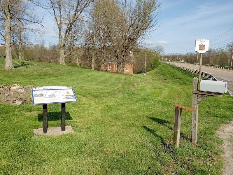
Photographed by Jason Voigt, April 16, 2024
2. Great Western School Marker
Other nearby markers. At least 8 other markers are within 2 miles of this marker, measured as the crow flies: Brick Tavern (a few steps from this marker); "Covered Bridge" (approx. 0.6 miles away); Ohio Native Plants (approx. 1.6 miles away); Ohio Buckeye Tree (approx. 1.6 miles away); State of Ohio (approx. 1.6 miles away); a different marker also named Ohio Native Plants (approx. 1.6 miles away); a different marker also named Ohio Native Plants (approx. 1.6 miles away); a different marker also named Ohio Native Plants (approx. 1.6 miles away).
Also see . . . Great Western Schoolhouse on Wikipedia. Added to the National Register of Historic Places on May 7, 1979 (#79001787). (Submitted on June 2, 2024, by Jason Voigt of Glen Carbon, Illinois.)
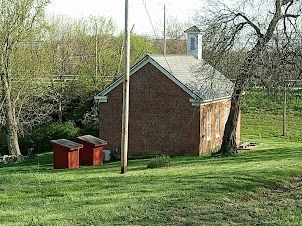
Photographed by Jason Voigt, April 16, 2024
3. Great Western School Marker
Back of the school, as seen from the country road just north of the marker
Credits. This page was last revised on June 2, 2024. It was originally submitted on June 2, 2024, by Jason Voigt of Glen Carbon, Illinois. This page has been viewed 261 times since then and 19 times this year. Photos: 1, 2, 3. submitted on June 2, 2024, by Jason Voigt of Glen Carbon, Illinois.
