Jackson in Jackson County, Michigan — The American Midwest (Great Lakes)
Jackson Poor Farm
Photographed by J.T. Lambrou, June 4, 2024
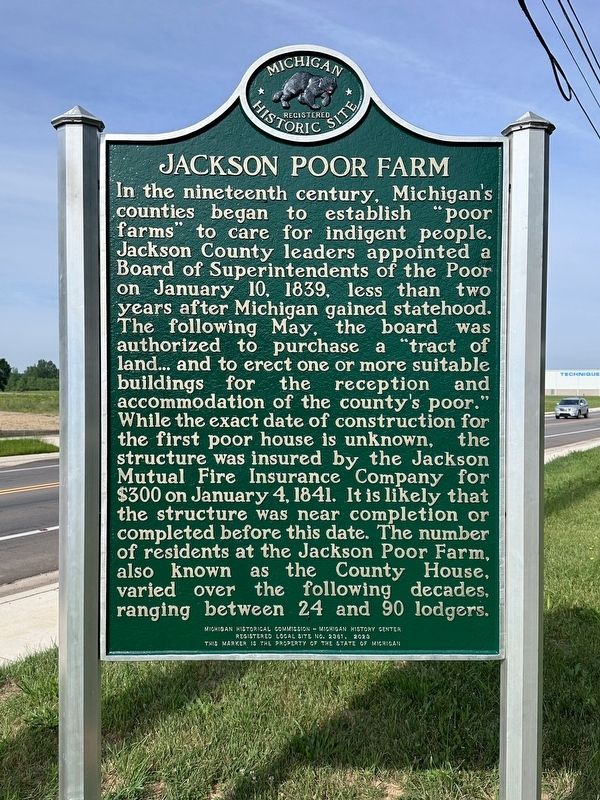
1. Jackson Poor Farm Marker, Side One
In the nineteenth century, Michigan's counties began to establish "poor farms" to care for indigent people. Jackson County leaders appointed a Board of Superintendents of the Poor on January 10, 1839, less than two years after Michigan gained statehood. The following May, the board was authorized to purchase a "tract of land... and to erect one or more suitable buildings for the reception and accommodation of the county's poor." While the exact date of construction for the first poor house is unknown, the structure was insured by the Jackson Mutual Fire Insurance Company for $300 on January 4, 1841. It is likely that the structure was near completion or completed before this date. The number of residents at the Jackson Poor Farm, also known as the County House, varied over the following decades, ranging between 24 and 90 lodgers.
A May 4, 1880, article of the Jackson Citizen detailed the facilities of the "poor farm.” They included 160 acres of farmland, a main brick building. which housed women, a wooden addition for those with mental illness. and a stone building for men. Women cooked,
this page online
Erected 2023 by Michigan Historical Commission and Michigan History Center. (Marker Number L2361.)
Topics and series. This historical marker is listed in these topic lists: Cemeteries & Burial Sites • Settlements & Settlers. In addition, it is included in the Michigan Historical Commission series list. A significant historical date for this entry is January 10, 1839.
Location. 42° 16.598′ N, 84° 28.05′ W. Marker is in Jackson, Michigan, in Jackson County. It is on County Farm Road near Technology Drive, on the right when traveling west. Touch for map.

Photographed by J.T. Lambrou, June 4, 2024
2. Jackson Poor Farm Marker Reverse

Regionally, this marker is in Mid-Michigan. It is also in the American Midwest. Globally, it is in North America, the Western Hemisphere, the Western World, and the Anglosphere. Historically, it finds itself in what was once the Northwest Territory.
Other nearby markers. At least 8 other markers are within 4 miles of this marker, measured as the crow flies: Jackson Poor Farm Cemetery (a few steps from this marker); Camp Jackson: Vital Civil War Training Ground (approx. 2.6 miles away); Camp Blair (approx. 2.6 miles away); Camp Blair: Major Military Headquarters (approx. 2.6 miles away); McCain School (approx. 3.1 miles away); James J. Keeley Park (approx. 3.3 miles away); Jackson County Korean Veterans Memorial (approx. 3.3 miles away); Gold Star Mothers Of Jackson County World War II Memorial (approx. 3.3 miles away). Touch for a list and map of all markers in Jackson.
Related marker. Click here for another marker that is related to this marker.
Also see . . . Peek Through Time: Jackson County Poor Farm was a home for the indigent and the less fortunate.

Photographed by J.T. Lambrou, June 4, 2024
3. Jackson Poor Farm Marker
No one knows how many lived at the facility from its inception in 1839 to its closure in 1963, or how many are buried in the cemetery because the records were lost in a fire. But in 1933, the Sarah Treat Prudden Chapter, Daughters of the American Revolution, did compile 25 names of those buried in the cemetery — mostly in the 1930s.(Submitted on June 4, 2024, by J.T. Lambrou of New Boston, Michigan.)

Photographed by J.T. Lambrou, December 9, 2022
4. Jackson Poor Farm Cemetery
The view of the entire cemetery from south side of road.
Photographed by J.T. Lambrou, December 9, 2022
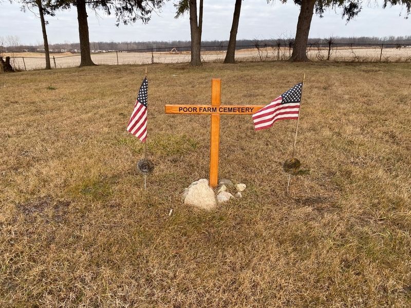
5. Jackson Poor Farm
This is the lone grave marker in the cemetery meant to represent all of the unknown that have been buried here.
Credits. This page was last revised on June 15, 2024. It was originally submitted on June 4, 2024, by J.T. Lambrou of New Boston, Michigan. This page has been viewed 403 times since then and 95 times this year. Photos: 1, 2, 3, 4, 5. submitted on June 4, 2024, by J.T. Lambrou of New Boston, Michigan. • J. Makali Bruton was the editor who published this page.
