
Lucketts in Loudoun County, Virginia — The American South (Mid-Atlantic)
Wayne's Crossing
Photographed by J. J. Prats, April 30, 2007
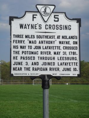
1. Wayne’s Crossing Marker
Three miles southeast, at Noland’s Ferry, “Mad Anthony” Wayne, on his way to join Lafayette, crossed the Potomac River, May 31, 1781. He passed through Leesburg June 3, and joined Lafayette near the Rapidan River, June 18.
Erected 1931 by the Conservation & Development Commission. (Marker Number F-5.)
Topics and series. This historical marker is listed in this topic list: War, US Revolutionary. In addition, it is included in the Virginia Department of Historic Resources (DHR) series list. A significant historical date for this entry is May 31, 1887.
Location. This marker has been replaced by another marker nearby. It was located near 39° 12.749′ N, 77° 32.121′ W. Marker was in Lucketts, Virginia, in Loudoun County. It was on James Monroe Highway (U.S. 15) 0.2 miles south of Stumptown Road and Lucketts Road, on the left when traveling south. It is next to the Elementary School at Lucketts Community Park. Touch for map. Marker was at or near this postal address: 14550 James Monroe Hwy, Leesburg VA 20176, United States of America. Touch for directions.

Regionally, this marker was in the Washington Metropolitan Area and in Northern
this page online
Other nearby markers. At least 8 other markers are within 3 miles of this location, measured as the crow flies: A different marker also named Wayne's Crossing (here, next to this marker); Catoctin Rural Historic District (a few steps from this marker); Lucketts School (approx. 0.2 miles away); Potomac Crossings (approx. half a mile away); The Kincaid Farm Barns (approx. 2.3 miles away); Welcome to Temple Hall Farm Regional Park (approx. 2.3 miles away); Conditions of the Enslaved at Temple Hall Farm (approx. 2.3 miles away); Enslaved Workers at Temple Hall Farm (approx. 2.3 miles away). Touch for a list and map of all markers in Lucketts.
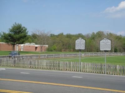
More about this marker. This and the other marker are turned to face the roadway,
Photographed by J. J. Prats, April 30, 2007
2. F-5 and F-27 Markers Side By Side
This marker was originally erected near the Maryland State line, about 4½ road miles north. Noland’s Ferry is about 3 miles southeast from there, it is 3½ miles northeast from the marker’s current location.
Related marker. Click here for another marker that is related to this marker. This marker has been replaced with the linked marker.
Also see . . . Nolands Ferry. C&O Canal Trust website entry (Submitted on April 4, 2022, by Larry Gertner of New York, New York.)
Additional commentary.
1. Noland’s Ferry
Not mentioned on the marker, Noland’s Ferry was also used to convey 5,000 British prisoners captured at Saratoga in 1778 to holding areas in Virginia. In addition to use during the Revolutionary War, Noland’s Ferry was used during the American Civil War by both armies, particularly during the Antietam campaign.
— Submitted June 17, 2007, by Craig Swain of Leesburg, Virginia.
Additional keywords. General Lafayette, Gilbert du Motier, Marquis de La Fayette. General Anthony Wayne.
Photographed by Craig Swain, June 16, 2007
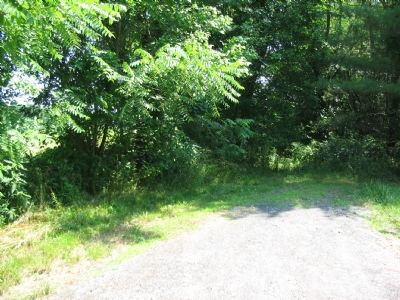
3. Road to Noland’s Ferry
The site of Noland’s Ferry is now on private land. The original road can be reached by turning East at the stop light just North of the marker, onto Lucketts Road (Route 662). After roughly four miles turn left onto Nolands Ferry Road.
Credits. This page was last revised on January 11, 2026. It was originally submitted on May 2, 2007, by J. J. Prats of Powell, Ohio. This page has been viewed 2,953 times since then and 66 times this year. Last updated on June 6, 2024, by John Laycock of Sykesville, Maryland. Photos: 1, 2. submitted on May 2, 2007, by J. J. Prats of Powell, Ohio. 3. submitted on June 17, 2007, by Craig Swain of Leesburg, Virginia. • Bernard Fisher was the editor who published this page.
