Dinwiddie in Dinwiddie County, Virginia — The American South (Mid-Atlantic)
The Battle of Dinwiddie Court House

Photographed by Bernard Fisher, June 8, 2024
1. The Battle of Dinwiddie Court House Marker
"In less than ten minutes we had gained the summit."
The South's Sunset Charge and the Lat Rebel Yell
Gibbs' Brigade had fallen back from the Boisseau farm to a point 1/2 mile north of here. There he was joined by Colonel J. Irvin Gregg's cavalry brigade. Gibbs and Gregg struck the flank of Pickett causing him to wheel into position to meet the new threat.
David Johnston of the 7th Virginia described the Confederate advance across these fields towards the Adams farm. "The line being formed and just as the last rays of the sun had disappeared, the charge began and in less than ten minutes we had gained the summit held by the enemy a moment before and he was now retreating in utter confusion before the rapid volleys fired by our men, leaving his dead and wounded thickly strewing the ground." Here was heard the last "Rebel yell" of the war.
A Union cavalryman in Gibb's Brigade recorded amazement that the Confederate infantry "seemed utterly reckless of death. In the face of our severest fire, they would swoop down upon us across an open field with such a careless swing, it seemed as if they enjoyed being on the
this page online
For more information on tours, preservation efforts and the history of the battlefields in and around Petersburg, visit the Petersburg Battlefields Foundation at www.petebattlefields.org
Erected 2024 by Petersburg Battlefields Foundation.
Topics. This historical marker is listed in this topic list: War, US Civil. A significant historical date for this entry is March 31, 1865.
Location. 37° 5.786′ N, 77° 35.264′ W. Marker is in Dinwiddie, Virginia, in Dinwiddie County. It can be reached from Courthouse Road
Photographed by Evan Dwyer, November 28, 2025
2. The Battle of Dinwiddie Court House Marker
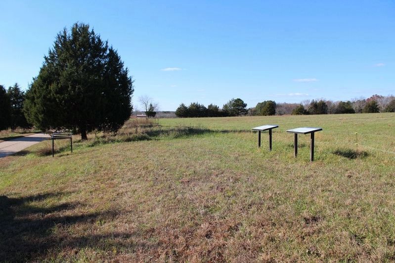
Two markers are at this location out of the original five. The other three shown in earlier photographs of the site have been relocated to the Courthouse, Fitzgerald's Ford, and Dinwiddie Middle School, respectively.

Regionally, this marker is in Virginia’s Piedmont, in Southside Virginia, and specifically in Central Virginia. It is also in the American South and specifically in the Upper South. Globally, it is in North America, the Western Hemisphere, the Western World, and the Anglosphere. Historically, it finds itself in what was once the territory of the Mississippian Culture, one of the original Thirteen Colonies, one of the Confederate States of America, and the Antebellum South.
Other nearby markers. At least 8 other markers are within 2 miles of this marker, measured as the crow flies: A different marker also named The Battle of Dinwiddie Court House (a few steps from this marker); a different marker also named The Battle of Dinwiddie Court House (approx. one mile away); Vaughan Road (approx. 1.1 miles away); a different marker also named The Battle of Dinwiddie Court House
circa 2025
3. Adams Farm - "Bonneville"
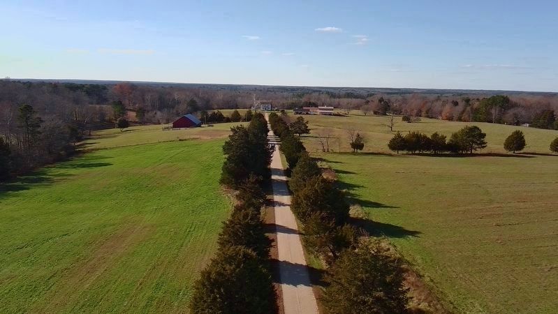
The marker is at the entrance to the Bonneville Farm driveway; this ca. 1800 house is the Adams house referenced in the marker, and stood in the midst of the battle. It is private property. (This aerial view shows the house from a drone launched on public right of way following all FAA recreational drone use laws.)
Another marker is no longer nearby. Early Education in Dinwiddie County (was approx. 1.3 miles away but has been replaced with another marker now near it).
Related markers. Click here for a list of markers that are related to this marker. This marker is one of five that comprise the Battle of Dinwiddie Courthouse Driving Tour (4 Stops):
Also see . . .
1. Petersburg Battlefields Foundation. (Submitted on June 8, 2024.)
2. Petersburg Battlefields Foundation Facebook Page. (Submitted on June 8, 2024.)
3. Petersburg National Battlefield. National Park Service (Submitted on June 8, 2024.)

Photographed by Bernard Fisher, June 8, 2024
4. The Battle of Dinwiddie Court House Markers
Credits. This page was last revised on January 11, 2026. It was originally submitted on June 8, 2024, by Bernard Fisher of Richmond, Virginia. This page has been viewed 225 times since then and 44 times this year. Last updated on January 9, 2026, by Evan Dwyer of Richmond, Virginia. Photos: 1. submitted on June 8, 2024, by Bernard Fisher of Richmond, Virginia. 2. submitted on January 9, 2026, by Evan Dwyer of Richmond, Virginia. 3. submitted on January 9, 2026. 4. submitted on June 8, 2024, by Bernard Fisher of Richmond, Virginia. • Devry Becker Jones was the editor who published this page.
