
Valkenburg in Valkenburg aan de Geul, Limburg, Netherlands — Northwestern Europe
Plenkertgroeve
⎯⎯⎯
Plenkert Quarry
Photographed by Andrew Ruppenstein, May 28, 2024
1. Plenkertgroeve / Plenkert Quarry Marker

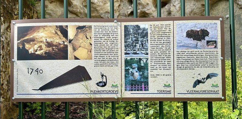
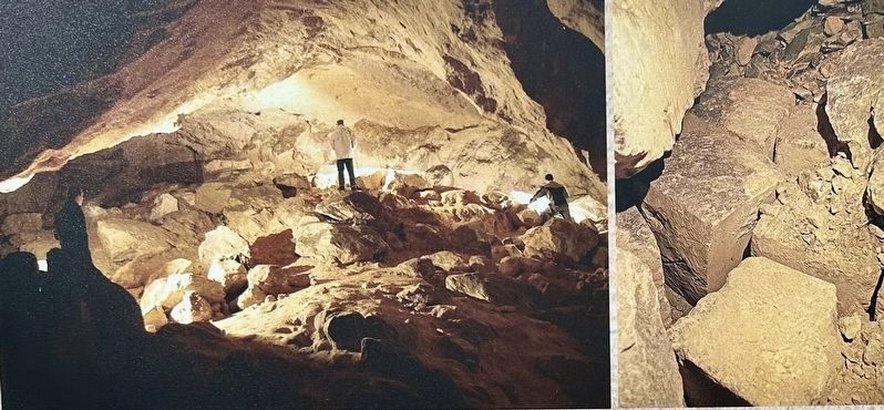
De Plenkertgroeve is een bouwsteenontginning uit het begin van de achttiende eeuw. Er werden hier door de blokbrekers stenen gezaagd. De groeve staat in verbinding met een achterliggend, ouder gangenstelsel van waaruit de oudste gedeelten van de huidige Gemeentegrot zijn ontgonnen. Beide stelsels zijn van elkaar gescheiden door een grote instortingszone. De gangen in het achterste deel van groeve zijn instabiel en het landschap daar wordt gekenmerkt door grote, hoge koepels. In de instorting kan men hier en daar nog de verloren gegane mergelblokken onder het puin zien staan. Het oudste opschrift in de Plenkertgroeve stamt uit het jaar 1740.
Toerisme
Op 28 juni 1963 opende de Valkenburgse journalist Ben Koster hier de "Fantoomspelonken". De groeve werd omgetoverd tot een ondergrondse, onaardse sprookjeswereld. Het jaar daarop, in 1964, breidde Koster de attractie uit tot een gewaagde belevingsexpositie met de ruimtevaart als thema.. "Cape Kennedy” was geboren en trok van meet af aan grote aantallen bezoekers. De attractie bestond tot 1985. In dat jaar nam Valkenburger Albert Otermans
this page online
Sinds 2005 is de groeve verlaten.
Vleermuisreservaat
Van oktober tot april wordt de Plenkertgroeve bevolkt door verschillende soorten vleermuizen, die hier hun winterslaap doorbrengen. Dwergvleermuis, Ingekorven vleermuis, Meervleermuis, Baardvleermuis, Franjestaart en Watervleermuis. Vleermuizen zijn erg nuttige dieren. Een Dwergvleermuis kan bijvoorbeeld in één nacht wel 300 tot 400 muggen vangen. Door hun winterhabitat actief te beschermen draagt de gemeente bij aan de instandhouding van dit bijzondere diertje.
(English translation:)
Plenkert Quarry
The Plenkert Quarry is a building stone quarry from the beginning of the eighteenth century. Stones were sawed here by the block breakers. The quarry is connected to an underlying, older tunnel system from which the oldest parts of the current Municipal Cave were mined. Both systems are separated by a large collapse zone. The corridors in the rear part of the quarry are unstable and the landscape there is characterized by large,
Photographed by Andrew Ruppenstein, May 28, 2024
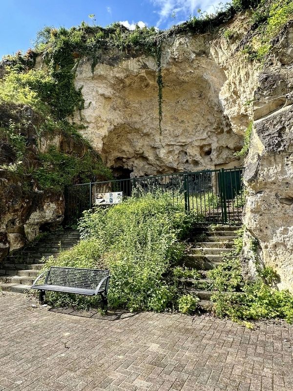
2. Plenkertgroeve / Plenkert Quarry Marker - wide view
Tourism
Here on June 28, 1963 the Valkenburg journalist Ben Koster opened the "Phantom Caves". The quarry was transformed to an underground, unearthly fairytale world. The following year, 1964, Koster expanded the attraction into a daring experience exhibition with space travel as a theme. "Cape Kennedy” was born and attracted large numbers of visitors from the start. The attraction existed until 1985. In that year, Valkenburger Albert Otermans took over the location. He changed the name to “Prehistoric Monster Cave” and focused more on showing dinosaur models.
The quarry has been closed since 2005.
Bat Reserve
From October to April, the Plenkert quarry is populated by various species of bats, which spend their hibernation here - Pipistrelle bat, Basket-tailed bat, Lake bat, Bearded bat, Fringe-tailed bat and Water bat (note that these are direct translations of the Dutch names for the bats and that they may not correspond to their names in English).
Photographed by Andrew Ruppenstein, May 28, 2024
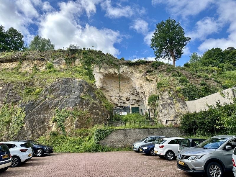
3. Plenkertgroeve / Plenkert Quarry Marker - wider view
Erected 2023 by Gemeente Valkenburg aan de Geul.
Topics. This historical marker is listed in these topic lists: Animals • Industry & Commerce • Man-Made Features. A significant historical date for this entry is June 28, 1963.
Location. 50° 51.858′ N, 5° 49.628′ E. Marker is in Valkenburg, Limburg, in Valkenburg aan de Geul. It is on Plenkertstraat, on the right when traveling east. Touch for map. Marker is at or near this postal address: Plenkertstraat 47, Valkenburg, Limburg 6301 GM, Netherlands. Touch for directions.

Regionally, it is in Europe, the European Union, Atlantic Europe, the Benelux Low Countries, the Schengen Area, Western Europe, and the Western World. Historically, it finds itself in what was once the Roman Empire and specifically also the Holy Roman Empire.
Other nearby markers. At least 8 other markers are within walking distance of this marker: Valkenburg en Anton Mussert / Valkenburg and Anton Mussert
4. Marker photos
Credits. This page was last revised on June 16, 2024. It was originally submitted on June 16, 2024, by Andrew Ruppenstein of Lamorinda, California. This page has been viewed 261 times since then and 30 times this year. Photos: 1, 2, 3, 4. submitted on June 16, 2024, by Andrew Ruppenstein of Lamorinda, California.
