Pasadena in Los Angeles County, California — The American West (Pacific Coastal)
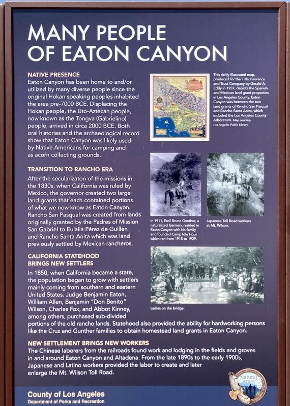
Many People of Eaton Canyon
Photographed by Craig Baker, June 18, 2024
1. Many People of Eaton Canyon Marker
Native Presence
Eaton Canyon has been home to and/or utilized by many diverse people since the original Hokan speaking peoples inhabited the area pre-7000 BCE. Displacing the Hokan people, the Uto-Aztecan people, now known as the Tongva (Gabrielino) people, arrived in circa 2000 BCE. Both oral histories and the archaeological record show that Eaton Canyon was likely used by Native Americans for camping and as acorn collecting grounds.
Transition to Rancho Era
After the secularization of the missions in the 1830s, when California was ruled by Mexico, the governor created two large land grants that each contained portions of what we now know as Eaton Canyon. Rancho San Pasqual was created from lands originally granted by the Padres of Mission San Gabriel to Eulalia Pérez de Guillén and Rancho Santa Anita which was land previously settled by Mexican rancheros.
California Statehood Brings New Settlers
In 1850, when California became a state, the population began to grow with settlers mainly coming from southern and eastern United States. Judge Benjamin Eaton, William
this page online
New Settlement Brings New Workers
The Chinese laborers from the railroads found work and lodging in the fields and groves in and around Eaton Canyon and Altadena. From the late 1890s to the early 1900s, Japanese and Latino workers provided the labor to create and later enlarge the Mt. Wilson Toll Road.
photo captions:
· In 1911, Emil Bruno Gunther, a naturalized German, resided in Eaton Canyon with his family and founded Camp Idle Hour which ran from 1915 to 1929.
· This richly illustrated map, produced for the Title Insurance and Trust Company by Gerald A. Eddy in 1937, depicts the Spanish and Mexican land grant properties in Los Angeles County. Eaton Canyon was between the two land grants of Rancho San Pascual and Rancho Santa Anita, which included the Los Angeles County Arboretum. Map courtesy Los Angeles

Photographed by Craig Baker, June 18, 2024
2. Many People of Eaton Canyon Marker
· Japanese Toll Road workers at Mt. Wilson.
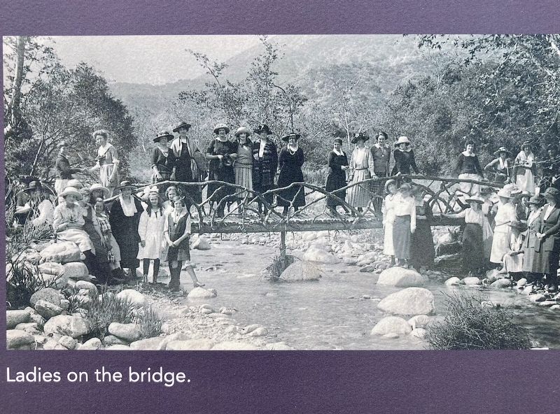
· Ladies on the bridge.
Erected 2014 by County of Los Angeles Department of Parks and Recreation.
Topics. This historical marker is listed in these topic lists: Indigenous Peoples and Communities • Settlements & Settlers. A significant historical year for this entry is 2000 BCE.
Location. 34° 10.642′ N, 118° 5.787′ W. Marker is in Pasadena, California, in Los Angeles County. It can be reached from Altadena Drive north of New York Drive. Located at the Eaton Canyon Nature Center parking lot (closed). Touch for map. Marker is at or near this postal address: 1750 N Altadena Dr, Pasadena CA 91107, United States of America. Touch for directions.

Regionally, this marker is in Greater Los Angeles and in the Transverse Ranges. It is also on the American Pacific Coast. Globally, it is in North America, on the Ring of Fire, on the Pacific Rim, in the Western Hemisphere, in the Western World, and in the Anglosphere. Historically, it finds itself in what was once New Spain and also Mexico’s Alta California.
Other nearby markers. At least 8 other markers are

Photographed by Craig Baker, June 18, 2024
3. Map of Land Grants (Ranchos)
Spanish and Mexican land grant properties in Los Angeles County. Eaton Canyon was between the two land grants of Rancho San Pascual and Rancho Santa Anita. Map courtesy Los Angeles Public Library.
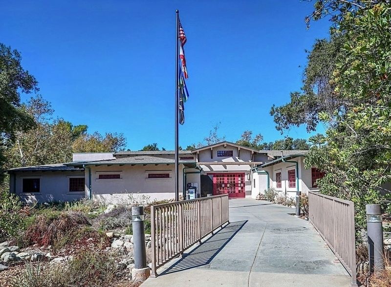
More about this marker. The Eaton Canyon Nature Center was destroyed by the Eaton Fire in 2025. It had been rebuilt in 1998 after it was destroyed by the Kinneloa Fire in 1993.
Additional keywords. Eaton Fire, Southern California Wildfires, 2025
Photographed by Craig Baker, June 18, 2024
4. Ladies on the Bridge
courtesy L.A. County Parks
5. Eaton Canyon Nature Center

courtesy L.A. County, January 9, 2025
6. Eaton Canyon Nature Center
Destroyed by the Eaton Fire in 2025.
Credits. This page was last revised on May 20, 2026. It was originally submitted on June 18, 2024, by Craig Baker of Sylmar, California. This page has been viewed 916 times since then and 66 times this year. Photos: 1, 2, 3, 4. submitted on June 18, 2024, by Craig Baker of Sylmar, California. 5. submitted on January 17, 2025, by Craig Baker of Sylmar, California. 6. submitted on January 22, 2025, by Craig Baker of Sylmar, California.
