Georgetown in Williamson County, Texas — The American South (West South Central)
The Double File Trail (Georgetown)
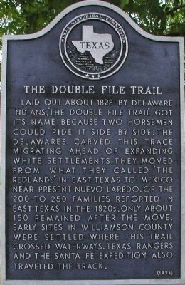
Laid out about 1828 by Delaware Indians, “The Double File Trail” got its name because two horsemen could ride it side by side. The Delawares carved this trace migrating ahead of expanding white settlements. They moved from what they called “The Redlands” in east Texas to Mexico near present Nuevo Laredo. Of the 200 to 250 families reported in east Texas in the 1820s, only about 150 remained after the move. Early sites in Williamson County were settled where this trail crossed waterways. Texas Rangers and the Sante Fe Expedition also traveled the track.
Erected 1978 by Texas Historical Commission. (Marker Number 9049.)
Topics. This historical marker is listed in these topic lists: Native Americans • Notable Places. A significant historical year for this entry is 1828.
Location. 30° 38.699′ N, 97° 35.55′ W. Marker is in Georgetown, Texas, in Williamson County. Marker is on State Highway 29. Touch for map. Marker is in this post office area: Georgetown TX 78626, United States of America. Touch for directions.
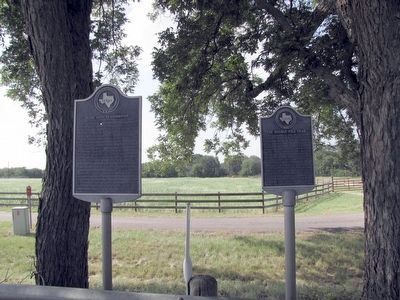
Other nearby markers. At least 8 other markers are within 4 miles of this marker, measured as the crow flies. Texan Santa Fe Expedition (here, next to this marker); Mankins Crossing (approx. 0.6 miles away); Weir Community Cemetery (approx. 1.4 miles away); City of Weir (approx. 2.1 miles away); Pennington Family Cemetery (approx. 2.9 miles away); Community of Jonah (approx. 3.1 miles away); Jesse Cooper House (approx. 3.2 miles away); John Berry, Frontiersman (approx. 3.8 miles away). Touch for a list and map of all markers in Georgetown.
Also see . . . The Double File Trail Georgetown Texas. Information and photos from the Williamson County Historical Commission. (Submitted on May 15, 2011, by Wayne Ware of Georgetown, Texas.)
Credits. This page was last revised on November 29, 2020. It was originally submitted on November 28, 2009, by Keith Peterson of Cedar Park, Texas. This page has been viewed 1,282 times since then and 55 times this year. Photos: 1. submitted on November 28, 2009, by Keith Peterson of Cedar Park, Texas. 2. submitted on August 22, 2015, by QuesterMark of Fort Worth, Texas. • Kevin W. was the editor who published this page.

