Fairfield in Utah County, Utah — The American Mountains (Southwest)
Camp Floyd Cemetery
Photographed by Jeremy Snow, June 23, 2024
1. Camp Floyd Cemetery Marker
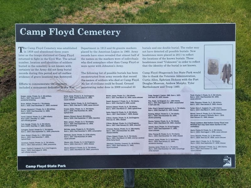
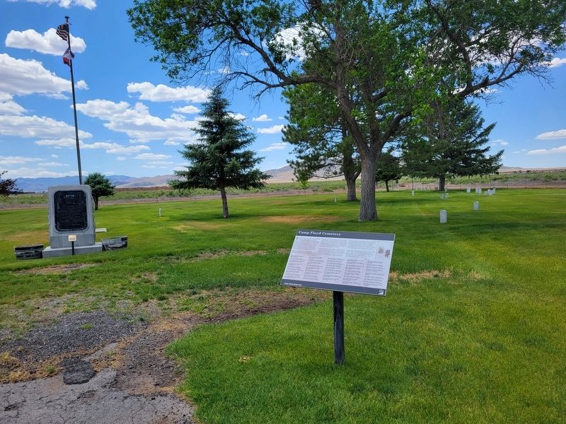
The Camp Floyd Cemetery was established in 1858 and abandoned three years later as the troops stationed at Camp Floyd returned to fight in the Civil War. The actual number, location and identities of soldiers buried in the cemetery is not known with certainty as the Army did not keep burial records during this period and all surface evidence of grave locations was destroyed. Efforts to commemorate the cemetery included a monument dedicated by the War Department in 1913 and 84 granite markers placed by the American Legion in 1960. Army records have since revealed that almost half of the names on the markers were of individuals who died someplace other than Camp Floyd or were never with Johnston's Army.
The following list of possible burials has been reconstructed from army records that record the names of soldiers who died at Camp Floyd. No list of civilians could be found. Ground penetrating radar done in 2009 revealed 33 burials and one double burial. The radar may not have detected all possible burials. New headstones were placed in 2011 to reflect the locations of the known burials. These headstones read "Unknown"
this page online
Camp Floyd / Stagecoach Inn State Park would like to thank the Veterans Administration, Curtis Allen, Ephriam Dickson with the Fort Douglas Museum, Andrew Murphey, Tyler Bartholomew and Troop 1460.
Topics. This historical marker is listed in these topic lists: Cemeteries & Burial Sites • Forts and Castles. A significant historical year for this entry is 1858.
Location. 40° 15.147′ N, 112° 5.905′ W. Marker is in Fairfield, Utah, in Utah County. It can be reached from South Allens Ranch Road. Touch for map. Marker is at or near this postal address: 378 S Allens Rnch Rd, Cedar Valley UT 84013, United States of America. Touch for directions.

Regionally, this marker is in the Wasatch Front and in Greater Provo. It is also in the American Mountain West and on the Colorado Plateau. Globally, it is in North America, the Rocky Mountains, the Western Hemisphere, the Western World, and the Anglosphere. Historically, it finds itself in what was once New Spain and also Mexico’s Alta California.
Other nearby markers. At least 8 other markers are within walking
Photographed by Jeremy Snow, June 23, 2024
2. Camp Floyd Cemetery Marker
Credits. This page was last revised on July 7, 2024. It was originally submitted on June 25, 2024, by Jeremy Snow of Cedar City, Utah. This page has been viewed 327 times since then and 31 times this year. Photos: 1, 2. submitted on June 25, 2024, by Jeremy Snow of Cedar City, Utah. • J. Makali Bruton was the editor who published this page.
