Columbia in Boone County, Missouri — The American Midwest (Upper Plains)
Kuhlman Court
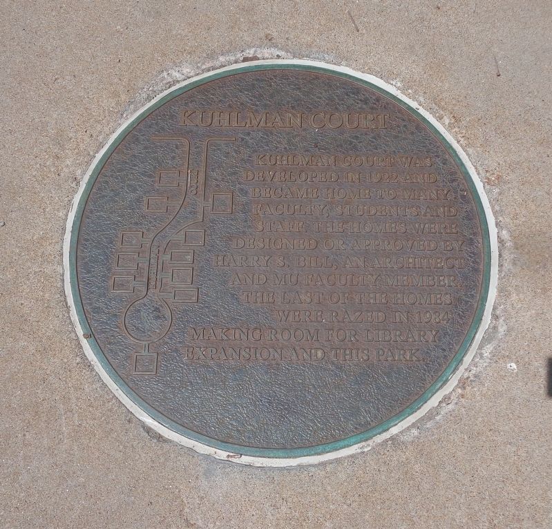
Photographed by Jason Voigt, June 25, 2024
1. Kuhlman Court Marker
Topics. This historical marker is listed in these topic lists: Education • Parks & Recreational Areas. A significant historical year for this entry is 1922.
Location. 38° 56.601′ N, 92° 19.603′ W. Marker is in Columbia, Missouri, in Boone County. It can be reached from the intersection of Hitt Street and Rollins Street. Marker is located at the center of the plaza. Parking is accessible from Hitt Street. It is on the campus of the University of Missouri, across from the Student Union center. Touch for map. Marker is at or near this postal address: 901 Rollins Street, Columbia MO 65201, United States of America. Touch for directions.

Regionally, this marker is in Little Dixie and in the Missouri River Corridor. It is also in the American Midwest, in the Lewis & Clark Corridor, and in the Corn Belt. Globally, it is in North America, the Western Hemisphere,
this page online
Other nearby markers. At least 8 other markers are within walking distance of this marker: The Mel Carnahan Quadrangle (about 700 feet away, measured in a direct line); Memorial Union Tower (about 700 feet away); Beetle Bailey (approx. 0.2 miles away); Sanborn Field and Soil Erosion Plot (approx. ¼ mile away); Historic Sanborn Field (approx. ¼ mile away); Aureomycin Originated Here (approx. ¼ mile away); Site of Columbia College (approx. 0.4 miles away); The F.L. Duley - M.E. Miller Erosion Plots (approx. 0.4 miles away). Touch for a list and map of all markers in Columbia.

Photographed by Jason Voigt, June 25, 2024
2. Kuhlman Court Marker
Marker is located at the center of the park
Credits. This page was last revised on June 25, 2024. It was originally submitted on June 25, 2024, by Jason Voigt of Glen Carbon, Illinois. This page has been viewed 396 times since then and 40 times this year. Photos: 1, 2. submitted on June 25, 2024, by Jason Voigt of Glen Carbon, Illinois.
