Pawling in Dutchess County, New York — The American Northeast (Mid-Atlantic)
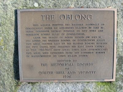
The Oblong
Later the Treaty of Dover signed on May 14, 1731 moved the western border of Connecticut about two miles farther east to the present border between the two states, thus creating the area since known as “The Oblong” sixty miles long and approximately two miles wide extending from the southern border of Massachusetts to Long Island Sound.
Erected 1976 by the Historical Society of Quaker Hill and Vicinity.
Topics. This historical marker is listed in this topic list: Colonial Era. A significant historical month for this entry is May 1778.
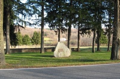
Location. 41° 33.473′ N, 73° 33.837′ W. Marker is in Pawling, New York, in Dutchess County. Marker is on Quaker Hill Road (County Road 67) 0.2 miles west of Glen Arden Drive, on the right when traveling east. Touch for map. Marker is in this post office area: Pawling NY 12564, United States of America. Touch for directions.
Other nearby markers. At least 8 other markers are within 2 miles of this marker, measured as the crow flies. Living Memorial (approx. 0.7 miles away); Mizzen Top Hotel (approx. 0.7 miles away); Purgatory Hill (approx. ¾ mile away); Akin Hall (approx. ¾ mile away); The Great Barbecue (approx. 1.6 miles away); In memory of General George Washington (approx. 1.6 miles away); a different marker also named The Great Barbecue (approx. 1.6 miles away); Fredericksburg 1778 (approx. 1.6 miles away). Touch for a list and map of all markers in Pawling.
Regarding The Oblong. Because of inaccurate land surveying and allocating of land, the exact border between New York and Connecticut, had been under dispute until the early part of the 18th century. Connecticut received the panhandle in the southwest corner of the state, and New York received an equivalent area measuring 2 miles by 60 miles along its eastern edge, "The Oblong."
Additional commentary.
1. Thank you
Thank you from a descendant of Daniel Townsend (original owner of Oblong lot #6, in ~1730). I look forward to visiting the marker and lot #6. Note To Editor only visible by Contributor and editor
— Submitted December 22, 2009, by Connie M. Drysdale of Branford, Connecticut.
Credits. This page was last revised on September 10, 2019. It was originally submitted on November 29, 2009, by Michael Herrick of Southbury, Connecticut. This page has been viewed 4,126 times since then and 295 times this year. Photos: 1, 2. submitted on November 29, 2009, by Michael Herrick of Southbury, Connecticut. • Kevin W. was the editor who published this page.

