Hurricane in Washington County, Utah — The American Mountains (Southwest)
See Mollies Nipple
"It's a Butte!"
Photographed by Jeremy Snow, June 28, 2024
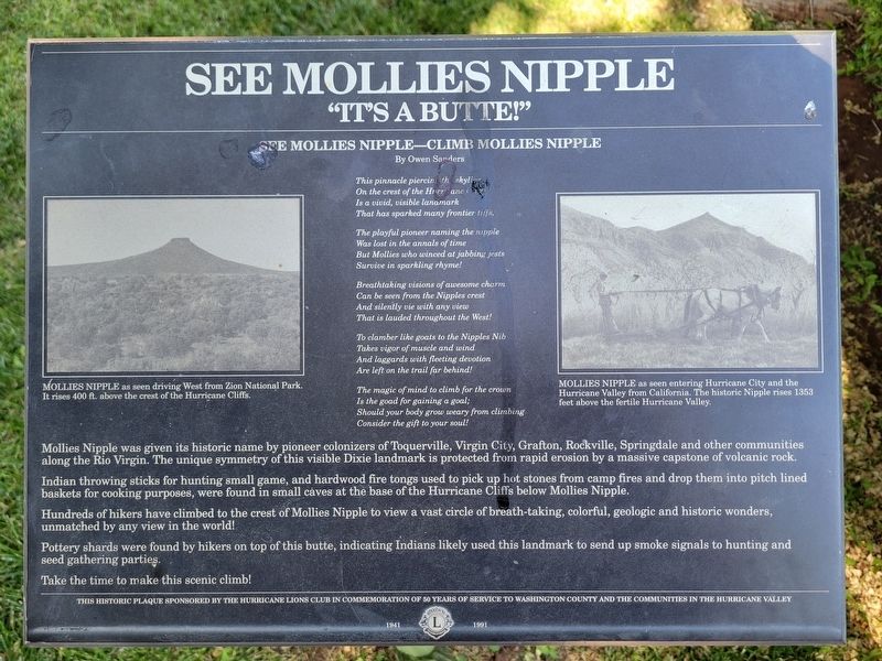
1. See Mollies Nipple Marker
Mollies Nipple was given its historic name by pioneer colonizers of Toquerville, Virgin City, Grafton, Rockville, Springdale and other communities along the Rio Virgin. The unique symmetry of this visible Dixie landmark is protected from rapid erosion by a massive capstone of volcanic rock.
Indian throwing sticks for hunting small game, and hardwood fire tongs used to pick up hot stones from camp fires and drop them into pitch line baskets for cooking purposes, were found in small caves at the base of the Hurricane Cliffs below Mollies Nipple.
Hundreds of hikers have climbed to the crest of Mollies Nipple to view a vast circle of breath-taking, colorful, geologic and historic wonders, unmatched by any view in the world!
Pottery shards were found by hikers on top of this butte, indicating Indians likely used this landmark to send up smoke signals to hunting and seed gathering parties.
Take the time to make this scenic climb!
See Mollies Nipple - Climb Mollies Nipple
By Owen Sanders
This pinnacle piercing the skyline
On the crest of the Hurricane
Is a vivid, visible landmark
That has sparked many frontier tiffs.
The playful pioneer naming the nipple
Was lost in the annals of time
But Mollies who winced at jabbing jest
Survive in sparkling rhyme!
Breathtaking visions of awesome charm
Can be seen from the Nipples crest
And silently vie with any view
That is lauded throughout the West!
To clamber like goats to the Nipples Nib
Takes vigor of muscle and wind
And laggards with fleeting devotion
Are left on the trail far behind!
The magic of mind to climb for the crown
Is the good for gaining a goal;
Should your body grow weary from climbing
Consider the gift to your soul!
(photo caption)
this page online
(photo caption) MOLLIES NIPPLE as seen entering Hurricane City and the Hurricane Valley from California. The historic Nipple rises 135 feet above the fertile Hurricane Valley.
This historic plaque sponsored by the Hurricane Lions Club in commemoration of 50 years of service to Washington County and the communities in the Hurricane Valley 1941 - 1991
Erected by Hurricane Lions Club.
Topics. This historical marker is listed in these topic lists: Indigenous Peoples and Communities • Settlements & Settlers.
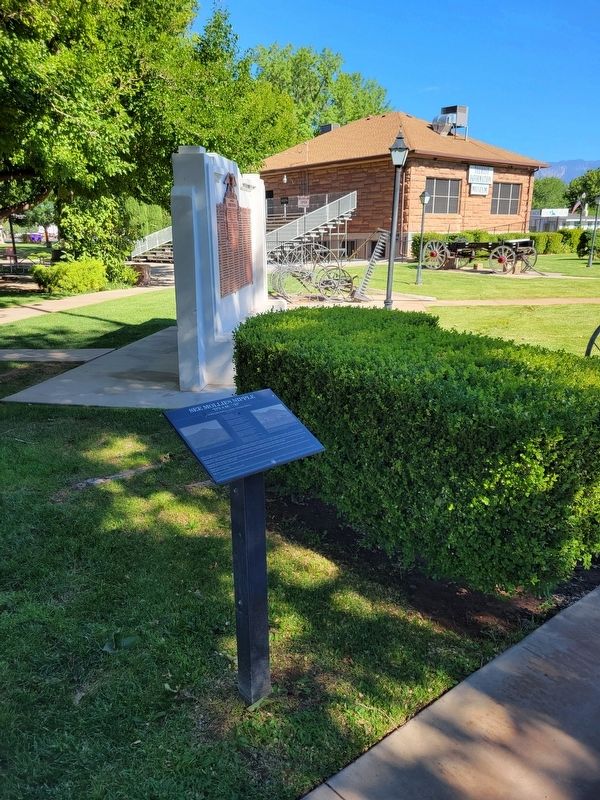
Location. 37° 10.562′ N, 113° 17.311′ W. Marker is in Hurricane, Utah, in Washington County. It can be reached from State Street. Marker is on the grounds of the Hurricane Valley Heritage Park Museum. Touch for map. Marker is at or near this postal address: 35 State Street, Hurricane UT 84737, United States of America. Touch for directions.

Regionally, this marker is in Color Country. It is also in the American Southwest, in the Mountain West, and
Photographed by Jeremy Snow, June 28, 2024
2. See Mollies Nipple Marker
Other nearby markers. At least 8 other markers are within walking distance of this marker: Pioneer Trails (here, next to this marker); Hurricane Canal (here, next to this marker); Hurricane City (a few steps from this marker); Survival in Utah’s Dixie (a few steps from this marker); Hurricane Pioneers (a few steps from this marker); The Roads to Utah’s Dixie (a few steps from this marker); Pioneer Gratitude (a few steps from this marker); Smith Mesa (within shouting distance of this marker). Touch for a list and map of all markers in Hurricane.
Credits. This page was last revised on June 30, 2024. It was originally submitted on June 29, 2024, by Jeremy Snow of Cedar City, Utah. This page has been viewed 331 times since then and 91 times this year. Photos: 1, 2. submitted on June 29, 2024, by Jeremy Snow of Cedar City, Utah. • Andrew Ruppenstein was the editor who published this page.
