Near Randall in Montgomery County, New York — The American Northeast (Mid-Atlantic)
Road Maps on the Water
The Erie Canal
Photographed by Steve Stoessel, June 11, 2024
1. Road Maps on the Water Marker
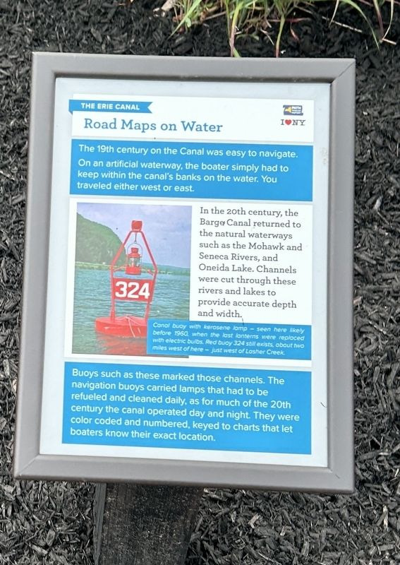
The 19th century on the Canal was easy to navigate. On an artificial waterway, the boater simply had to keep within the canal's banks on the water. You traveled either west or east.
In the 20th century, the Barge Canal returned to the natural waterways such as the Mohawk and Seneca Rivers, and Oneida Lake. Channels were cut through these rivers and lakes to provide accurate depth and width.
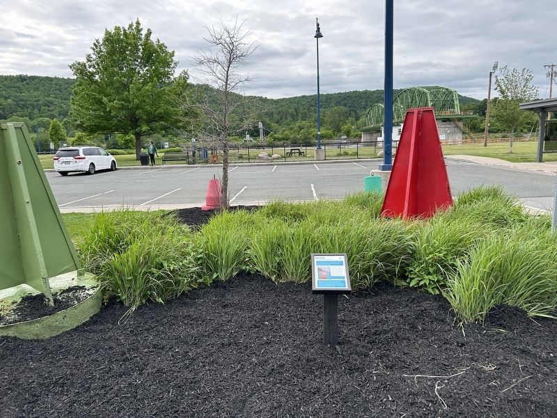
Buoys such as these marked those channels. The navigation buoys carried lamps that had to be refueled and cleaned daily, as for much of the 20th century the canal operated day and night. They were color coded and numbered, keyed to charts that let boaters know their exact location.
[Photo Caption:] Canal buoy with kerosene lamp - seen here likely before 1960 when the last lanterns were replaced with electric bulbs. Red buoy 324 still exists, about two miles west of here- just west of Lasher Creek
Erected by Pathway Through History, I ❤️ NY.
Topics. This historical marker is listed in this topic list: Waterways & Vessels. A significant historical year for this entry is 1960.
Location. 42° 54.992′ N, 74° 26.734′ W.
this page online

Regionally, this marker is in Upstate New York and in the Mohawk Valley. It is also in the American Northeast and in the Mid-Atlantic. Globally, it is in North America, the Western Hemisphere, the Western World, and the Anglosphere. Historically, it finds itself in what was once the Haudenosaunee (Iroquois) Confederacy, New Netherland, and one of the original Thirteen Colonies.
Other nearby markers. At least 8 other markers are within walking distance of this marker: Bollards (within shouting distance of this marker); The Mohawk Valley (within shouting distance of this marker); Transportation is King / Modernization (within shouting distance of this marker); The Erie Canal (within shouting distance of this marker); a different marker also named The Mohawk Valley (within shouting distance of this marker); Giving Sal a Rest
Photographed by Steve Stoessel, June 11, 2024
2. Road Maps on the Water Marker
Also see . . . New York State Canal System (Wikipedia). (Submitted on July 1, 2024, by Steve Stoessel of Niskayuna, New York.)
Photographed by Steve Stoessel, June 11, 2024
3. Road Maps on the Water Marker
Credits. This page was last revised on July 2, 2024. It was originally submitted on July 1, 2024, by Steve Stoessel of Niskayuna, New York. This page has been viewed 147 times since then and 15 times this year. Photos: 1, 2, 3. submitted on July 1, 2024, by Steve Stoessel of Niskayuna, New York.
