Mouassine in Marrakesh, Marrakesh-Safi, Morocco — Africa (Northern Africa)
Gravity-fed Water
Photographed by J. Makali Bruton, May 28, 2024
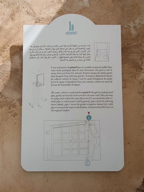
1. Gravity-fed Water Marker

الماء الموجه من النقطة ) بواسطة أنبوب (قادوس تحت الأرض ينبع في هذا الجيب (المعيدة) الذي تم حفره في الحائط الذي يحف الحديقة. و يمكن أن نرى بها الأن الأنبوب الذي يخرج منه الماء ،[1] وحوله أنابيب أخرى من
this page online
L'eau acheminée du point 0 par un conduit
Photographed by J. Makali Bruton, May 28, 2024
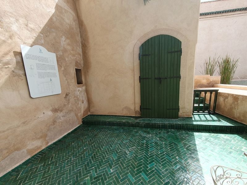
2. Gravity-fed Water Marker
Note the niche to the right of the marker as mentioned in the marker text.
The water, which is conducted from point 0 through an underground pipe, gushes out into this niche carved in the outer wall. Here you may see a pipe, from which the water flows out [1], surrounded by other similar pipes in which water is fed by gravity: pipe 2 feeds the collecting basin (sahrij), pipe 3 serves the garden irrigation channel [a], while pipe 4 conveyed the water to the kitchens, located north of the tower in the original complex. (Marker Number 1b.)
Topics. This historical marker is listed in this topic list: Parks & Recreational Areas.
Location. 31° 37.867′ N, 7° 59.397′ W. Marker is in Marrakesh, Marrakesh-Safi. It is in Mouassine. It can be reached from Rue Mouassine, on the left when traveling north. The marker is visible inside the Riad Al Krissi, the Secret Garden. A small entry fee is required to enter the site. Touch for map. Marker is at or near this postal address: Rue Mouassine 182, Marrakesh, Marrakesh-Safi 40000, Morocco. Touch for directions.

Regionally, it is in Africa, North Africa, The Maghreb, and in a coastal Mediterranean country. Historically, it finds itself in what was once Portuguese colonies, a Spanish colony, and specifically a French colony.
Other nearby markers. At least 8 other markers are within walking distance of this marker: Communicating Vessels (a few steps from this marker); Marble Fountain (Khossa) (a few steps from this marker); Water from the Atlas Mountains (within shouting distance of this marker); Octagonal Basin (within shouting distance of this marker); Water Distribution Point (within shouting distance of this marker); Riad Al-Krissi (The Secret Garden) (within shouting distance of this marker); The Mausoleum of Sidi Abou Faris Abdelaziz Tebbaa (about 120 meters away, measured in a direct line); Mouassine Square (about 150 meters away). Touch for a list and map of all markers in Marrakesh.
Credits. This page was last revised on July 1, 2024. It was originally submitted on July 1, 2024, by J. Makali Bruton of Washington, District of Columbia. This page has been viewed 133 times since then and 21 times this year. Photos: 1, 2. submitted on July 1, 2024, by J. Makali Bruton of Washington, District of Columbia.
