Fairbank in Cochise County, Arizona — The American Mountains (Southwest)
Fort Huachuca
the former training ground within the San Pedro Riparian National Conservation Area

Photographed by James Hulse, June 16, 2024
1. Fort Huachuca Marker
Fort Huachuca's Beginnings
In 1877, this area was established as a military outpost named Camp Huachuca because of its sheltering hills and perennial stream. In 1882, the camp was designated as Fort Huachuca and the fort's soldiers protected settlers and transportation routes during the Apache Indian Wars. The fort remained active through World War I and was home to the 10th Cavalry Regiment, one of the original all African-American cavalry regiments.
Fort Huachuca During World War II
On September 9, 1943, the federal government obtained a lease from the Boquillas Land and Cattle Company to use 3,220 acres of land. The land became part of the fort's East Artillery Range; and was used for artillery and infantry training.
A portion of the leased land contained the ruins of the town of Charleston. Charleston was
this page online
Between 1946 and 1947, all leases affecting the Boquillas land and Charleston ruins were terminated or cancelled. In the summer of 1947, Fort Huachuca closed. During that year, Detachment No. 14 of the 9800th Technical Support Unit searched the "Boquillas Area of Cochise County" for ordnance and explosive hazards; however, specific locations where items were found or the areas cleared are not provided in historical documentation.
Fort Huachuca After World War II
In 1951, the Army moved back into the developed area of the fort and began a major renovation of the post. On November 18, 1988, the U.S. Department of Interior, Bureau of Land Management established 56,000 acres of land along the San Pedro River, including the Boquillas land; as the San Pedro Riparian National Conservation Area (SPRNCA).
On September 30, 1999, the U.S. Army Corps of Engineers determined that the Boquillas land and the former Charleston
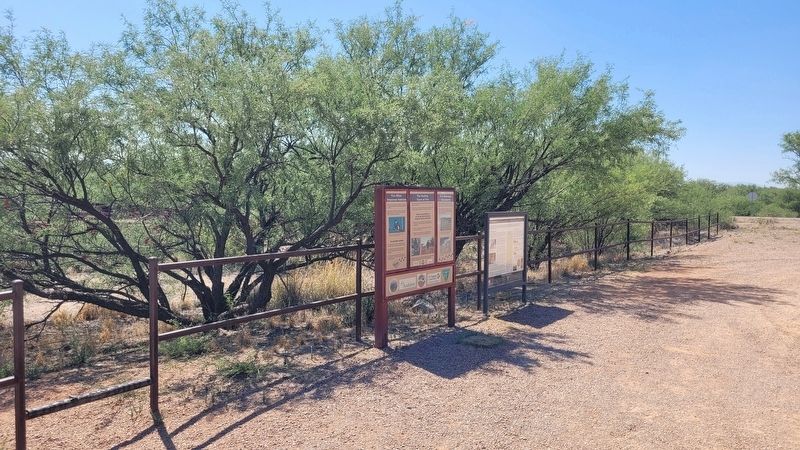
Photographed by James Hulse, June 16, 2024
2. The Fort Huachuca Marker along the parking lot
Enjoy SPRNCA Safely
Munitions related to past military use have been reported at SPRNCA. While encounters are rare, SPRNCA visitors need to be aware that potentially hazardous munitions could remain due to past military use of the area. Accordingly, the U.S. Army Corps of Engineers advises SPRNCA visitors not to pick up, handle or examine any potential military debris and to follow the 3Rs of Explosives Safety.
Follow the 3Rs of Explosives Safety:
Recognize - when you may have encountered a munitions and that munitions are dangerous.
Retreat - do not approach, touch, move or disturb it, but carefully leave the area.
Report - what you saw and where you saw it by calling the 24-hour Federal Law Enforcement Communication Center at (623) 434-4580 or 911.
photo captions:
· Above: Soldiers assault the ghost town of Charleston, AZ by scaling cargo nets. Date unknown.
· Below: Firing exercises for
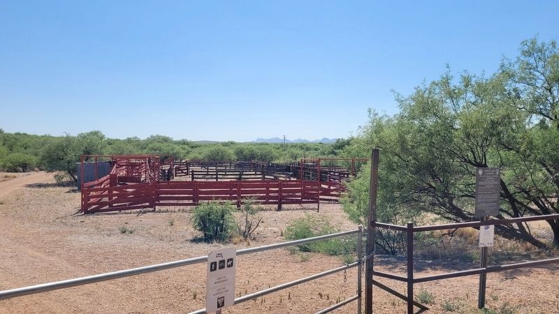
Photographed by James Hulse, June 16, 2024
3. Fort Huachuca Marker
A view of the cattle pens next to the marker.
· Spent 30-caliber housing. July 2009
· 155mm illumination round. July 2009
· 81mm mortar fragment. July 2009
Erected by US Army Corps of Engineers.
Topics. This historical marker is listed in these topic lists: Forts and Castles • War, World I • War, World II • Wars, US Indian. A significant historical date for this entry is September 9, 1943.
Location. 31° 43.329′ N, 110° 11.159′ W. Marker is in Fairbank, Arizona, in Cochise County. It is at the intersection of Arizona Route 82 and N Old Fairbank Rd, on the left when traveling west on Arizona Route 82. The marker is located across the highway from the Fairbank Historic Townsite. Touch for map. Marker is at or near this postal address: 2323 AZ-82, Huachuca City AZ 85616, United States of America. Touch for directions.

Regionally, this marker is in the Sky Islands and in Southeastern Arizona. It is also in the American Borderlands and in the Southwest. Globally, it is in North America, the Western Hemisphere, the Western World, and the Anglosphere. Historically, it finds itself in what was once New Spain and also the Gadsden Purchase.
Other nearby markers. At least 8 other markers are within 7 miles of this marker, measured as the crow flies: Boom Days (approx. 0.2 miles away); Welcome to Fairbank Historic Townsite (approx. 0.2 miles away); On the right track (approx. 0.2 miles away); Water... (approx. 0.2 miles away); A diversity of people (approx. 0.2 miles away); Fairbank... (approx. 0.2 miles away); Edward Schieffelin (approx. 4.9 miles away); Grand Army of the Republic Memorial (approx. 6.4 miles away). Touch for a list and map of all markers in Fairbank.
Credits. This page was last revised on May 12, 2025. It was originally submitted on July 1, 2024, by James Hulse of Medina, Texas. This page has been viewed 486 times since then and 99 times this year. Photos: 1, 2, 3. submitted on July 1, 2024, by James Hulse of Medina, Texas.
