Newton in Harvey County, Kansas — The American Midwest (Upper Plains)
Newton's Cowboy Era
Photographed by Mark Hilton, July 1, 2024
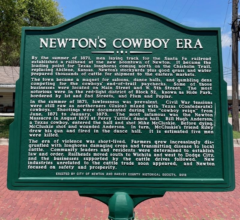
1. Newton's Cowboy Era Marker
By the summer of 1871, men laying track for the Santa Fe railroad established a railhead at the new boomtown of Newton. It became the loading point for Texas longhorns coming north on the Chisholm Trail, replacing Abilene, Kansas. Newton's stockyards plus good grass and water prepared thousands of cattle for shipment to the eastern markets.
The town became a magnet for saloons, dance halls, and gambling dens competing for the cowboys' end-of-trail paychecks. Some of those businesses were located on Main Street and W. 5th Street. The most notorious were in the red-light district of Block 52, known as Hide Park, bordered by 1st and 2nd Streets, and Plum and Poplar.
In the summer of 1871, lawlessness was prevalent. Civil War tensions were still raw as northerners (Union) mixed with Texas (Confederate) cowboys. Shootings were documented during the "cowboy reign" from June, 1871 to January, 1873. The most infamous was the Newton Massacre in August 1871 at Perry Tuttle's dance hall. Bill Hugh Anderson, a Texas cowboy, entered the hall and shot Mike McCluskie. Before dying, McCluskie shot and wounded Anderson.
this page online
The era of violence was short-lived. Farmers grew increasingly dis- gruntled with longhorns damaging crops and transmitting disease to local cattle. Community leaders and residents were determined to establish law and order. Railheads moved south to Wichita and west to Dodge City, and the businesses supported by the cattle drives followed. New industries unrelated to the cattle trade soon appeared, and Newton focused on safety and prosperity.
Erected 2018 by the City of Newton and Harvey County Historical Society.
Topics. This historical marker is listed in these topic lists: Railroads & Streetcars • Settlements & Settlers • War, US Civil. A significant historical month for this entry is January 1873.
Location. 38° 2.633′ N, 97° 20.757′ W. Marker is in Newton, Kansas, in Harvey County. It is at the intersection of Second Street West and Old Mill Road, on the left when traveling west on Second Street West. Touch for map. Marker is at or near this postal address: 113 Second St W, Newton KS 67114, United States
Photographed by Mark Hilton, July 1, 2024
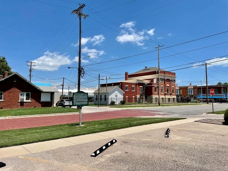
2. View from marker looking towards the Harvey County Historical Society building.

Regionally, this marker is in Central Kansas and in Greater Wichita. It is also in the American Midwest, in the Corn Belt, on the prairies, and on the Southern Plains. Globally, it is in North America, the Western Hemisphere, the Western World, and the Anglosphere. Historically, it finds itself in what was once the Louisiana Purchase.
Other nearby markers. At least 8 other markers are within walking distance of this marker: Newton Carnegie Library (within shouting distance of this marker); Bernhard Warkentin (approx. 0.2 miles away); 1871 Water Well Memorial (approx. ¼ mile away); Railroad Savings and Loan Building (approx. ¼ mile away); Midland National Bank (approx. 0.3 miles away); John Jacob Krehbiel Memorial Park (approx. 0.4 miles away); Anderson Book and Office Supply (approx. 0.4 miles away); The Masonic Lodge (approx. 0.4 miles away). Touch for a list and map of all markers in Newton.
Also see . . . Newton’s Wild West past. (Submitted on July 2, 2024, by Mark Hilton of Montgomery, Alabama.)
Credits. This page was last revised on July 2, 2024. It was originally submitted on July 2, 2024, by Mark Hilton of Montgomery, Alabama. This page has been viewed 360 times since then and 121 times this year. Photos: 1, 2. submitted on July 2, 2024, by Mark Hilton of Montgomery, Alabama.
