Wayne Township near Westfall in Pickaway County, Ohio — The American Midwest (Great Lakes)
State Feeder Dam
Canal Park
| — | Pickaway County Park District | — |

Photographed by Craig Doda, June 22, 2024
1. State Feeder Dam Marker
Water leaked and evaporated from the canal continuously and so the canal was always located near a natural stream to add water as needed. The feeder dam at Circleville was built in 1830 and added water to the canal as it flowed southward. A dam in the Scioto River increased the water level so that water could be routed through a weir to the feeder which allowed the water to enter the canal below Lock 34 (located under one of the houses south of the main entrance to Canal Park). The dam consisted of terraced levels that slowed the river current north of the dam to raise the water level to a point where weir gates could be opened and allow the water to flow into the feeder. In case of high water situations on the Scioto River, the locktender could close off the water flow to protect the canal from flooding.
Erected by Pickaway County Park District.
Topics and series. This historical marker is listed in this topic list: Waterways & Vessels. In addition, it is included in the Ohio and Erie Canal series list. A significant historical year for this entry is 1830.
Location. 39° 35.393′ N, 82° 58.344′ W. Marker
this page online

Regionally, this marker is in the Scioto Valley and in the Columbus Metropolitan Area. It is also in the American Midwest and in the Corn Belt. Globally, it is in North America, the Western Hemisphere, the Western World, and the Anglosphere. Historically, it finds itself in what was once the Haudenosaunee (Iroquois) Confederacy, the territory of the Mississippian Culture, and the Northwest Territory.
Other nearby markers. At least 8 other markers are within 2 miles of this marker, measured as the crow flies: Canal Park (within shouting distance of this marker); William J. Barthelmas, Jr. (within shouting distance of this marker); Ohio-Erie Canal (about 300 feet away, measured in a direct line); The Towpath Trail (about 300 feet away); Political Meeting at Second Baptist Church (approx. 1.4 miles away); Circleville (approx. 1½ miles away);

Photographed by Craig Doda, June 22, 2024
2. State Feeder Dam Marker
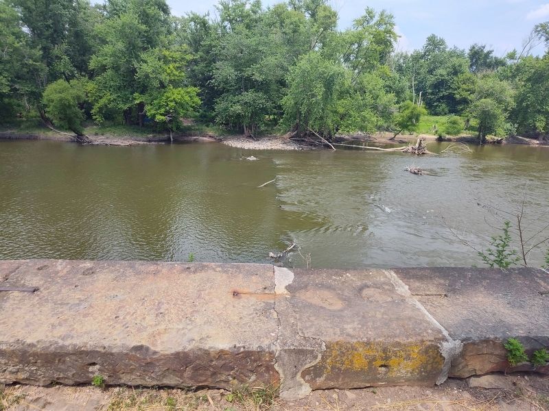
Photographed by Craig Doda, June 22, 2024
3. State Feeder Dam

Photographed by Craig Doda, June 22, 2024
4. State Feeder Dam Marker

Photographed by Craig Doda, June 22, 2024
5. State Feeder Dam Marker
Credits. This page was last revised on July 9, 2024. It was originally submitted on July 3, 2024, by Craig Doda of Napoleon, Ohio. This page has been viewed 250 times since then and 23 times this year. Photos: 1, 2, 3, 4, 5. submitted on July 3, 2024, by Craig Doda of Napoleon, Ohio. • J. Makali Bruton was the editor who published this page.
