Near Munfordville in Hart County, Kentucky — The American South (East South Central)
The Raider
Morgan and his Raiders
| — | Woodsonville, 1861 | — |
Photographed by Lee Hattabaugh, January 25, 2011
1. The Raider Marker
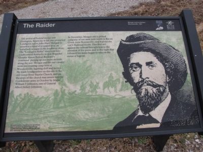
The arrival of Federal troops into Lexington, Kentucky in fall 1861 prompted Lexington native John Hunt Morgan to assemble a band of 17 armed men on horseback to support the Southern cause. The "Lexington Rifle" then rode into south central Kentucky to join Brigadier General Simon Bolivar Buckner's command picking up 200 more recruits along the way. Morgan and his raw cavalry went into training camp here at Woodsonville, learning drill and tactics. He made headquarters on this site in the old Green River Baptist Church, and on the steps of the church was sworn into the Confederate army in October by Major William P. Johnston, son of General Albert Sidney Johnston.
In December, Morgan and a picked company of 100 men rode north to Bacon Creek (now Bonnieville) and burned the L&N Railroad trestle. This first act against the railroad brought him to the attention of the press, and in the raids that followed his name began to take on the status of legend.
(caption) Morgan's raiders frequently tore up railroad track to prevent the Union from moving supplies and men. They heated the rails and bent them into "Morgan's Neckties."
Erected by Battle
this page online
Topics and series. This historical marker is listed in these topic lists: Railroads & Streetcars • Religion & Religious Structures • Settlements & Settlers • War, US Civil. In addition, it is included in the John Hunt Morgan Heritage Trail in Kentucky series list. A significant historical year for this entry is 1861.
Location. 37° 15.44′ N, 85° 53.276′ W. Marker is near Munfordville, Kentucky, in Hart County. It is on Charlie Dowling Road north of Bragg Avenue, on the left when traveling north. This marker is no longer accessible.. Touch for map. Marker is at or near this postal address: 300 Charlie Dowling Rd, Munfordville KY 42765, United States of America. Touch for directions.

Regionally, this marker is in Mammoth Cave Country and in the Pennyroyal Region. It is also in the American South and specifically in the Upper South. Globally, it is in North America, the Western Hemisphere, the Western World, and the Anglosphere. Historically, it finds itself in what was once the territory of the Mississippian Culture and also the Antebellum South.
Other nearby markers. At least
Photographed by Lee Hattabaugh, January 25, 2011
2. The Raider Marker
on the right.
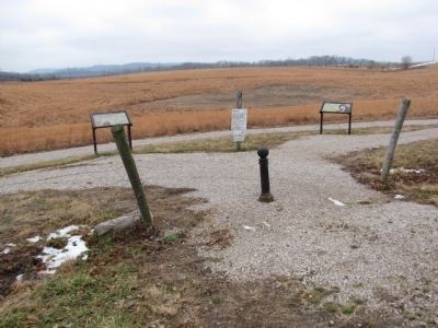
More about this marker. This marker is no longer accessible. It is on private property. Please do not attempt to access it without permission of the property owner. According to a Google Review by Patrica Chapman, "We drove out to the site and all that was there were signs saying 'trails closed'. The stands where you would normally find information and maps were empty and behind a fence with a 'no trespassing' sign."
Related markers. Click here for a list of markers that are related to this marker.
Also see . . . Battle for the Bridge Historic Preserve. (Submitted on February 2, 2011, by Lee Hattabaugh of Capshaw, Alabama.)
Credits. This page was last revised on July 4, 2024. It was originally submitted on February 2, 2011. This page has been viewed 1,684 times since then and 50 times this year. Last updated on July 3, 2024. Photos: 1, 2. submitted on February 2, 2011, by Lee Hattabaugh of Capshaw, Alabama. • Bernard Fisher was the editor who published this page.
